 |
|
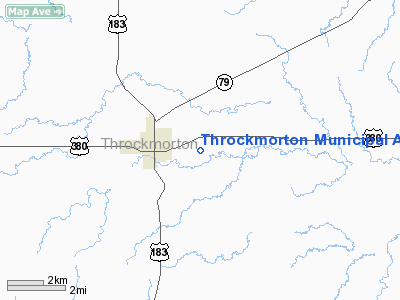
Throckmorton Muni Airport |
Location & QuickFacts
| FAA Information Effective: | 2008-09-25 |
| Airport Identifier: | 72F |
| Airport Status: | Operational |
| Longitude/Latitude: | 099-08-59.2690W/33-10-45.3760N
-99.149797/33.179271 (Estimated) |
| Elevation: | 1273 ft / 388.01 m (Estimated) |
| Land: | 56 acres |
| From nearest city: | 1 nautical miles NE of Throckmorton, TX |
| Location: | Throckmorton County, TX |
| Magnetic Variation: | 08E (1985) |
Owner & Manager
| Ownership: | Publicly owned |
| Owner: | City Of Throckmorton |
| Address: | P.o. Box 640
Throckmorton, TX 76083 |
| Phone number: | 940-849-4411 |
| Manager: | Casey Chambers
CITY MANAGER. |
| Address: | P.o. Box 640
Throckmorton, TX 76083 |
| Phone number: | 940-849-4411
EMERGENCY PHONE: (940) 849-9421 (SHERIFF). |
Airport Operations and Facilities
| Airport Use: | Open to public |
| Wind indicator: | Yes |
| Segmented Circle: | No |
| Control Tower: | No |
| Lighting Schedule: | DUSK-DAWN |
| Beacon Color: | Clear-Green (lighted land airport) |
| Landing fee charge: | No |
| Sectional chart: | Dallas-ft Worth |
| Region: | ASW - Southwest |
| Boundary ARTCC: | ZFW - Fort Worth |
| Tie-in FSS: | FTW - Fort Worth |
| FSS on Airport: | No |
| FSS Phone: | 817-541-3474 |
| FSS Toll Free: | 1-800-WX-BRIEF |
| NOTAMs Facility: | FTW (NOTAM-d service avaliable) |
Airport Communications
Airport Services
| Airframe Repair: | NONE |
| Power Plant Repair: | NONE |
Runway Information
Runway 17/35
| Dimension: | 3720 x 60 ft / 1133.9 x 18.3 m |
| Surface: | ASPH, Good Condition |
| Weight Limit: | Single wheel: 12000 lbs. |
| Edge Lights: | Low |
| |
Runway 17 |
Runway 35 |
| Traffic Pattern: | Left | Left |
| Markings: | Basic, Good Condition | Nonstandard, Good Condition |
| Displaced threshold: | 525.00 ft | 505.00 ft |
| Runway End Identifier: | No | No |
| Centerline Lights: | No | No |
| Touchdown Lights: | No | No |
| Obstruction: | 18 ft road, 300.0 ft from runway, 5:1 slope to clear
APCH SLOPE 29:1 TO DSPLCD THLD. | 85 ft tree, 1910.0 ft from runway, 125 ft left of centerline, 20:1 slope to clear
APCH SLOPE 20:1 AT DSPLCD THLD. |
|
Radio Navigation Aids
| ID |
Type |
Name |
Ch |
Freq |
Var |
Dist |
| ONY | NDB | Olney | | 272.00 | 07E | 19.7 nm |
| AKL | NDB | Haskell | | 407.00 | 08E | 28.7 nm |
| BKD | NDB | Breckenridge | | 245.00 | 07E | 29.1 nm |
| GHX | NDB | Graham | | 371.00 | 07E | 32.9 nm |
| TMV | NDB | Stamford | | 290.00 | 08E | 34.9 nm |
| GZV | NDB | Brazos River | | 280.00 | 07E | 39.6 nm |
| SKB | NDB | Scotland | | 344.00 | 08E | 49.5 nm |
| OIP | NDB | Old Rip | | 410.00 | 07E | 50.0 nm |
Remarks
- CONSTRUCTION UNDERWAY AT AIRPORT NO "X'S" PRESENT
Images and information placed above are from
http://www.airport-data.com/airport/72F/
We thank them for the data!
| General Info
|
| Country |
United States
|
| State |
TEXAS
|
| FAA ID |
72F
|
| Latitude |
33-10-45.376N
|
| Longitude |
099-08-59.269W
|
| Elevation |
1273 feet
|
| Near City |
THROCKMORTON
|
We don't guarantee the information is fresh and accurate. The data may
be wrong or outdated.
For more up-to-date information please refer to other sources.
|
|


