 |
|
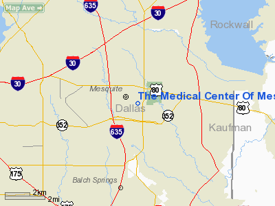
The Medical Center Of Mesquite Heliport |
Location & QuickFacts
| FAA Information Effective: | 2008-09-25 |
| Airport Identifier: | 2TA2 |
| Airport Status: | Operational |
| Longitude/Latitude: | 096-36-04.0000W/32-46-46.0000N
-96.601111/32.779444 (Estimated) |
| Elevation: | 506 ft / 154.23 m (Estimated) |
| Land: | 0 acres |
| From nearest city: | 0 nautical miles N of Mesquite, TX |
| Location: | Dallas County, TX |
| Magnetic Variation: | 06E (1985) |
Owner & Manager
| Ownership: | Privately owned |
| Owner: | Health Mgmt Associates Inc |
| Address: | Medical Center Of Mesquite, 1011 North Galloway
Mesquite, TX 75149 |
| Phone number: | 214-320-7000 |
| Manager: | Ray De Blasi |
| Address: | 1011 North Galloway
Mesquite, TX 75149 |
| Phone number: | 214-320-7000 |
Airport Operations and Facilities
| Airport Use: | Private
MEDICAL. |
| Wind indicator: | Yes |
| Segmented Circle: | No |
| Control Tower: | No |
| Lighting Schedule: | PHONE REQ
FOR PERIMETER LGTS CALL 214-320-7000. |
| Landing fee charge: | No |
| Sectional chart: | Dallas-ft Worth |
| Region: | ASW - Southwest |
| Boundary ARTCC: | ZFW - Fort Worth |
| Tie-in FSS: | FTW - Fort Worth |
| FSS on Airport: | No |
| FSS Phone: | 817-541-3474 |
| FSS Toll Free: | 1-800-WX-BRIEF |
Runway Information
Helipad H1
| Dimension: | 40 x 40 ft / 12.2 x 12.2 m |
| Surface: | CONC, |
| |
Runway H1 |
Runway |
| Traffic Pattern: | Left | Left |
| Markings: | Basic, | , |
|
Radio Navigation Aids
| ID |
Type |
Name |
Ch |
Freq |
Var |
Dist |
| PQF | NDB | Mesquite | | 248.00 | 06E | 4.1 nm |
| JUG | NDB | Jecca | | 388.00 | 06E | 7.5 nm |
| LNC | NDB | Lancaster | | 239.00 | 06E | 13.6 nm |
| RBD | NDB | Redbird | | 287.00 | 06E | 15.0 nm |
| AVZ | NDB | Travis | | 260.00 | 06E | 17.8 nm |
| XQH | NDB | Cedar Hill | | 353.00 | 08E | 22.1 nm |
| MII | NDB | Caddo Mills | | 316.00 | 06E | 23.7 nm |
| SYW | NDB | Cash | | 428.00 | 05E | 29.6 nm |
| CGQ | NDB | Powell | | 344.00 | 06E | 43.9 nm |
| CRS | NDB | Corsicana | | 396.00 | 06E | 46.4 nm |
| MJF | TACAN | Arvilla | 033X | | 05E | 32.2 nm |
| NFW | TACAN | Nas Jrb Fort Worth | 024X | | 07E | 42.4 nm |
| CVE | VOR/DME | Cowboy | 109X | 116.20 | 06E | 16.7 nm |
| TTT | VOR/DME | Maverick | 078X | 113.10 | 06E | 22.8 nm |
| FUZ | VORTAC | Ranger | 104X | 115.70 | 06E | 29.9 nm |
| CQY | VORTAC | Cedar Creek | 095X | 114.80 | 06E | 40.6 nm |
| BYP | VORTAC | Bonham | 093X | 114.60 | 06E | 49.2 nm |
| DAL | VOT | Dallas Love Field | | 113.30 | | 13.3 nm |
| FTW | VOT | Fort Worth Meacham | | 108.20 | | 38.3 nm |
Remarks
- OWNER DESIRES HELIPORT NOT BE CHARTED.
- PRVDD WINDSOCK IS RELOCATED ON TOP OF HOSPITAL BLDG NEAR HELIPAD.
Images and information placed above are from
http://www.airport-data.com/airport/2TA2/
We thank them for the data!
| General Info
|
| Country |
United States
|
| State |
TEXAS
|
| FAA ID |
2TA2
|
| Latitude |
32-46-07.463N
|
| Longitude |
096-35-57.973W
|
| Elevation |
500 feet
|
| Near City |
MESQUITE
|
We don't guarantee the information is fresh and accurate. The data may
be wrong or outdated.
For more up-to-date information please refer to other sources.
|
|


