 |
|
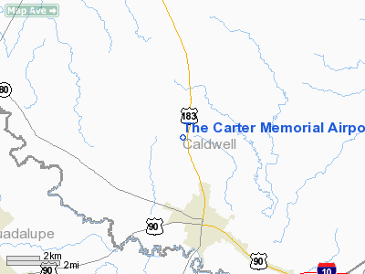
The Carter Memorial Airport |
Location & QuickFacts
| FAA Information Effective: | 2008-09-25 |
| Airport Identifier: | T91 |
| Airport Status: | Operational |
| Longitude/Latitude: | 097-39-33.9940W/29-43-41.8170N
-97.659443/29.728282 (Estimated) |
| Elevation: | 475 ft / 144.78 m (Estimated) |
| Land: | 56 acres |
| From nearest city: | 3 nautical miles N of Luling, TX |
| Location: | Caldwell County, TX |
| Magnetic Variation: | 07E (1985) |
Owner & Manager
| Ownership: | Publicly owned |
| Owner: | City Of Luling |
| Address: | 509 E. Crockett Street
Luling, TX 78648 |
| Phone number: | 830-875-2481 |
| Manager: | Bobby Berger
CITY MANAGER. |
| Address: | 509 E.crockett Street
Luling, TX 78648 |
| Phone number: | 830-875-2481 |
Airport Operations and Facilities
| Airport Use: | Open to public |
| Wind indicator: | Yes |
| Segmented Circle: | No |
| Control Tower: | No |
| Lighting Schedule: | DUSK-DAWN |
| Beacon Color: | Clear-Green (lighted land airport)
ROTG BCN OTS INDEFLY. |
| Landing fee charge: | No |
| Sectional chart: | San Antonio |
| Region: | ASW - Southwest |
| Boundary ARTCC: | ZHU - Houston |
| Tie-in FSS: | SJT - San Angelo |
| FSS on Airport: | No |
| FSS Toll Free: | 1-800-WX-BRIEF |
| NOTAMs Facility: | SJT (NOTAM-d service avaliable) |
| Federal Agreements: | Y1 |
Airport Communications
Airport Services
| Power Plant Repair: | NONE |
| Bottled Oxygen: | NONE |
| Bulk Oxygen: | NONE |
Runway Information
Runway 17/35
| Dimension: | 2790 x 45 ft / 850.4 x 13.7 m |
| Surface: | ASPH, Good Condition |
| Weight Limit: | Single wheel: 11000 lbs. |
| Edge Lights: | Non-standard lighting system
NSTD LIRL. LGTS 95 FT OUTBOARD FM RY CNTRLN. |
| |
Runway 17 |
Runway 35 |
| Traffic Pattern: | Left | Left |
| Markings: | Basic, Good Condition | Basic, Good Condition |
| Obstruction: | 25 ft pline, 200.0 ft from runway, 90 ft right of centerline
DIRT ROAD ACROSS APCH AT THLD; 4 FT FENCE 195 FT FM THLD ACROSS APCH; +6 FT TREE 195 FT FM THLD 115 FT LEFT. | 23 ft trees, 200.0 ft from runway, 88 ft left of centerline
10-20 FT BRUSH 100-200 FT FM THLD 85 FT L. |
|
Radio Navigation Aids
| ID |
Type |
Name |
Ch |
Freq |
Var |
Dist |
| OKT | NDB | Yoakum | | 350.00 | 06E | 37.0 nm |
| GYB | NDB | Lee County | | 385.00 | 07E | 44.3 nm |
| DHK | TACAN | Randolph | 036X | | 09E | 33.8 nm |
| SSF | VOR | Stinson | | 108.40 | 09E | 49.8 nm |
| RND | VORTAC | Randolph | 70X | 112.30 | 09E | 35.0 nm |
| CWK | VORTAC | Centex | 075X | 112.80 | 06E | 39.7 nm |
| SAT | VORTAC | San Antonio | 115X | 116.80 | 08E | 42.2 nm |
| SAT | VOT | San Antonio Intl | | 110.40 | | 43.9 nm |
Remarks
- LIRL RY 17/35 OTS INDEFLY.
- PRE DATES THE ACT.
Images and information placed above are from
http://www.airport-data.com/airport/T91/
We thank them for the data!
| General Info
|
| Country |
United States
|
| State |
TEXAS
|
| FAA ID |
T91
|
| Latitude |
29-43-41.817N
|
| Longitude |
097-39-33.994W
|
| Elevation |
475 feet
|
| Near City |
LULING
|
We don't guarantee the information is fresh and accurate. The data may
be wrong or outdated.
For more up-to-date information please refer to other sources.
|
|


