 |
|
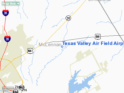
Texas Valley Air Field Airport |
Location & QuickFacts
| FAA Information Effective: | 2008-09-25 |
| Airport Identifier: | TA57 |
| Airport Status: | Operational |
| Longitude/Latitude: | 096-59-32.9870W/31-37-25.5960N
-96.992496/31.623777 (Estimated) |
| Elevation: | 450 ft / 137.16 m (Estimated) |
| Land: | 0 acres |
| From nearest city: | 10 nautical miles NE of Waco, TX |
| Location: | Mc Lennan County, TX |
| Magnetic Variation: | 06E (1990) |
Owner & Manager
| Ownership: | Privately owned |
| Owner: | Joe Nazario |
| Address: | 6152 Old Mexia Road
Waco, TX 76705 |
| Phone number: | 813-417-5394 |
| Manager: | Joe Nazario |
| Address: | 6152 Old Mexia Road
Waco, TX 76705 |
| Phone number: | 813-417-5394 |
Airport Operations and Facilities
| Airport Use: | Private |
| Wind indicator: | Yes |
| Segmented Circle: | Yes |
| Control Tower: | No |
| Lighting Schedule: | DUSK-DAWN |
| Beacon Color: | Clear (unlighted land airport) |
| Sectional chart: | Houston |
| Region: | ASW - Southwest |
| Boundary ARTCC: | ZFW - Fort Worth |
| Tie-in FSS: | FTW - Fort Worth |
| FSS on Airport: | No |
| FSS Phone: | 817-541-3474 |
| FSS Toll Free: | 1-800-WX-BRIEF |
Runway Information
Runway 15/33
| Dimension: | 2000 x 150 ft / 609.6 x 45.7 m |
| Surface: | TURF, |
| Edge Lights: | Medium |
| |
Runway 15 |
Runway 33 |
| Traffic Pattern: | Left | Right |
| Displaced threshold: | 600.00 ft | 600.00 ft |
| Obstruction: | 30 ft pline, 50.0 ft from runway | 30 ft trees, 0.0 ft from runway |
|
Radio Navigation Aids
| ID |
Type |
Name |
Ch |
Freq |
Var |
Dist |
| ROB | NDB | Robinson | | 400.00 | 07E | 8.2 nm |
| LXY | NDB | Mexia | | 329.00 | 07E | 24.6 nm |
| CRS | NDB | Corsicana | | 396.00 | 06E | 39.0 nm |
| CGQ | NDB | Powell | | 344.00 | 06E | 39.1 nm |
| PYF | NDB | Pyramid | | 418.00 | 06E | 43.1 nm |
| HLR | NDB | Hood | | 347.00 | 07E | 47.4 nm |
| GNL | VOR/DME | Groesbeck | 025X | 108.80 | 05E | 22.8 nm |
| TPL | VOR/DME | Temple | 041X | 110.40 | 09E | 33.4 nm |
| ACT | VORTAC | Waco | 100X | 115.30 | 09E | 14.3 nm |
Remarks
- MINOR POWERPLANT & AIRFRAME MAINTENANCE.
- PRVDD ACTIONS STATED IN PROPONENT'S 1/1/93 LETTER ARE IMPLEMENTED.
Images and information placed above are from
http://www.airport-data.com/airport/TA57/
We thank them for the data!
| General Info
|
| Country |
United States
|
| State |
TEXAS
|
| FAA ID |
TA57
|
| Latitude |
31-37-25.596N
|
| Longitude |
096-59-32.987W
|
| Elevation |
450 feet
|
| Near City |
WACO
|
We don't guarantee the information is fresh and accurate. The data may
be wrong or outdated.
For more up-to-date information please refer to other sources.
|
|


