 |
|
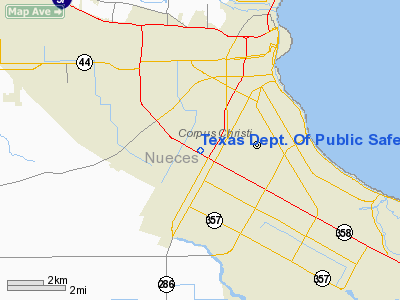
Texas Dept. Of Public Safety Heliport |
Location & QuickFacts
| FAA Information Effective: | 2008-09-25 |
| Airport Identifier: | 3TX0 |
| Airport Status: | Operational |
| Longitude/Latitude: | 097-26-05.9720W/27-44-28.1060N
-97.434992/27.741141 (Estimated) |
| Elevation: | 37 ft / 11.28 m (Estimated) |
| Land: | 0 acres |
| From nearest city: | 0 nautical miles N of Corpus Christi, TX |
| Location: | Nueces County, TX |
| Magnetic Variation: | 07E (1985) |
Owner & Manager
| Ownership: | Publicly owned |
| Owner: | Texas Dept Of Public Safety |
| Address: | Box 4087
Austin, TX 78773 |
| Phone number: | 512-854-2681 |
| Manager: | Alfred E. Matocha |
| Address: | 1922 S.p.i.d.
Corpus Christi, TX 78416 |
| Phone number: | 512-854-2681 |
Airport Operations and Facilities
| Airport Use: | Private
POLICE USE ONLY. |
| Wind indicator: | Yes |
| Segmented Circle: | No |
| Control Tower: | No |
| Lighting Schedule: | PHONE REQ
FOR PERIMETER LGTS CALL 512-854-2681. |
| Sectional chart: | Brownsville |
| Region: | ASW - Southwest |
| Boundary ARTCC: | ZHU - Houston |
| Tie-in FSS: | SJT - San Angelo |
| FSS on Airport: | No |
| FSS Toll Free: | 1-800-WX-BRIEF |
Airport Services
Runway Information
Helipad H1
| Dimension: | 100 x 20 ft / 30.5 x 6.1 m |
| Surface: | CONC, |
| |
Runway H1 |
Runway |
| Traffic Pattern: | Left | Left |
|
Radio Navigation Aids
| ID |
Type |
Name |
Ch |
Freq |
Var |
Dist |
| RKP | NDB | Rockport | | 391.00 | 06E | 29.4 nm |
| MNO | NDB | Mellon Ranch | | 375.00 | 06E | 34.6 nm |
| TKB | NDB | Kleberg County | | 347.00 | 06E | 35.6 nm |
| BEA | NDB | Beeville | | 284.00 | 07E | 42.3 nm |
| BKS | NDB | Brooks County | | 353.00 | 06E | 48.7 nm |
| NQI | TACAN | Kingsville | 125X | | 09E | 24.5 nm |
| NOG | TACAN | Orange Grove | 063X | | 09E | 33.6 nm |
| ALI | VOR | Alice | | 114.50 | 06E | 31.2 nm |
| NGP | VORTAC | Truax | 087X | 114.00 | 06E | 8.2 nm |
| CRP | VORTAC | Corpus Christi | 102X | 115.50 | 09E | 9.8 nm |
Remarks
- PRVDD LTR OF AGREEMENT WITH CORPUS CHRISTI ATCT IS ESTABD TO SET PROCS FOR OPNS AT THE HELIPORT & ANTENNA & PLINES ARE RELCTD AS DISCUSSED DURING THE ON-SITE EVALUATION.
Images and information placed above are from
http://www.airport-data.com/airport/3TX0/
We thank them for the data!
| General Info
|
| Country |
United States
|
| State |
TEXAS
|
| FAA ID |
3TX0
|
| Latitude |
27-44-28.106N
|
| Longitude |
097-26-05.972W
|
| Elevation |
37 feet
|
| Near City |
CORPUS CHRISTI
|
We don't guarantee the information is fresh and accurate. The data may
be wrong or outdated.
For more up-to-date information please refer to other sources.
|
|


