 |
|
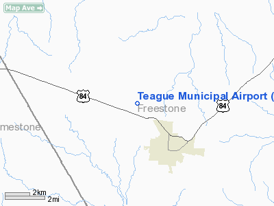
Location & QuickFacts
| FAA Information Effective: | 2008-09-25 |
| Airport Identifier: | 68F |
| Airport Status: | Operational |
| Longitude/Latitude: | 096-18-35.9080W/31-39-40.6080N
-96.309974/31.661280 (Estimated) |
| Elevation: | 525 ft / 160.02 m (Estimated) |
| Land: | 52 acres |
| From nearest city: | 3 nautical miles NW of Teague, TX |
| Location: | Freestone County, TX |
| Magnetic Variation: | 06E (1985) |
Owner & Manager
| Ownership: | Publicly owned |
| Owner: | City Of Teague |
| Address: | 105 South 4th Ave
Teague, TX 75860 |
| Phone number: | 254-739-2547 |
| Manager: | Donald Doering
CITY ADMINISTRATOR. |
| Address: | 105 S. 4th Ave.
Teague, TX 75860 |
| Phone number: | 254-739-2547 |
Airport Operations and Facilities
| Airport Use: | Open to public |
| Wind indicator: | Yes |
| Segmented Circle: | Yes |
| Control Tower: | No |
| Lighting Schedule: | DUSK-DAWN |
| Beacon Color: | Clear-Green (lighted land airport) |
| Landing fee charge: | No |
| Sectional chart: | Houston |
| Region: | ASW - Southwest |
| Boundary ARTCC: | ZFW - Fort Worth |
| Tie-in FSS: | FTW - Fort Worth |
| FSS on Airport: | No |
| FSS Phone: | 817-541-3474 |
| FSS Toll Free: | 1-800-WX-BRIEF |
| NOTAMs Facility: | FTW (NOTAM-d service avaliable) |
| Federal Agreements: | 1Y |
Airport Communications
Airport Services
| Fuel available: | 100LL
24 HR SELF SERVICE. |
| Bulk Oxygen: | NONE |
Runway Information
Runway 15/33
| Dimension: | 3300 x 50 ft / 1005.8 x 15.2 m |
| Surface: | ASPH, Good Condition |
| Weight Limit: | Single wheel: 16000 lbs. |
| Edge Lights: | Medium |
| |
Runway 15 |
Runway 33 |
| Traffic Pattern: | Left | Left |
| Markings: | Basic, Good Condition | Basic, Good Condition |
| Obstruction: | 31 ft trees, 407.0 ft from runway, 119 ft right of centerline, 6:1 slope to clear | 17 ft tree, 287.0 ft from runway, 5:1 slope to clear
5 FT FENCE 195 FT FROM THLD, EXTENDING BOTH LEFT AND RIGHT OUT TO PRIMARY SURFACE BOUNDARY. |
|
Radio Navigation Aids
| ID |
Type |
Name |
Ch |
Freq |
Var |
Dist |
| LXY | NDB | Mexia | | 329.00 | 07E | 10.4 nm |
| PYF | NDB | Pyramid | | 418.00 | 06E | 13.4 nm |
| CRS | NDB | Corsicana | | 396.00 | 06E | 22.4 nm |
| CGQ | NDB | Powell | | 344.00 | 06E | 24.9 nm |
| LIQ | NDB | Lochridge Ranch | | 335.00 | 09E | 27.8 nm |
| CSZ | NDB | Crossroads | | 215.00 | 08E | 30.1 nm |
| PSN | NDB | Palestine | | 375.00 | 04E | 31.9 nm |
| AHX | NDB | Athens | | 269.00 | 06E | 38.7 nm |
| ROB | NDB | Robinson | | 400.00 | 07E | 40.0 nm |
| GNL | VOR/DME | Groesbeck | 025X | 108.80 | 05E | 13.1 nm |
| FZT | VOR/DME | Frankston | 051X | 111.40 | 06E | 46.9 nm |
| CQY | VORTAC | Cedar Creek | 095X | 114.80 | 06E | 31.9 nm |
| LOA | VORTAC | Leona | 045X | 110.80 | 08E | 36.8 nm |
| ACT | VORTAC | Waco | 100X | 115.30 | 09E | 49.1 nm |
Images and information placed above are from
http://www.airport-data.com/airport/68F/
We thank them for the data!
| General Info
|
| Country |
United States
|
| State |
TEXAS
|
| FAA ID |
68F
|
| Latitude |
31-39-40.608N
|
| Longitude |
096-18-35.908W
|
| Elevation |
525 feet
|
| Near City |
TEAGUE
|
We don't guarantee the information is fresh and accurate. The data may
be wrong or outdated.
For more up-to-date information please refer to other sources.
|
|


