 |
|
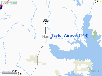
Location & QuickFacts
| FAA Information Effective: | 2008-09-25 |
| Airport Identifier: | T14 |
| Airport Status: | Operational |
| Longitude/Latitude: | 096-05-45.0000W/32-57-08.0000N
-96.095833/32.952222 (Estimated) |
| Elevation: | 473 ft / 144.17 m (Estimated) |
| Land: | 33 acres |
| From nearest city: | 3 nautical miles NE of Quinlan, TX |
| Location: | Hunt County, TX |
| Magnetic Variation: | 06E (1990) |
Owner & Manager
| Ownership: | Privately owned |
| Owner: | George W. Taylor, Sr |
| Address: | 6734 Co. Road 3511
Quinlan, TX 75474 |
| Phone number: | 903-883-3921 |
| Manager: | George W. Taylor, Sr |
| Address: | 6734 Co. Road 3511
Quinlan, TX 75474 |
| Phone number: | 903-883-3921 |
Airport Operations and Facilities
| Airport Use: | Open to public |
| Wind indicator: | Yes |
| Segmented Circle: | No |
| Control Tower: | No |
| Sectional chart: | Dallas-ft Worth |
| Region: | ASW - Southwest |
| Boundary ARTCC: | ZFW - Fort Worth |
| Tie-in FSS: | FTW - Fort Worth |
| FSS on Airport: | No |
| FSS Phone: | 817-541-3474 |
| FSS Toll Free: | 1-800-WX-BRIEF |
| NOTAMs Facility: | FTW (NOTAM-d service avaliable) |
Airport Communications
Runway Information
Runway 18/36
| Dimension: | 2800 x 50 ft / 853.4 x 15.2 m |
| Surface: | TURF, Poor Condition
RUNWAY NOT MAINTAINED, +1 FT GRASS/WEEDS OVER THE ENTIRE SURFACE. |
| |
Runway 18 |
Runway 36 |
| Traffic Pattern: | Left | Left |
| Obstruction: | 41 ft trees, 71 ft left of centerline | 32 ft trees, 384.0 ft from runway, 12:1 slope to clear |
|
Radio Navigation Aids
| ID |
Type |
Name |
Ch |
Freq |
Var |
Dist |
| SYW | NDB | Cash | | 428.00 | 05E | 2.3 nm |
| MII | NDB | Caddo Mills | | 316.00 | 06E | 9.3 nm |
| AVZ | NDB | Travis | | 260.00 | 06E | 13.9 nm |
| PQF | NDB | Mesquite | | 248.00 | 06E | 23.5 nm |
| JUG | NDB | Jecca | | 388.00 | 06E | 27.9 nm |
| LNC | NDB | Lancaster | | 239.00 | 06E | 38.8 nm |
| HJM | NDB | Rayburn | | 415.00 | 06E | 40.0 nm |
| RBD | NDB | Redbird | | 287.00 | 06E | 42.5 nm |
| TY | NDB | Tyler | | 320.00 | 06E | 45.2 nm |
| XQH | NDB | Cedar Hill | | 353.00 | 08E | 49.5 nm |
| AHX | NDB | Athens | | 269.00 | 06E | 49.5 nm |
| MJF | TACAN | Arvilla | 033X | | 05E | 7.1 nm |
| SLR | VOR/DME | Sulphur Springs | 027X | 109.00 | 08E | 31.6 nm |
| UIM | VOR/DME | Quitman | 087X | 114.00 | 08E | 37.0 nm |
| CVE | VOR/DME | Cowboy | 109X | 116.20 | 06E | 40.9 nm |
| TTT | VOR/DME | Maverick | 078X | 113.10 | 06E | 47.9 nm |
| PRX | VOR/DME | Paris | 083X | 113.60 | 07E | 48.1 nm |
| BYP | VORTAC | Bonham | 093X | 114.60 | 06E | 35.9 nm |
| CQY | VORTAC | Cedar Creek | 095X | 114.80 | 06E | 46.5 nm |
| DAL | VOT | Dallas Love Field | | 113.30 | | 38.7 nm |
Images and information placed above are from
http://www.airport-data.com/airport/T14/
We thank them for the data!
| General Info
|
| Country |
United States
|
| State |
TEXAS
|
| FAA ID |
T14
|
| Latitude |
32-57-08.000N
|
| Longitude |
096-05-45.000W
|
| Elevation |
473 feet
|
| Near City |
QUINLAN
|
We don't guarantee the information is fresh and accurate. The data may
be wrong or outdated.
For more up-to-date information please refer to other sources.
|
|


