 |
|
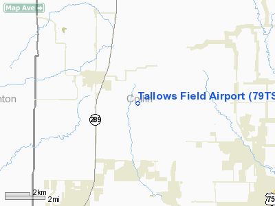
Location & QuickFacts
| FAA Information Effective: | 2008-09-25 |
| Airport Identifier: | 79TS |
| Airport Status: | Operational |
| Longitude/Latitude: | 096-44-49.9840W/33-18-15.4110N
-96.747218/33.304281 (Estimated) |
| Elevation: | 729 ft / 222.20 m (Estimated) |
| Land: | 164 acres |
| From nearest city: | 3 nautical miles SE of Celina, TX |
| Location: | Collin County, TX |
| Magnetic Variation: | 07E (1985) |
Owner & Manager
| Ownership: | Privately owned |
| Owner: | C.f. Mullaney |
| Address: | Rt 2 Box 83
Celina, TX 75009 |
| Phone number: | 214-382-3249 |
| Address: |
|
Airport Operations and Facilities
| Airport Use: | Private |
| Wind indicator: | Yes |
| Segmented Circle: | No |
| Control Tower: | No |
| Sectional chart: | Dallas-ft Worth |
| Region: | ASW - Southwest |
| Boundary ARTCC: | ZFW - Fort Worth |
| Tie-in FSS: | FTW - Fort Worth |
| FSS Phone: | 817-541-3474 |
| FSS Toll Free: | 1-800-WX-BRIEF |
Runway Information
Runway 17/35
| Dimension: | 1000 x 75 ft / 304.8 x 22.9 m |
| Surface: | TURF, |
| |
Runway 17 |
Runway 35 |
| Traffic Pattern: | Left | Left |
| Obstruction: | 5 ft fence | 30 ft tree |
|
Radio Navigation Aids
| ID |
Type |
Name |
Ch |
Freq |
Var |
Dist |
| MII | NDB | Caddo Mills | | 316.00 | 06E | 29.7 nm |
| DNI | NDB | Denison | | 341.00 | 06E | 31.5 nm |
| PQF | NDB | Mesquite | | 248.00 | 06E | 31.7 nm |
| GLE | NDB | Gainesville | | 330.00 | 06E | 33.7 nm |
| HJM | NDB | Rayburn | | 415.00 | 06E | 34.2 nm |
| RBD | NDB | Redbird | | 287.00 | 06E | 38.2 nm |
| SYW | NDB | Cash | | 428.00 | 05E | 39.3 nm |
| JUG | NDB | Jecca | | 388.00 | 06E | 39.7 nm |
| AVZ | NDB | Travis | | 260.00 | 06E | 41.2 nm |
| DUA | NDB | Durant | | 359.00 | 05E | 42.1 nm |
| LNC | NDB | Lancaster | | 239.00 | 06E | 43.7 nm |
| XQH | NDB | Cedar Hill | | 353.00 | 08E | 44.4 nm |
| MJF | TACAN | Arvilla | 033X | | 05E | 37.3 nm |
| NFW | TACAN | Nas Jrb Fort Worth | 024X | | 07E | 47.4 nm |
| CVE | VOR/DME | Cowboy | 109X | 116.20 | 06E | 26.1 nm |
| TTT | VOR/DME | Maverick | 078X | 113.10 | 06E | 30.0 nm |
| URH | VOR/DME | Texoma | 090X | 114.30 | 05E | 42.4 nm |
| BYP | VORTAC | Bonham | 093X | 114.60 | 06E | 29.3 nm |
| FUZ | VORTAC | Ranger | 104X | 115.70 | 06E | 33.1 nm |
| DAL | VOT | Dallas Love Field | | 113.30 | | 28.0 nm |
| FTW | VOT | Fort Worth Meacham | | 108.20 | | 42.5 nm |
Images and information placed above are from
http://www.airport-data.com/airport/79TS/
We thank them for the data!
| General Info
|
| Country |
United States
|
| State |
TEXAS
|
| FAA ID |
79TS
|
| Latitude |
33-18-15.411N
|
| Longitude |
096-44-49.984W
|
| Elevation |
729 feet
|
| Near City |
CELINA
|
We don't guarantee the information is fresh and accurate. The data may
be wrong or outdated.
For more up-to-date information please refer to other sources.
|
|


