 |
|
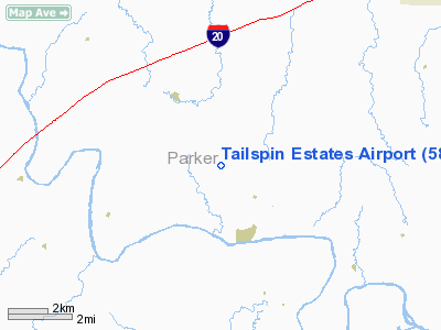
Location & QuickFacts
| FAA Information Effective: | 2008-09-25 |
| Airport Identifier: | 58TX |
| Airport Status: | Operational |
| Longitude/Latitude: | 097-56-01.1350W/32-39-04.4770N
-97.933649/32.651244 (Estimated) |
| Elevation: | 830 ft / 252.98 m (Estimated) |
| Land: | 30 acres |
| From nearest city: | 8 nautical miles SW of Weatherford, TX |
| Location: | Parker County, TX |
| Magnetic Variation: | 07E (1985) |
Owner & Manager
| Ownership: | Privately owned |
| Owner: | Expression Homes & Pools Inc |
| Address: | 1261 Pritchard Lane
Weatherford, TX 76087 |
| Phone number: | 817-596-8008 |
| Manager: | Charles Beckum |
| Address: | 1261 Pritchard Lane
Weatherford, TX 76087 |
| Phone number: | 817-596-8008 |
Airport Operations and Facilities
| Airport Use: | Private |
| Segmented Circle: | No |
| Control Tower: | No |
| Lighting Schedule: | RDO-CTL
ACTVT MIRL RY 02/20 & REIL RYS 02 & 20 - 122.9. |
| Sectional chart: | Dallas-ft Worth |
| Region: | ASW - Southwest |
| Boundary ARTCC: | ZFW - Fort Worth |
| Tie-in FSS: | FTW - Fort Worth |
| FSS on Airport: | No |
| FSS Phone: | 817-541-3474 |
| FSS Toll Free: | 1-800-WX-BRIEF |
Runway Information
Runway 02/20
| Dimension: | 2675 x 80 ft / 815.3 x 24.4 m |
| Surface: | TURF, |
| Edge Lights: | Medium |
| |
Runway 02 |
Runway 20 |
| Traffic Pattern: | Right | Left |
|
Radio Navigation Aids
| ID |
Type |
Name |
Ch |
Freq |
Var |
Dist |
| MWL | NDB | Mineral Wells | | 266.00 | 06E | 10.2 nm |
| GZV | NDB | Brazos River | | 280.00 | 07E | 30.2 nm |
| GHX | NDB | Graham | | 371.00 | 07E | 42.0 nm |
| OIP | NDB | Old Rip | | 410.00 | 07E | 47.0 nm |
| XQH | NDB | Cedar Hill | | 353.00 | 08E | 48.6 nm |
| BKD | NDB | Breckenridge | | 245.00 | 07E | 48.8 nm |
| NFW | TACAN | Nas Jrb Fort Worth | 024X | | 07E | 26.0 nm |
| TTT | VOR/DME | Maverick | 078X | 113.10 | 06E | 47.0 nm |
| MQP | VORTAC | Millsap | 124X | 117.70 | 09E | 5.5 nm |
| JEN | VORTAC | Glen Rose | 097X | 115.00 | 06E | 29.7 nm |
| FUZ | VORTAC | Ranger | 104X | 115.70 | 06E | 40.7 nm |
| FTW | VOT | Fort Worth Meacham | | 108.20 | | 30.8 nm |
Remarks
Images and information placed above are from
http://www.airport-data.com/airport/58TX/
We thank them for the data!
| General Info
|
| Country |
United States
|
| State |
TEXAS
|
| FAA ID |
58TX
|
| Latitude |
32-39-04.477N
|
| Longitude |
097-56-01.135W
|
| Elevation |
830 feet
|
| Near City |
WEATHERFORD
|
We don't guarantee the information is fresh and accurate. The data may
be wrong or outdated.
For more up-to-date information please refer to other sources.
|
|


