 |
|
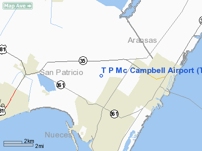
Location & QuickFacts
| FAA Information Effective: | 2008-09-25 |
| Airport Identifier: | TFP |
| Airport Status: | Operational |
| Longitude/Latitude: | 097-12-41.4000W/27-54-46.9000N
-97.211500/27.913028 (Estimated) |
| Elevation: | 18 ft / 5.49 m (Estimated) |
| Land: | 231 acres |
| From nearest city: | 2 nautical miles N of Ingleside, TX |
| Location: | San Patricio County, TX |
| Magnetic Variation: | 07E (1985) |
Owner & Manager
| Ownership: | Publicly owned |
| Owner: | San Patricio County
JIM PRICE, COUNTY COMMISSIONER. |
| Address: | 400 West Sinton St.
Sinton, TX 78387 |
| Phone number: | 361-364-6120 |
| Manager: | George Alvarado |
| Address: | 3141 Fm 3512
Aransas Pass, TX 78336 |
| Phone number: | 361-758-2000 |
Airport Operations and Facilities
| Airport Use: | Open to public |
| Wind indicator: | Yes |
| Segmented Circle: | Yes |
| Control Tower: | No |
| Lighting Schedule: | DUSK-DAWN
MIRL RY 13/31 PRESET LOW INTST; TO INCR INTST ACTVT - 123.0. |
| Beacon Color: | Clear-Green (lighted land airport) |
| Sectional chart: | Brownsville |
| Region: | ASW - Southwest |
| Boundary ARTCC: | ZHU - Houston |
| Tie-in FSS: | SJT - San Angelo |
| FSS on Airport: | No |
| FSS Toll Free: | 1-800-WX-BRIEF |
| NOTAMs Facility: | SJT (NOTAM-d service avaliable) |
| Federal Agreements: | NY1 |
Airport Communications
| CTAF: | 122.700 |
| Unicom: | 122.700 |
Airport Services
| Fuel available: | 100LLA
FUEL SELF-SERVICE. |
Runway Information
Runway 13/31
| Dimension: | 5000 x 75 ft / 1524.0 x 22.9 m |
| Surface: | ASPH, Good Condition |
| Edge Lights: | Medium |
| |
Runway 13 |
Runway 31 |
| Longitude: | 097-12-59.3663W | 097-12-23.3511W |
| Latitude: | 27-55-05.8020N | 27-54-28.0197N |
| Elevation: | 15.00 ft | 13.00 ft |
| Alignment: | 127 | 127 |
| Traffic Pattern: | Left | Left |
| Markings: | Non-precision instrument, Good Condition | Non-precision instrument, Good Condition |
| Crossing Height: | 38.00 ft | 31.00 ft |
| VASI: | 2-light PAPI on left side | 2-light PAPI on left side |
| Visual Glide Angle: | 3.00° | 3.00° |
|
Radio Navigation Aids
| ID |
Type |
Name |
Ch |
Freq |
Var |
Dist |
| RKP | NDB | Rockport | | 391.00 | 06E | 13.8 nm |
| MNO | NDB | Mellon Ranch | | 375.00 | 06E | 22.1 nm |
| BEA | NDB | Beeville | | 284.00 | 07E | 41.3 nm |
| NQI | TACAN | Kingsville | 125X | | 09E | 40.2 nm |
| NOG | TACAN | Orange Grove | 063X | | 09E | 44.2 nm |
| ALI | VOR | Alice | | 114.50 | 06E | 44.3 nm |
| CRP | VORTAC | Corpus Christi | 102X | 115.50 | 09E | 12.4 nm |
| NGP | VORTAC | Truax | 087X | 114.00 | 06E | 14.3 nm |
Remarks
- GND ADJ TO RY 13/31 AND TAXIWAY A (SE END) MORE THAN 1 1/2 INCH BELOW RY.
Images and information placed above are from
http://www.airport-data.com/airport/TFP/
We thank them for the data!
|
|


