 |
|
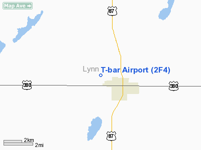
Location & QuickFacts
| FAA Information Effective: | 2008-09-25 |
| Airport Identifier: | 2F4 |
| Airport Status: | Operational |
| Longitude/Latitude: | 101-49-11.5640W/33-10-37.3340N
-101.819879/33.177037 (Estimated) |
| Elevation: | 3126 ft / 952.80 m (Estimated) |
| Land: | 56 acres |
| From nearest city: | 1 nautical miles NW of Tahoka, TX |
| Location: | Lynn County, TX |
| Magnetic Variation: | 09E (1985) |
Owner & Manager
| Ownership: | Publicly owned |
| Owner: | City Of Tahoka |
| Address: | Po Box 300
Tahoka, TX 79373 |
| Phone number: | 806-561-4211 |
| Manager: | Jerry Webster
CITY MANAGER. |
| Address: | Po Box 300
Tahoka, TX 79373 |
| Phone number: | 806-561-4211
EMERGENCY 806-561-5255. |
Airport Operations and Facilities
| Airport Use: | Open to public |
| Wind indicator: | Yes |
| Segmented Circle: | No |
| Control Tower: | No |
| Lighting Schedule: | DUSK-DAWN
MIRL RY 17/35 PRESET LOW INTST; TO INCR INTST ACTVT - 122.8. |
| Beacon Color: | Clear-Green (lighted land airport) |
| Landing fee charge: | No |
| Sectional chart: | Dallas-ft Worth |
| Region: | ASW - Southwest |
| Boundary ARTCC: | ZFW - Fort Worth |
| Tie-in FSS: | FTW - Fort Worth |
| FSS on Airport: | No |
| FSS Phone: | 817-541-3474 |
| FSS Toll Free: | 1-800-WX-BRIEF |
| NOTAMs Facility: | FTW (NOTAM-d service avaliable) |
Airport Communications
| CTAF: | 122.800 |
| Unicom: | 122.800
UNICOM OTS INDEFLY. |
Airport Services
Runway Information
Runway 08/26
| Dimension: | 2543 x 33 ft / 775.1 x 10.1 m |
| Surface: | GRVL, Good Condition |
| Weight Limit: | Single wheel: 10000 lbs. |
| |
Runway 08 |
Runway 26 |
| Traffic Pattern: | Left | Right |
| Obstruction: | 6 ft post, 95 ft left of centerline | 5 ft road, 30.0 ft from runway, 6:1 slope to clear |
|
Runway 17/35
| Dimension: | 3278 x 50 ft / 999.1 x 15.2 m |
| Surface: | ASPH, |
| Weight Limit: | Single wheel: 12500 lbs. |
| Edge Lights: | Medium
ONLY SOUTH 3093 FT RY 17/35 LIGHTED. |
| |
Runway 17 |
Runway 35 |
| Traffic Pattern: | Right | Left |
| Markings: | Basic, Good Condition | Basic, Good Condition |
| Obstruction: | 10 ft road, 201.0 ft from runway, 125 ft left of centerline | 10 ft road, 201.0 ft from runway, 125 ft right of centerline
+10 FT ROAD 0-200 FT FM THLD 125 FT RIGHT. |
|
Radio Navigation Aids
| ID |
Type |
Name |
Ch |
Freq |
Var |
Dist |
| BFE | NDB | Brownfield | | 311.00 | 09E | 18.7 nm |
| LSA | NDB | Lamesa | | 338.00 | 09E | 25.6 nm |
| LLN | NDB | Levelland | | 266.00 | 09E | 36.0 nm |
| CZX | NDB | Crosbyton | | 332.00 | 09E | 39.7 nm |
| LBB | VORTAC | Lubbock | 029X | 109.20 | 11E | 32.1 nm |
Remarks
- HVY DUSTER ACTIVITY MAY THRU OCT.
- RWY 08/26 THRS NOT DEFINED.
- 20 FT AGL IRRIGATION EQUIP 300 FT NORTH AER 35.
Images and information placed above are from
http://www.airport-data.com/airport/2F4/
We thank them for the data!
| General Info
|
| Country |
United States
|
| State |
TEXAS
|
| FAA ID |
2F4
|
| Latitude |
33-10-37.334N
|
| Longitude |
101-49-11.564W
|
| Elevation |
3126 feet
|
| Near City |
TAHOKA
|
We don't guarantee the information is fresh and accurate. The data may
be wrong or outdated.
For more up-to-date information please refer to other sources.
|
|


