 |
|
Location & QuickFacts
| FAA Information Effective: | 2008-09-25 |
| Airport Identifier: | 40TE |
| Airport Status: | Operational |
| Longitude/Latitude: | 097-39-18.0380W/30-47-20.6760N
-97.655011/30.789077 (Estimated) |
| Elevation: | 841 ft / 256.34 m (Estimated) |
| Land: | 0 acres |
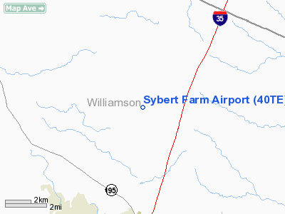
| From nearest city: | 3 nautical miles SW of Jarrell, TX |
| Location: | Williamson County, TX |
| Magnetic Variation: | 07E (1985) |
Owner & Manager
| Ownership: | Privately owned |
| Owner: | Jimmy & Donald Sybert |
| Address: | Route 1, Box 103
Jarrell, TX 76537 |
| Phone number: | 512-746-2022 |
| Manager: | Jimmy & Donald Sybert |
| Address: | Route 1, Box 103
Jarrell, TX 76537 |
| Phone number: | 512-746-2022 |
Airport Operations and Facilities
| Airport Use: | Private |
| Wind indicator: | Yes |
| Segmented Circle: | No |
| Control Tower: | No |
| Landing fee charge: | No |
| Sectional chart: | San Antonio |
| Region: | ASW - Southwest |
| Boundary ARTCC: | ZHU - Houston |
| Tie-in FSS: | SJT - San Angelo |
| FSS on Airport: | No |
| FSS Toll Free: | 1-800-WX-BRIEF |
Airport Services
| Airframe Repair: | NONE |
| Power Plant Repair: | NONE |
Runway Information
Runway 02/20
| Dimension: | 1200 x 100 ft / 365.8 x 30.5 m |
| Surface: | TURF, |
| |
Runway 02 |
Runway 20 |
| Traffic Pattern: | Left | Left |
|
Runway 05/23
| Dimension: | 1000 x 100 ft / 304.8 x 30.5 m |
| Surface: | TURF, |
| |
Runway 05 |
Runway 23 |
| Traffic Pattern: | Left | Left |
|
Runway 10/28
| Dimension: | 1300 x 100 ft / 396.2 x 30.5 m |
| Surface: | TURF, |
| |
Runway 10 |
Runway 28 |
| Traffic Pattern: | Left | Left |
|
Radio Navigation Aids
| ID |
Type |
Name |
Ch |
Freq |
Var |
Dist |
| GUO | NDB | Georgetown | | 332.00 | 06E | 6.4 nm |
| IL | NDB | Iresh | | 278.00 | 07E | 14.4 nm |
| HLR | NDB | Hood | | 347.00 | 07E | 20.6 nm |
| GR | NDB | Starn | | 323.00 | 07E | 25.5 nm |
| BMQ | NDB | Burnet | | 341.00 | 07E | 30.2 nm |
| MFS | NDB | Horseshoe Bay Resort | | 403.00 | 07E | 39.7 nm |
| GRK | VOR/DME | Gray | 055X | 111.80 | 07E | 16.8 nm |
| TPL | VOR/DME | Temple | 041X | 110.40 | 09E | 27.9 nm |
| CWK | VORTAC | Centex | 075X | 112.80 | 06E | 25.5 nm |
| LZZ | VORTAC | Lampasas | 072X | 112.50 | 08E | 34.6 nm |
Remarks
- CTLG OBST: UNMRKD PLINE & BLDG.
Images and information placed above are from
http://www.airport-data.com/airport/40TE/
We thank them for the data!
| General Info
|
| Country |
United States
|
| State |
TEXAS
|
| FAA ID |
40TE
|
| Latitude |
30-47-20.676N
|
| Longitude |
097-39-18.038W
|
| Elevation |
841 feet
|
| Near City |
JARRELL
|
We don't guarantee the information is fresh and accurate. The data may
be wrong or outdated.
For more up-to-date information please refer to other sources.
|
|


