|
|
 |
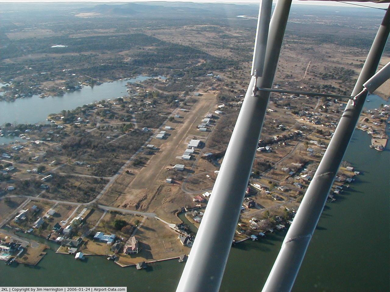
(Click on the photo to enlarge) |
 |
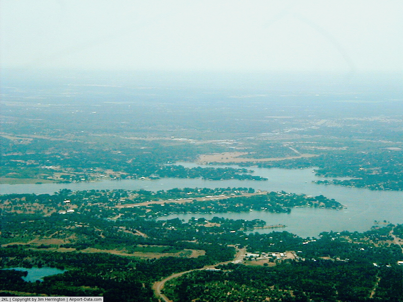
(Click on the photo to enlarge) |
Location & QuickFacts
| FAA Information Effective: | 2008-09-25 |
| Airport Identifier: | 2KL |
| Airport Status: | Operational |
| Longitude/Latitude: | 098-24-31.0980W/30-35-55.6750N
-98.408638/30.598799 (Estimated) |
| Elevation: | 854 ft / 260.30 m (Estimated) |
| Land: | 14 acres |
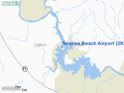
| From nearest city: | 1 nautical miles NE of Sunrise Beach Village, TX |
| Location: | Llano County, TX |
| Magnetic Variation: | 07E (1985) |
Owner & Manager
| Ownership: | Publicly owned |
| Owner: | Sunrise Beach Village |
| Address: | 124 Sunrise Drive
Sunrise Beach, TX 78643 |
| Phone number: | 325-388-6438 |
| Manager: | Jim Boies |
| Address: | 356 E Lakeshore
Sunrise Beach, TX 78643 |
| Phone number: | 325-388-4371 |
Airport Operations and Facilities
| Airport Use: | Open to public |
| Wind indicator: | Yes |
| Segmented Circle: | Yes |
| Control Tower: | No |
| Lighting Schedule: | DUSK-2230 |
| Landing fee charge: | No |
| Sectional chart: | San Antonio |
| Region: | ASW - Southwest |
| Boundary ARTCC: | ZHU - Houston |
| Tie-in FSS: | SJT - San Angelo |
| FSS on Airport: | No |
| FSS Toll Free: | 1-800-WX-BRIEF |
| NOTAMs Facility: | SJT (NOTAM-d service avaliable) |
Airport Communications
Airport Services
| Airframe Repair: | MAJOR
FOR AIRCRAFT SERVICE CALL 512-755-0399. |
| Power Plant Repair: | MAJOR |
Runway Information
Runway 12/30
| Dimension: | 2649 x 110 ft / 807.4 x 33.5 m |
| Surface: | TURFRVL, Good Condition |
| Edge Lights: | Low |
| |
Runway 12 |
Runway 30 |
| Traffic Pattern: | Left | Right |
| Obstruction: | 26 ft tree, 535.0 ft from runway, 40 ft left of centerline, 20:1 slope to clear | 27 ft trees, 165.0 ft from runway, 30 ft right of centerline, 6:1 slope to clear |
|
Radio Navigation Aids
| ID |
Type |
Name |
Ch |
Freq |
Var |
Dist |
| MFS | NDB | Horseshoe Bay Resort | | 403.00 | 07E | 5.2 nm |
| BMQ | NDB | Burnet | | 341.00 | 07E | 12.3 nm |
| GUO | NDB | Georgetown | | 332.00 | 06E | 38.0 nm |
| GR | NDB | Starn | | 323.00 | 07E | 43.8 nm |
| IL | NDB | Iresh | | 278.00 | 07E | 44.3 nm |
| HLR | NDB | Hood | | 347.00 | 07E | 48.1 nm |
| GRK | VOR/DME | Gray | 055X | 111.80 | 07E | 40.3 nm |
| LLO | VORTAC | Llano | 019X | 108.20 | 08E | 22.9 nm |
| STV | VORTAC | Stonewall | 085X | 113.80 | 08E | 28.2 nm |
| LZZ | VORTAC | Lampasas | 072X | 112.50 | 08E | 37.9 nm |
| CWK | VORTAC | Centex | 075X | 112.80 | 06E | 47.4 nm |
Remarks
- 20-30 FT TREES ALONG BOTH SIDES OF RY 75 FT EACH SIDE OF RY CNTRLN.
- PAEW ADJ RY 12/30.
- TREES IN APCH AREA & HANGARS WITHIN 60 FT OF RY.
- BE ALERT FOR DEER ON & INVOF RY.
- NO TOUCH & GO OPERATIONS.
- TRANSIENT PARKING LMTD TO 72 HRS.
- FOR EMERG CALL 325-247-5767-LLANO SHERIFF DEPT.
- PAEW & 4 FT DEEP BY 40 FT WIDE TRENCH 25 FT FM AER 12.
- EXISTED PRIOR TO THE FAA ACT.
Images and information placed above are from
http://www.airport-data.com/airport/2KL/
We thank them for the data!
| General Info
|
| Country |
United States
|
| State |
TEXAS
|
| FAA ID |
2KL
|
| Latitude |
30-35-55.675N
|
| Longitude |
098-24-31.098W
|
| Elevation |
854 feet
|
| Near City |
SUNRISE BEACH VILLAGE
|
We don't guarantee the information is fresh and accurate. The data may
be wrong or outdated.
For more up-to-date information please refer to other sources.
|
|