 |
|
Location & QuickFacts
| FAA Information Effective: | 2008-09-25 |
| Airport Identifier: | X43 |
| Airport Status: | Operational |
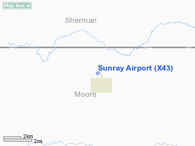
| Longitude/Latitude: | 101-49-43.6160W/36-01-45.1280N
-101.828782/36.029202 (Estimated) |
| Elevation: | 3507 ft / 1068.93 m (Estimated) |
| Land: | 85 acres |
| From nearest city: | 1 nautical miles NW of Sunray, TX |
| Location: | Moore County, TX |
| Magnetic Variation: | 09E (1985) |
Owner & Manager
| Ownership: | Publicly owned |
| Owner: | City Of Sunray |
| Address: | Po Box 250
Sunray, TX 79086 |
| Phone number: | 806-948-4111 |
| Manager: | Greg Smith
CITY MANAGER, CITY OF SUNRAY. |
| Address: | Po Box 250
Sunray, TX 79086 |
| Phone number: | 806-948-4111 |
Airport Operations and Facilities
| Airport Use: | Open to public |
| Wind indicator: | Yes |
| Segmented Circle: | No |
| Control Tower: | No |
| Lighting Schedule: | DUSK-DAWN |
| Beacon Color: | Clear-Green (lighted land airport)
ROTG BCN OTS INDEFLY. |
| Landing fee charge: | No |
| Sectional chart: | Wichita |
| Region: | ASW - Southwest |
| Traffic Pattern Alt: | 1000 ft |
| Boundary ARTCC: | ZAB - Albuquerque |
| Tie-in FSS: | FTW - Fort Worth |
| FSS on Airport: | No |
| FSS Phone: | 817-541-3474 |
| FSS Toll Free: | 1-800-WX-BRIEF |
| NOTAMs Facility: | FTW (NOTAM-d service avaliable) |
Airport Communications
Airport Services
| Airframe Repair: | NONE |
| Power Plant Repair: | NONE |
| Bottled Oxygen: | NONE |
| Bulk Oxygen: | NONE |
Runway Information
Runway 02/20
| Dimension: | 3760 x 50 ft / 1146.0 x 15.2 m |
| Surface: | GRVL, Fair Condition |
| |
Runway 02 |
Runway 20 |
| Traffic Pattern: | Left | Left |
| Obstruction: | 30 ft pline, 29.0 ft from runway, 125 ft right of centerline | 15 ft road, 60.0 ft from runway, 131 ft left of centerline, 4:1 slope to clear |
|
Runway 17/35
| Dimension: | 3250 x 50 ft / 990.6 x 15.2 m |
| Surface: | ASPH, Good Condition |
| Weight Limit: | Single wheel: 13000 lbs. |
| Edge Lights: | Low |
| |
Runway 17 |
Runway 35 |
| Traffic Pattern: | Left | Left |
| Markings: | Basic, Good Condition | Basic, Good Condition |
| Obstruction: | 15 ft road, 200.0 ft from runway, 20 ft left of centerline
ROAD AT THLD 60 FT LEFT; 2 FT SIGN 20 FT FM THLD 18 FT R. | 23 ft rr, 263.0 ft from runway, 2:1 slope to clear
ROAD 150 FT FM THLD ACROSS APCH; 6 FT WOOD POST 105 FT FM THLD 35 FT RIGHT; 8 FT SIGN 100 FT FM THLD 135 FT RIGHT. |
|
Radio Navigation Aids
| ID |
Type |
Name |
Ch |
Freq |
Var |
Dist |
| DUX | NDB | Durrett | | 414.00 | 09E | 13.4 nm |
| GUY | NDB | Guymon | | 275.00 | 09E | 43.6 nm |
| PPA | NDB | Pampa | | 368.00 | 09E | 47.9 nm |
| BGD | VORTAC | Borger | 023X | 108.60 | 11E | 25.5 nm |
| DHT | VORTAC | Dalhart | 057X | 112.00 | 12E | 35.0 nm |
| PNH | VORTAC | Panhandle | 113X | 116.60 | 08E | 48.2 nm |
Remarks
- RY 17/35 HGRS, PARKED VEHICLES, PIPE SUPPLIES & ACFT OBSTRUCT PRIMARY SFC.
- 10 FT AGL GAS WELL LCTD 375 FT EAST OF SOUTH END RY 02/20.
- WELL HEAD 10 FT HIGH, 147 FT LEFT OF RY 20 END.
Images and information placed above are from
http://www.airport-data.com/airport/X43/
We thank them for the data!
| General Info
|
| Country |
United States
|
| State |
TEXAS
|
| FAA ID |
X43
|
| Latitude |
36.029202
36° 01' 45.13" N
|
| Longitude |
-101.828783
101° 49' 43.62" W
|
| Elevation |
3507 feet
1069 meters
|
| Magnetic Variation |
007° E (01/06)
|
| Beacon |
Yes
|
| Operating Agency |
U.S.CIVIL AIRPORT WHEREIN PERMIT COVERS USE BY TRANSIT MILITARY AIRCRAFT
|
| Daylight Saving Time |
Second Sunday in March at 0200 to first Sunday in November at 0200 local time (Exception Arizona and that portion of Indiana in the Eastern Time Zone)
|
We don't guarantee the information is fresh and accurate. The data may
be wrong or outdated.
For more up-to-date information please refer to other sources.
|
|


