|
|
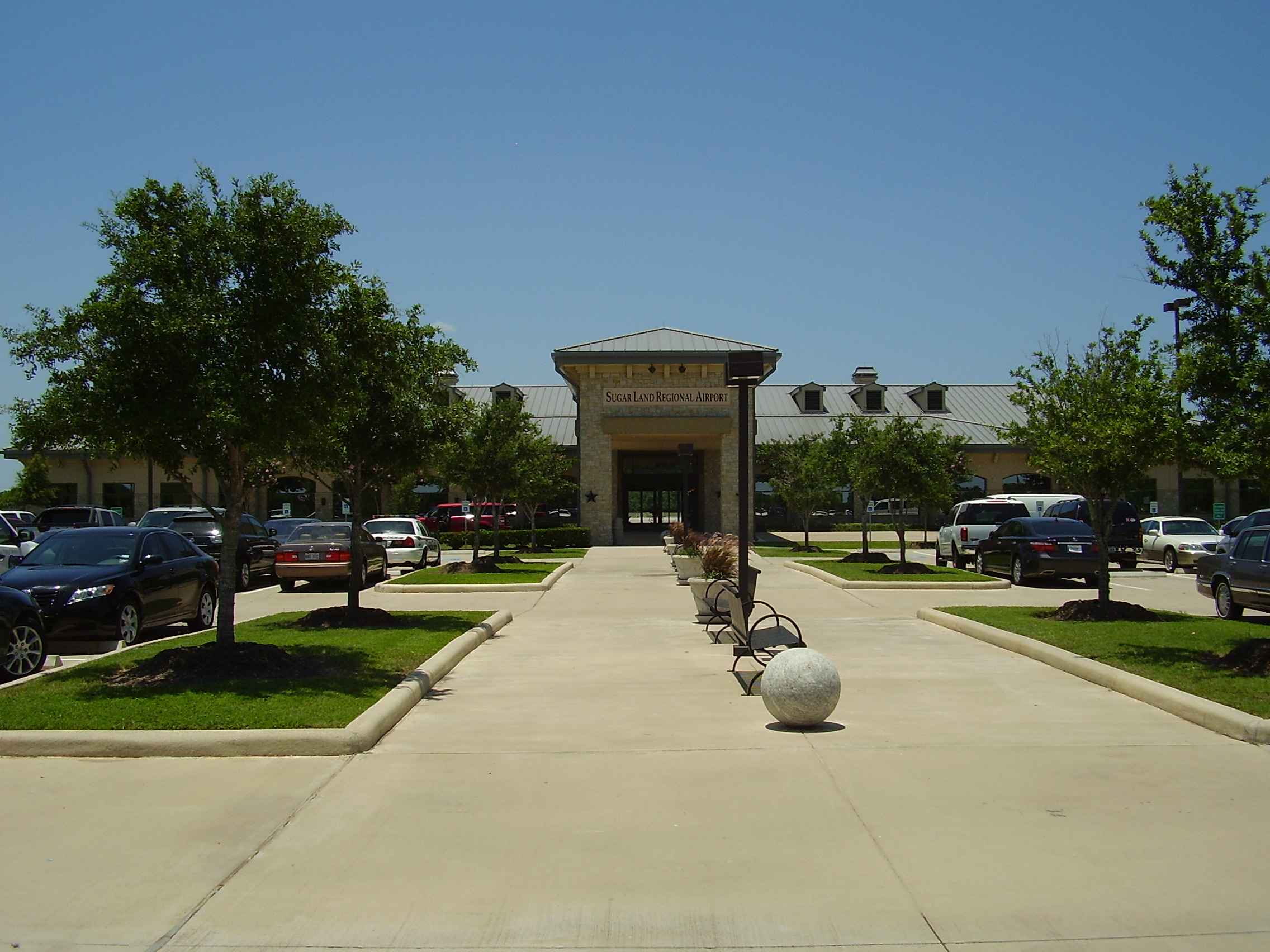
| Sugar Land Regional Airport |
 |
| IATA: SGR – ICAO: KSGR – FAA LID: SGR |
| Summary |
| Airport type |
Public |
| Owner |
City of Sugar Land |
| Serves |
Houston, Texas |
| Location |
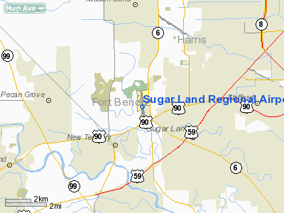
Sugar Land, Texas |
| Elevation AMSL |
82 ft / 25 m |
| Coordinates |
29°37′20″N 095°39′24″W / 29.62222°N 95.65667°W / 29.62222; -95.65667 |
| Website |
www.FlySGR.com |
| Runways |
| Direction |
Length |
Surface |
| ft |
m |
| 17/35 |
8,000 |
2,438 |
Concrete |
| Statistics (2005) |
| Aircraft operations |
90,758 |
| Based aircraft |
160 |
| Sources: airport web site and FAA |
Sugar Land Regional Airport (IATA: SGR, ICAO: KSGR, FAA LID: SGR) is a city-owned public-use airport located in Sugar Land, Fort Bend County, Texas, United States, 17 miles (27 km) southwest of the central business district of Houston.
It was formerly known as Sugar Land Municipal Airport or Hull Field. The airport was purchased from a private interest in 1990 by the city of Sugar Land. It is the fourth-largest airport within the Houston–Sugar Land–Baytown metropolitan area and handles approximately 250 aircraft operations per day.
The airport today serves the area's general aviation (GA) aircraft serving corporate, governmental, and private clientele. A new 20,000-square-foot (1,900 m) Terminal opened in 2006 and a 60-acre (240,000 m) GA complex is currently under construction. The airport, the fourth largest airport in Greater Houston, receives yearly usage from over 100 Fortune 500 companies. TXP, Inc. released a report identifying the airport as "foremost general reliever airport in the southwest sector" and "a catalyst for corporate commerce in the Greater Houston market including the Westchase District, Uptown/Galleria, and Greenway Plaza."
The city of Houston maintains Cullinan Park that occupies 750 acres (3.0 km) of land directly north and west of the Sugar Land Regional Airport that is surrounded by Sugar Land homes, and there is a highway and rail road track directly south of the airport—all factors that block airport expansion. The Central Unit, a Texas Department of Criminal Justice prison for males, is in land zoned for airport expansion. HistoryDonald Hull, an oral surgeon that established a dental program for the Texas Department of Corrections in the early 1950s. Hull, who commuted across Southeast Texas to provide dental care to prisoners, originally operated aircraft to South Houston Airport and Sam Houston Airport. The City of Houston forced those airports to close. Hull decided to develop an airport that would not be closed. In 1952 Hull landed his biplane in a field near Sugar Land. Afterwards, with a loan from a friend, Hull purchased the field. In 1985 the airport saw service to Houston Intercontinental through Metro Airlines, operating as Eastern Airlines Express.
The City of Sugar Land purchased Hull Field on December 18, 1990 and renamed the airport "Sugar Land Municipal Airport." The City of Sugar Land opened an NFCT (non-federal control tower) that it funds and operates. This control tower manages traffic within 4 miles (6 km) of Sugar Land Airport from 6:00 a.m. to 10:00 p.m. daily. From the northern hemisphere summer of 1993 to early 1995, Sugar Land Regional Airport handled commercial passenger service during the mid-1990s for a now-defunct Texas carrier known as Conquest Airlines. Conquest offered commercial flights from the airport to Austin, Dallas, and San Antonio. The airline closed after financial difficulties occurred. The airport received its current name in October 2002.
Facilities and aircraft
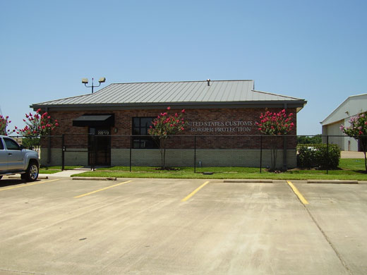 | |
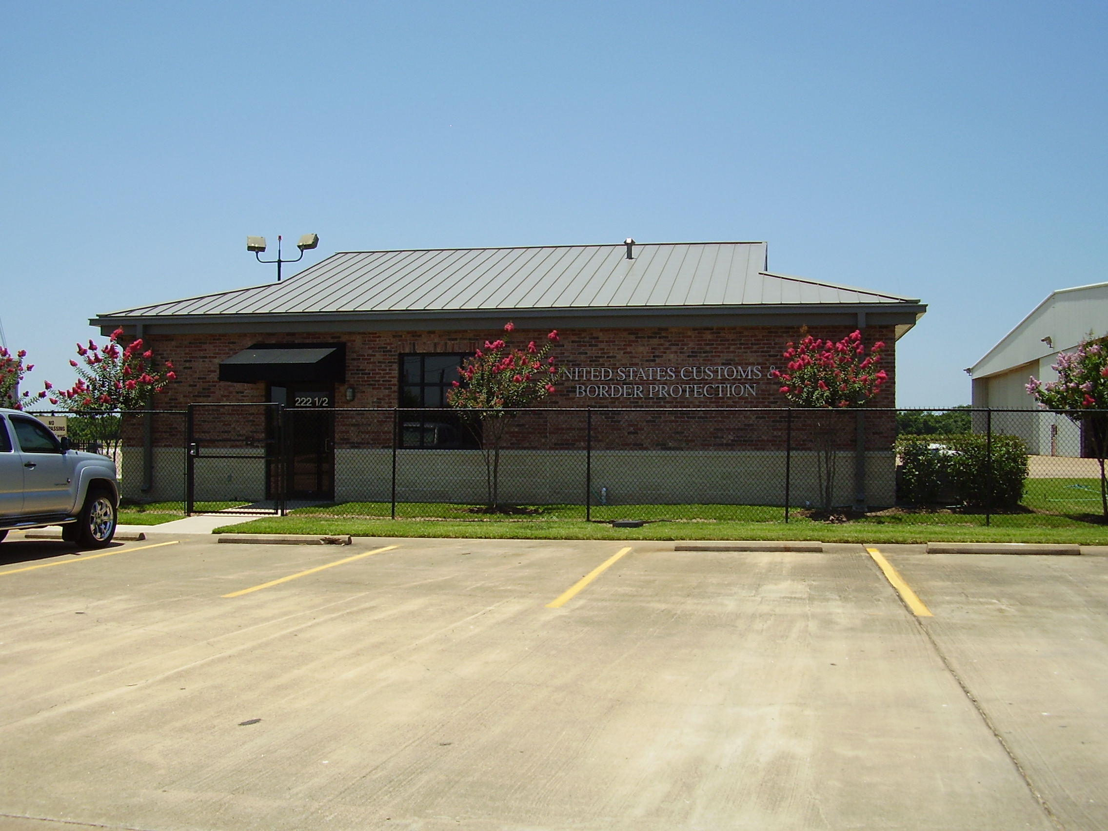
U.S. Customs and Border Protection at the airport |
Sugar Land Regional Airport covers an area of 426 acres (172 ha) and contains one concrete paved runway designated 17/35 which measures 8,000 x 100 ft (2,438 x 30 m). For the 12-month period ending July 28, 2005, the airport had 90,758 aircraft operations, an average of 248 per day: 95% general aviation, 5% air taxi and <1% military. At that time there were 160 aircraft based at this airport: 58% single-engine, 22% multi-engine, 16% jet and 4% helicopter. The airport includes the former Stanford Aviation hangar, described by Mimi Swartz of Texas Monthly as "impeccably landscaped." Flights from the terminal went to Antigua.
Gallery
The above content comes from Wikipedia and is published under free licenses – click here to read more.
Location & QuickFacts
| FAA Information Effective: | 2008-09-25 |
| Airport Identifier: | SGR |
| Airport Status: | Operational |
| Longitude/Latitude: | 095-39-23.5000W/29-37-20.1000N
-95.656528/29.622250 (Estimated) |
| Elevation: | 82 ft / 24.99 m (Surveyed) |
| Land: | 426 acres |
| From nearest city: | 17 nautical miles SW of Houston, TX |
| Location: | Fort Bend County, TX |
| Magnetic Variation: | 05E (2000) |
Owner & Manager
| Ownership: | Publicly owned |
| Owner: | City Of Sugar Land |
| Address: | Po Box 110
Sugar Land, TX 77478-0110 |
| Phone number: | 281-275-2710 |
| Manager: | Phillip W. Savko |
| Address: | 12888 B Hwy 6 South
Sugar Land, TX 77478 |
| Phone number: | 281-275-2100 |
Airport Operations and Facilities
| Airport Use: | Open to public |
| Wind indicator: | Yes |
| Segmented Circle: | Yes |
| Control Tower: | Yes |
| Lighting Schedule: | DUSK-DAWN
ACTVT HIRL RY 17/35, REIL RYS 17 & 35 - CTAF. |
| Beacon Color: | Clear-Green (lighted land airport) |
| Landing fee charge: | Yes
RAMP FEE FOR CIVIL ACFT; WAIVED WITH FUEL PURCHASE. |
| Sectional chart: | Houston |
| Region: | ASW - Southwest |
| Boundary ARTCC: | ZHU - Houston |
| Tie-in FSS: | CXO - Montgomery County |
| FSS on Airport: | No |
| FSS Toll Free: | 1-800-WX-BRIEF |
| NOTAMs Facility: | SGR (NOTAM-d service avaliable) |
| Federal Agreements: | N |
Airport Communications
| CTAF: | 118.650 |
| Unicom: | 122.950 |
Airport Services
| Fuel available: | 100LLA
FOR FUEL AFT HRS CALL 281-275-2400 BEFORE 2300. |
| Airframe Repair: | MAJOR |
| Power Plant Repair: | MAJOR |
| Bottled Oxygen: | NONE |
| Bulk Oxygen: | HIGH/LOW
NITROGEN AVBL DURG BUSINESS HRS. |
Runway Information
Runway 17/35
| Dimension: | 8000 x 100 ft / 2438.4 x 30.5 m |
| Surface: | CONC, Good Condition |
| Weight Limit: | Single wheel: 80000 lbs.
Dual wheel: 120000 lbs.
Dual tandem wheel: 200000 lbs.
Dual dual tandem wheel: 600000 lbs. |
| Edge Lights: | High |
| |
Runway 17 |
Runway 35 |
| Longitude: | 095-39-27.2501W | 095-39-19.7959W |
| Latitude: | 29-37-59.5567N | 29-36-40.6328N |
| Elevation: | 82.00 ft | 74.00 ft |
| Alignment: | 127 | 127 |
| ILS Type: | | ILS/DME
|
| Traffic Pattern: | Left | Left |
| Markings: | Precision instrument, Good Condition | Precision instrument, Fair Condition |
| Crossing Height: | 52.00 ft | 56.00 ft |
| Displaced threshold: | 380.00 ft | 1984.00 ft |
| VASI: | 2-light PAPI on right side | 4-light PAPI on left side |
| Visual Glide Angle: | 3.50° | 3.00° |
| Runway End Identifier: | Yes | Yes |
| Obstruction: | 45 ft trees, 550.0 ft from runway, 7:1 slope to clear
APCH SLOPE 20:1 AT DSPLCD THLD; 50 FT TREES 1025 FT FM DSPLCD THLD 0B CNTRLN.
ASPH ROAD AT 57 FT FM THLD. | 20 ft road, 200.0 ft from runway
APCH SLOPE 50:1 TO DSPLCD THLD TO +27 FT RR TRACKS 2074 FT FM THLD.
+27 FT RR 90 FT FM THR ON CNTRLN; DIRT RD 25 FT FM THR ACROSS APCH. |
|
Radio Navigation Aids
| ID |
Type |
Name |
Ch |
Freq |
Var |
Dist |
| SGR | NDB | Hull | | 388.00 | 05E | 0.6 nm |
| LYD | NDB | Lakeside | | 249.00 | 05E | 11.7 nm |
| SYG | NDB | Sandy Point | | 402.00 | 05E | 12.2 nm |
| EYQ | NDB | Weiser | | 286.00 | 06E | 18.7 nm |
| DWH | NDB | David Hooks | | 521.00 | 05E | 30.6 nm |
| JPA | NDB | Sanjac | | 347.00 | 05E | 30.8 nm |
| BVP | NDB | Nixin | | 326.00 | 05E | 32.1 nm |
| ARM | NDB | Wharton | | 245.00 | 06E | 34.1 nm |
| BYY | NDB | Bay City | | 344.00 | 06E | 40.5 nm |
| EFD | TACAN | Ellington | 031X | | 05E | 26.0 nm |
| HUB | VOR/DME | Hobby | 118X | 117.10 | 05E | 19.9 nm |
| ELA | VOR/DME | Eagle Lake | 111X | 116.40 | 08E | 34.6 nm |
| MHF | VOR/DME | Trinity | 083X | 113.60 | 07E | 47.7 nm |
| IAH | VORTAC | Humble | 113X | 116.60 | 05E | 25.8 nm |
| TNV | VORTAC | Navasota | 106X | 115.90 | 08E | 45.2 nm |
| VUH | VORTAC | Scholes | 077X | 113.00 | 06E | 46.4 nm |
| HOU | VOT | Houston Wm P Hobby | | 108.40 | | 19.8 nm |
Remarks
- NO TOUCH & GO LNDGS NIGHTTIME.
- MILITARY AND CORPORATE GND TRANSPORTATION PRVDD.
- TPA FOR SINGLE ENGINE PISTON ACFT 1000 FT MSL; TPA FOR TWIN AND TURBOJET ACFT 1500 FT MSL; TPA FOR HELICOPTERS WITHIN 2 NM 500 FT MSL.
- BIRDS ON & INVOF ARPT.
- NOISE ABATEMENT PROCEDURE: NOISE SENSITIVE AREAS - INFO AVBL AT TERMINAL.
- NO INTERSECTION DEPARTURES FOR MULTI-ENGINE ACFT.
- PRVDD THRS DSPLCD TO MAINTAIN CLEAR 20:1 APCH SLOPE OVER ALL OBSTNS AT RWY ENDS.
Images and information placed above are from
http://www.airport-data.com/airport/SGR/
We thank them for the data!
| General Info
|
| Country |
United States
|
| State |
TEXAS
|
| FAA ID |
SGR
|
| Latitude |
29-37-20.111N
|
| Longitude |
095-39-23.504W
|
| Elevation |
82 feet
|
| Near City |
HOUSTON
|
We don't guarantee the information is fresh and accurate. The data may
be wrong or outdated.
For more up-to-date information please refer to other sources.
|
|