 |
|
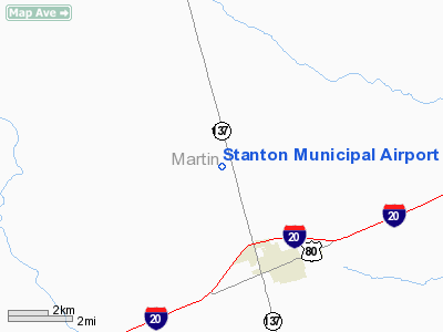
Location & QuickFacts
| FAA Information Effective: | 2008-09-25 |
| Airport Identifier: | 63F |
| Airport Status: | Operational |
| Longitude/Latitude: | 101-49-20.9000W/32-10-24.8990N
-101.822472/32.173583 (Estimated) |
| Elevation: | 2731 ft / 832.41 m (Estimated) |
| Land: | 77 acres |
| From nearest city: | 3 nautical miles NW of Stanton, TX |
| Location: | Martin County, TX |
| Magnetic Variation: | 09E (1985) |
Owner & Manager
| Ownership: | Publicly owned |
| Owner: | City Of Stanton |
| Address: | Po Box 370, 102 W. School St
Stanton, TX 79782 |
| Phone number: | 432-756-3301 |
| Manager: | Danny Fryar, City Mgr |
| Address: | Po Box 370
Stanton, TX 79782 |
| Phone number: | 432-756-3301 |
Airport Operations and Facilities
| Airport Use: | Open to public |
| Wind indicator: | Yes |
| Segmented Circle: | Yes |
| Control Tower: | No |
| Lighting Schedule: | DUSK-DAWN |
| Beacon Color: | Clear-Green (lighted land airport) |
| Landing fee charge: | No |
| Sectional chart: | Dallas-ft Worth |
| Region: | ASW - Southwest |
| Boundary ARTCC: | ZFW - Fort Worth |
| Tie-in FSS: | SJT - San Angelo |
| FSS on Airport: | No |
| FSS Toll Free: | 1-800-WX-BRIEF |
| NOTAMs Facility: | SJT (NOTAM-d service avaliable) |
| Federal Agreements: | 1Y |
Airport Communications
Airport Services
| Bottled Oxygen: | NONE |
| Bulk Oxygen: | NONE |
Runway Information
Runway 16/34
| Dimension: | 4240 x 60 ft / 1292.4 x 18.3 m |
| Surface: | ASPH, Fair Condition |
| Weight Limit: | Single wheel: 14000 lbs. |
| Edge Lights: | Low |
| |
Runway 16 |
Runway 34 |
| Longitude: | 101-49-27.2630W | 101-49-14.5370W |
| Latitude: | 32-10-45.1670N | 32-10-04.6320N |
| Elevation: | 2731.00 ft | 2722.00 ft |
| Alignment: | 127 | 127 |
| Traffic Pattern: | Left | Left |
| Markings: | Basic, Good Condition | Basic, Good Condition |
| Obstruction: | 15 ft road, 520.0 ft from runway, 21:1 slope to clear | 15 ft road, 520.0 ft from runway, 21:1 slope to clear |
|
Radio Navigation Aids
| ID |
Type |
Name |
Ch |
Freq |
Var |
Dist |
| MA | NDB | Farly | | 326.00 | 09E | 27.9 nm |
| LSA | NDB | Lamesa | | 338.00 | 09E | 35.5 nm |
| ANR | NDB | Andrews | | 245.00 | 09E | 37.8 nm |
| MAF | VORTAC | Midland | 095X | 114.80 | 11E | 21.2 nm |
| BGS | VORTAC | Big Spring | 090X | 114.30 | 11E | 21.4 nm |
| MAF | VOT | Midland International | | 108.20 | | 24.2 nm |
Remarks
- NUMEROUS 300 FT TALL WINDMILLS 1.25-3 MILES NW, NE AND EAST OF ARPT.
Images and information placed above are from
http://www.airport-data.com/airport/63F/
We thank them for the data!
| General Info
|
| Country |
United States
|
| State |
TEXAS
|
| FAA ID |
63F
|
| Latitude |
32-10-24.899N
|
| Longitude |
101-49-20.900W
|
| Elevation |
2731 feet
|
| Near City |
STANTON
|
We don't guarantee the information is fresh and accurate. The data may
be wrong or outdated.
For more up-to-date information please refer to other sources.
|
|


