 |
|
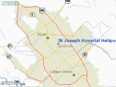
St Joseph Hospital Heliport |
Location & QuickFacts
| FAA Information Effective: | 2008-09-25 |
| Airport Identifier: | 82TX |
| Airport Status: | Operational |
| Longitude/Latitude: | 096-20-50.8650W/30-39-25.7130N
-96.347462/30.657143 (Estimated) |
| Elevation: | 320 ft / 97.54 m (Estimated) |
| Land: | 0 acres |
| From nearest city: | 1 nautical miles NE of Bryan, TX |
| Location: | Brazos County, TX |
| Magnetic Variation: | 06E (1985) |
Owner & Manager
| Ownership: | Privately owned |
| Owner: | St Joseph Hospital |
| Address: | 2801 Franciscan Dr
Bryan, TX 77801 |
| Phone number: | 409-776-3777 |
| Manager: | Sister Gretchen Kunz |
| Address: | 2801 Franciscan Dr
Bryan, TX 77801 |
| Phone number: | 409-776-3777 |
Airport Operations and Facilities
| Airport Use: | Private
MEDICAL. |
| Wind indicator: | Yes |
| Segmented Circle: | No |
| Control Tower: | No |
| Lighting Schedule: | PHONE REQ
FOR ROTG BCN & PERIMETER LGTS CALL 409-776-3777. |
| Beacon Color: | Clear-Green-Yellow (heliport) |
| Landing fee charge: | No |
| Sectional chart: | Houston |
| Region: | ASW - Southwest |
| Boundary ARTCC: | ZHU - Houston |
| Tie-in FSS: | CXO - Montgomery County |
| FSS on Airport: | No |
| FSS Toll Free: | 1-800-WX-BRIEF
FOR FP FILING CALL CXO FSS 1-800-833-5602. |
Runway Information
Helipad H1
| Dimension: | 50 x 50 ft / 15.2 x 15.2 m
TOUCHDOWN 50 FT BY 50 FT WITHIN A 200 FT BY 200 FT LNDG/TKOF AREA. |
| Surface: | CONC, |
| |
Runway H1 |
Runway |
| Traffic Pattern: | Left | Left |
|
Radio Navigation Aids
| ID |
Type |
Name |
Ch |
Freq |
Var |
Dist |
| BNH | NDB | Brenham | | 362.00 | 06E | 26.2 nm |
| UTS | NDB | Huntsville | | 308.00 | 06E | 39.4 nm |
| GYB | NDB | Lee County | | 385.00 | 07E | 43.9 nm |
| CLL | VORTAC | College Station | 080X | 113.30 | 08E | 4.9 nm |
| TNV | VORTAC | Navasota | 106X | 115.90 | 08E | 26.7 nm |
| LOA | VORTAC | Leona | 045X | 110.80 | 08E | 34.2 nm |
| IDU | VORTAC | Industry | 039X | 110.20 | 08E | 43.6 nm |
Remarks
Images and information placed above are from
http://www.airport-data.com/airport/82TX/
We thank them for the data!
| General Info
|
| Country |
United States
|
| State |
TEXAS
|
| FAA ID |
82TX
|
| Latitude |
30-39-25.713N
|
| Longitude |
096-20-50.865W
|
| Elevation |
320 feet
|
| Near City |
BRYAN
|
We don't guarantee the information is fresh and accurate. The data may
be wrong or outdated.
For more up-to-date information please refer to other sources.
|
|


