 |
|
Location & QuickFacts
| FAA Information Effective: | 2008-09-25 |
| Airport Identifier: | 88R |
| Airport Status: | Operational |
| Longitude/Latitude: | 098-07-16.0620W/30-28-40.7020N
-98.121128/30.477973 (Estimated) |
| Elevation: | 830 ft / 252.98 m (Estimated) |
| Land: | 21 acres |
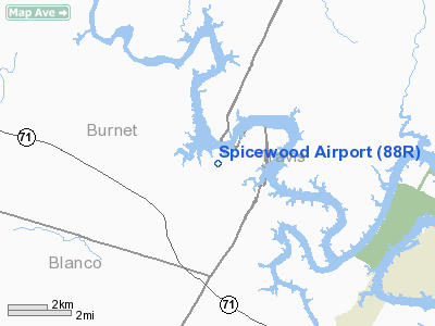
| From nearest city: | 2 nautical miles E of Spicewood, TX |
| Location: | Burnet County, TX |
| Magnetic Variation: | 07E (1985) |
Owner & Manager
| Ownership: | Privately owned |
| Owner: | Spicewood Aviation Inc |
| Address: | 111 Piper Lane
Spicewood, TX 78669 |
| Phone number: | 830-693-7707 |
| Manager: | Dana Martin |
| Address: | 111 Piper Lane
Spicewood, TX 78669 |
| Phone number: | 512-789-1221 |
Airport Operations and Facilities
| Airport Use: | Open to public |
| Wind indicator: | Yes |
| Segmented Circle: | No |
| Control Tower: | No |
| Sectional chart: | San Antonio |
| Region: | ASW - Southwest |
| Traffic Pattern Alt: | 1000 ft |
| Boundary ARTCC: | ZHU - Houston |
| Tie-in FSS: | SJT - San Angelo |
| FSS on Airport: | No |
| FSS Toll Free: | 1-800-WX-BRIEF |
| NOTAMs Facility: | SJT (NOTAM-d service avaliable) |
Airport Communications
| CTAF: | 122.800 |
| Unicom: | 122.800 |
Airport Services
| Fuel available: | 100LLA |
| Airframe Repair: | MINOR |
| Power Plant Repair: | MAJOR |
Runway Information
Runway 17/35
| Dimension: | 4185 x 30 ft / 1275.6 x 9.1 m |
| Surface: | ASPH, Good Condition |
| Weight Limit: | Single wheel: 12500 lbs. |
| |
Runway 17 |
Runway 35 |
| Traffic Pattern: | Left | Left |
| Markings: | Basic, Good Condition | Basic, Good Condition |
| Displaced threshold: | 464.00 ft | 0.00 ft |
| Obstruction: | 15 ft tree, 200.0 ft from runway
APCH RATIO 9:1 FM DSPLCD THLD TO 28 FT TREE 275 FT FM DSPLCD THLD 135 FT RIGHT.
+25 FT TREES FM RY END TO 200 FT ACROSS RY CENTERLINE. | 23 ft trees, 780.0 ft from runway, 25:1 slope to clear
+3-6 FT RISING GROUND FM THLD TO 145 FT 50 FT L. |
|
Radio Navigation Aids
| ID |
Type |
Name |
Ch |
Freq |
Var |
Dist |
| MFS | NDB | Horseshoe Bay Resort | | 403.00 | 07E | 12.6 nm |
| BMQ | NDB | Burnet | | 341.00 | 07E | 16.9 nm |
| GUO | NDB | Georgetown | | 332.00 | 06E | 26.0 nm |
| IL | NDB | Iresh | | 278.00 | 07E | 39.1 nm |
| GR | NDB | Starn | | 323.00 | 07E | 43.3 nm |
| HLR | NDB | Hood | | 347.00 | 07E | 44.5 nm |
| GRK | VOR/DME | Gray | 055X | 111.80 | 07E | 36.9 nm |
| CWK | VORTAC | Centex | 075X | 112.80 | 06E | 31.2 nm |
| STV | VORTAC | Stonewall | 085X | 113.80 | 08E | 34.4 nm |
| LLO | VORTAC | Llano | 019X | 108.20 | 08E | 39.4 nm |
| LZZ | VORTAC | Lampasas | 072X | 112.50 | 08E | 42.5 nm |
Remarks
- BE ALERT FOR DEER ON & INVOF ARPT.
- ARPT CLSD NIGHTS.
- ARPT CLSD TO JET & TURBO JET ACFT, EXCEPT FOR VERY LIGHT JETS.
- ARPT CLSD TO TGL, ULTRALIGHTS & HANG GLIDERS.
- NO LINE OF SIGHT BTN RY ENDS.
- ARPT CLSD TO ACFT OVER 12,500 GWT.
Images and information placed above are from
http://www.airport-data.com/airport/88R/
We thank them for the data!
| General Info
|
| Country |
United States
|
| State |
TEXAS
|
| FAA ID |
88R
|
| Latitude |
30-28-40.702N
|
| Longitude |
098-07-16.062W
|
| Elevation |
830 feet
|
| Near City |
SPICEWOOD
|
We don't guarantee the information is fresh and accurate. The data may
be wrong or outdated.
For more up-to-date information please refer to other sources.
|
|


