 |
|
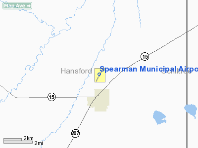
Location & QuickFacts
| FAA Information Effective: | 2008-09-25 |
| Airport Identifier: | E42 |
| Airport Status: | Operational |
| Longitude/Latitude: | 101-11-40.2000W/36-13-15.6000N
-101.194500/36.221000 (Estimated) |
| Elevation: | 3090 ft / 941.83 m (Surveyed) |
| Land: | 213 acres |
| From nearest city: | 1 nautical miles N of Spearman, TX |
| Location: | Hansford County, TX |
| Magnetic Variation: | 09E (1985) |
Owner & Manager
| Ownership: | Publicly owned |
| Owner: | City Of Spearman |
| Address: | Po Box 37
Spearman, TX 79081 |
| Phone number: | 806-659-2524 |
| Manager: | Ed Hansen
CITY MANAGER. |
| Address: | Po Box 37
Spearman, TX 79081 |
| Phone number: | 806-659-2524 |
Airport Operations and Facilities
| Airport Use: | Open to public |
| Wind indicator: | Yes |
| Segmented Circle: | Yes |
| Control Tower: | No |
| Lighting Schedule: | DUSK-DAWN
MIRL RY 02/20 PRESET LOW INTST; TO INCR INTST & ACTVT PAPI RYS 02 & 20 - 122.8. |
| Beacon Color: | Clear-Green (lighted land airport) |
| Landing fee charge: | No |
| Sectional chart: | Wichita |
| Region: | ASW - Southwest |
| Boundary ARTCC: | ZAB - Albuquerque |
| Tie-in FSS: | FTW - Fort Worth |
| FSS on Airport: | No |
| FSS Phone: | 817-541-3474 |
| FSS Toll Free: | 1-800-WX-BRIEF |
| NOTAMs Facility: | FTW (NOTAM-d service avaliable) |
| Federal Agreements: | NGY |
Airport Communications
Airport Services
| Fuel available: | 100LL
FOR FUEL CALL 806-659-2422 & HGR SPACE 806-659-2524 MON-SAT 0730-1900; OTHER HRS CALL 806-659-3707. |
Runway Information
Runway 02/20
| Dimension: | 5002 x 75 ft / 1524.6 x 22.9 m |
| Surface: | ASPH, |
| Weight Limit: | Single wheel: 12500 lbs. |
| Edge Lights: | Medium |
| |
Runway 02 |
Runway 20 |
| Longitude: | 101-11-55.1725W | 101-11-25.2046W |
| Latitude: | 36-12-54.0903N | 36-13-37.1722N |
| Elevation: | 3086.00 ft | 3090.00 ft |
| Alignment: | 29 | 127 |
| Traffic Pattern: | Left | Left |
| Markings: | Non-precision instrument, Good Condition | Non-precision instrument, Good Condition |
| VASI: | 2-light PAPI on left side
PAPI OTS INDEFLY. | 2-light PAPI on left side
PAPI OTS INDEFLY. |
| Obstruction: | 10 ft road, 575.0 ft from runway, 37:1 slope to clear | , 50:1 slope to clear |
|
Radio Navigation Aids
| ID |
Type |
Name |
Ch |
Freq |
Var |
Dist |
| PYX | NDB | Perryton | | 266.00 | 09E | 24.5 nm |
| GUY | NDB | Guymon | | 275.00 | 09E | 32.8 nm |
| PPA | NDB | Pampa | | 368.00 | 09E | 37.9 nm |
| HHF | NDB | Hemphill County | | 400.00 | 08E | 43.2 nm |
| DUX | NDB | Durrett | | 414.00 | 09E | 45.2 nm |
| BGD | VORTAC | Borger | 023X | 108.60 | 11E | 26.5 nm |
Remarks
- NO LINE OF SIGHT BTN RY ENDS.
Images and information placed above are from
http://www.airport-data.com/airport/E42/
We thank them for the data!
| General Info
|
| Country |
United States
|
| State |
TEXAS
|
| FAA ID |
E42
|
| Latitude |
36-13-15.600N
|
| Longitude |
101-11-40.200W
|
| Elevation |
3090 feet
|
| Near City |
SPEARMAN
|
We don't guarantee the information is fresh and accurate. The data may
be wrong or outdated.
For more up-to-date information please refer to other sources.
|
|


