 |
|
Southeast Texas Rgnl Airport |
| Southeast Texas Regional Airport |
 |
| IATA: BPT – ICAO: KBPT – FAA LID: BPT |
| Summary |
| Airport type |
Public |
| Owner |
Jefferson County |
| Serves |
Beaumont / Port Arthur, Texas |
| Location |
Nederland, Texas |
| Elevation AMSL |
15 ft / 5 m |
| Coordinates |
29°57′03″N 094°01′14″W / 29.95083°N 94.02056°W / 29.95083; -94.02056 |
| Website |
co.jefferson.tx.us/setra/ |
| Runways |
| Direction |
Length |
Surface |
| ft |
m |
| 12/30 |
6,750 |
2,057 |
Concrete |
| 16/34 |
5,070 |
1,545 |
Asphalt/Concrete |
| Statistics (2006) |
| Aircraft operations |
59,010 |
| Based aircraft |
87 |
| Source: Federal Aviation Administration |
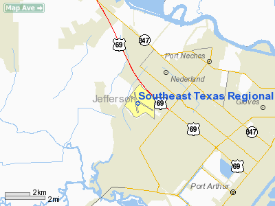
Southeast Texas Regional Airport (IATA: BPT, ICAO: KBPT, FAA LID: BPT), abbreviated as SETRA, is a public airport located near Port Arthur, Texas, United States, nine miles (14 km) southeast of the central business district of Beaumont and northeast of Port Arthur. It was formerly known as the Jefferson County Airport, but its name was changed in an attempt to promote its use. The airport, southwest of the city of Nederland in unincorporated Jefferson County, is mostly used for general aviation, but is also served by one commercial airline. Facilities and aircraft
Southeast Texas Regional Airport covers an area of 1,799 acres (728 ha) which contains two paved runways: 12/30 measuring 6,750 x 150 ft (2,057 x 46 m) and 16/34 measuring 5,070 x 150 ft (1,545 x 46 m).
For the 12-month period ending January 31, 2007, the airport had 59,010 aircraft operations, an average of 161 per day: 82% general aviation, 11% air taxi, 7% military and <1% scheduled commercial. There are 87 aircraft based at this airport: 67% single engine, 15% multi-engine, 10% jet aircraft and 8% helicopters.
Airlines and destinations
| Airlines |
Destinations |
| Continental Connection operated by Colgan Air |
Houston-Intercontinental |
Hurricane RitaIn September 24, 2005, Hurricane Rita hit the Beaumont-Port Arthur area. The Southeast Texas Regional Airport terminal had to be shut down, so the airport authority had to use the old one temporarily. The renovated terminal reopened in May 2008 after several delays. However, due to the reduction in airline service the airport has experienced since 2000, only a portion of the terminal was reopened. Much of the terminal building was walled off and renovations to that portion were left unfinished. The terminal facilities can be expanded back into that space in the future should the demand exist for reopening the closed gate areas.
The above content comes from Wikipedia and is published under free licenses – click here to read more.
Location & QuickFacts
| FAA Information Effective: | 2008-09-25 |
| Airport Identifier: | BPT |
| Airport Status: | Operational |
| Longitude/Latitude: | 094-01-14.5000W/29-57-03.0000N
-94.020694/29.950833 (Estimated) |
| Elevation: | 15 ft / 4.57 m (Surveyed) |
| Land: | 1799 acres |
| From nearest city: | 9 nautical miles SE of Beaumont/port Arthur, TX |
| Location: | Jefferson County, TX |
| Magnetic Variation: | 05E (1985) |
Owner & Manager
| Ownership: | Publicly owned |
| Owner: | Jefferson County |
| Address: | 1149 Pearl St 4th Floor
Beaumont, TX 77701 |
| Phone number: | 409-835-8466 |
| Manager: | Hal L. Ross |
| Address: | 4875 Parker Drive
Beaumont, TX 77705 |
| Phone number: | 409-722-0251 |
Airport Operations and Facilities
| Airport Use: | Open to public |
| Wind indicator: | Yes |
| Segmented Circle: | Yes |
| Control Tower: | Yes |
| Lighting Schedule: | DUSK-DAWN
WHEN ATCT CLSD HIRL RY 12/30 & REIL RY 30; HIRL RY 16/34 & REIL RYS 16 & 34 PRESET MED INTST. ACTVT MALSR RY 12 - CTAF. |
| Beacon Color: | Clear-Green (lighted land airport) |
| Landing fee charge: | No |
| Sectional chart: | Houston |
| Region: | ASW - Southwest |
| Boundary ARTCC: | ZHU - Houston |
| Tie-in FSS: | CXO - Montgomery County |
| FSS on Airport: | No |
| FSS Toll Free: | 1-800-WX-BRIEF
FOR FP FILING CALL CXO FSS 1-800-833-0050. |
| NOTAMs Facility: | BPT (NOTAM-d service avaliable) |
| Certification type/date: | I A S 05/1973 |
| Federal Agreements: | NGPY3 |
Airport Communications
| CTAF: | 119.500 |
| Unicom: | 122.950 |
Airport Services
| Fuel available: | 100LLA |
| Airframe Repair: | MINOR |
| Power Plant Repair: | MINOR |
| Bottled Oxygen: | NONE |
| Bulk Oxygen: | LOW |
Runway Information
Runway 12/30
| Dimension: | 6750 x 150 ft / 2057.4 x 45.7 m |
| Surface: | CONC, Good Condition |
| Surface Treatment: | Saw-cut or plastic Grooved
RY 16/34 FIRST 4271 FT OF RY 34 GRVD. |
| Weight Limit: | Single wheel: 90000 lbs.
Dual wheel: 170000 lbs.
Dual tandem wheel: 230000 lbs. |
| Edge Lights: | High |
| |
Runway 12 |
Runway 30 |
| Longitude: | 094-01-40.0708W | 094-00-34.2737W |
| Latitude: | 29-57-19.1147N | 29-56-44.7391N |
| Elevation: | 15.00 ft | 7.00 ft |
| Alignment: | 121 | 127 |
| ILS Type: | ILS/DME
| |
| Traffic Pattern: | Left | Left |
| Markings: | Precision instrument, Fair Condition | Precision instrument, Fair Condition |
| Crossing Height: | 0.00 ft | 54.00 ft |
| VASI: | | 4-box on left side |
| Visual Glide Angle: | 0.00° | 3.00° |
| RVR Equipment: | touchdown | |
| Approach lights: | MALSR | |
| Runway End Identifier: | | Yes |
| Obstruction: | 46 ft tree, 1041.0 ft from runway, 618 ft right of centerline, 18:1 slope to clear | 41 ft tree, 1024.0 ft from runway, 529 ft right of centerline, 20:1 slope to clear |
| Decleard distances: | Take off run available 6750.00 ft
Take off distance available 6750.00 ft
Actual stop distance available 6750.00 ft
Landing distance available 6750.00 ft
| Take off run available 6750.00 ft
Take off distance available 6750.00 ft
Actual stop distance available 6750.00 ft
Landing distance available 6750.00 ft
|
|
Runway 16/34
| Dimension: | 5070 x 150 ft / 1545.3 x 45.7 m |
| Surface: | ASPH-CONC, Fair Condition |
| Surface Treatment: | Saw-cut or plastic Grooved
RY 16/34 FIRST 4271 FT OF RY 34 GRVD. |
| Weight Limit: | Single wheel: 70000 lbs.
Dual wheel: 90000 lbs.
Dual tandem wheel: 145000 lbs. |
| Edge Lights: | High |
| |
Runway 16 |
Runway 34 |
| Longitude: | 094-01-31.2893W | 094-01-17.3054W |
| Latitude: | 29-57-28.7579N | 29-56-40.0738N |
| Elevation: | 15.00 ft | 12.00 ft |
| Alignment: | 127 | 127 |
| Traffic Pattern: | Left | Left |
| Markings: | Non-precision instrument, Good Condition | Non-precision instrument, Good Condition |
| Crossing Height: | 52.00 ft | 53.00 ft |
| VASI: | 4-box on left side | 4-box on left side |
| Visual Glide Angle: | 3.00° | 3.00° |
| Runway End Identifier: | Yes
REIL OTS INDEFLY. | Yes |
| Obstruction: | 48 ft tree, 761.0 ft from runway, 327 ft left of centerline, 11:1 slope to clear | , 50:1 slope to clear |
| Decleard distances: | Take off run available 5070.00 ft
Take off distance available 5070.00 ft
Actual stop distance available 5070.00 ft
Landing distance available 5070.00 ft
| Take off run available 5070.00 ft
Take off distance available 5070.00 ft
Actual stop distance available 5070.00 ft
Landing distance available 5070.00 ft
|
|
Radio Navigation Aids
| ID |
Type |
Name |
Ch |
Freq |
Var |
Dist |
| GDE | NDB | Goodhue | | 368.00 | 07E | 11.9 nm |
| ORG | NDB | Orange | | 211.00 | 05E | 13.8 nm |
| HRD | NDB | Hardin County | | 524.00 | 04E | 26.4 nm |
| UX | NDB | Sulfy | | 278.00 | 04E | 34.6 nm |
| CBC | NDB | Anahuac | | 413.00 | 05E | 35.1 nm |
| DQU | NDB | De Quincy | | 410.00 | 05E | 40.9 nm |
| BPT | VOR/DME | Beaumont | 092X | 114.50 | 07E | 0.4 nm |
| SBI | VOR/DME | Sabine Pass | 101X | 115.40 | 07E | 15.9 nm |
| MHF | VOR/DME | Trinity | 083X | 113.60 | 07E | 45.1 nm |
| DAS | VORTAC | Daisetta | 116X | 116.90 | 05E | 35.5 nm |
| LCH | VORTAC | Lake Charles | 081X | 113.40 | 07E | 49.0 nm |
Remarks
- BIRD ACTIVITY ON & INVOF ARPT.
Images and information placed above are from
http://www.airport-data.com/airport/BPT/
We thank them for the data!
| General Info
|
| Country |
United States
|
| State |
TEXAS
|
| FAA ID |
BPT
|
| Latitude |
29-57-03.000N
|
| Longitude |
094-01-14.500W
|
| Elevation |
15 feet
|
| Near City |
BEAUMONT/PORT ARTHUR
|
We don't guarantee the information is fresh and accurate. The data may
be wrong or outdated.
For more up-to-date information please refer to other sources.
|
|


