 |
|
South Texas Intl At Edinburg Airport |
| South Texas International Airport at Edinburg |
| IATA: none – ICAO: KEBG – FAA LID: EBG |
| Summary |
| Airport type |
Public |
| Owner/Operator |
City of Edinburg |
| Serves |
Edinburg, Texas |
| Location |
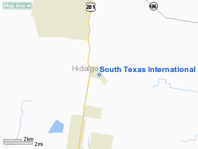
Hidalgo County, Texas |
| Elevation AMSL |
75 ft / 23 m |
| Coordinates |
26°26′30″N 098°07′20″W / 26.44167°N 98.12222°W / 26.44167; -98.12222 |
| Runways |
| Direction |
Length |
Surface |
| ft |
m |
| 14/32 |
5,000 |
1,524 |
Asphalt |
| Statistics (2005) |
| Aircraft operations |
4,800 |
| Source: Federal Aviation Administration |
South Texas International Airport at Edinburg (ICAO: KEBG, FAA LID: EBG) is a public-use airport located in unincorporated Hidalgo County, Texas. The airport is 9 nautical miles (17 km) north of the central business district of Edinburg. The airport is owned and operated by the City of Edinburg. It received its current name in July 2007, prior to which it was known as Edinburg International Airport.
Although most U.S. airports use the same three-letter location identifier for the FAA and IATA, this airport is assigned EBG by the FAA but has no designation from the IATA.
Facilities and aircraft
The airport covers an area of 490 acres (198 ha) and has one runway designated 14/32 with a 5,000 x 75 ft (1,524 x 23 m) asphalt surface. For the 12-month period ending September 29, 2005, the airport had 4,800 general aviation aircraft operations, an average of 13 per day.
The above content comes from Wikipedia and is published under free licenses – click here to read more.
Location & QuickFacts
| FAA Information Effective: | 2008-09-25 |
| Airport Identifier: | EBG |
| Airport Status: | Operational |
| Longitude/Latitude: | 098-07-20.0000W/26-26-30.0000N
-98.122222/26.441667 (Estimated) |
| Elevation: | 75 ft / 22.86 m (Estimated) |
| Land: | 490 acres |
| From nearest city: | 9 nautical miles N of Edinburg, TX |
| Location: | Hidalgo County, TX |
| Magnetic Variation: | 06E (2005) |
Owner & Manager
| Ownership: | Publicly owned |
| Owner: | City Of Edinburg |
| Address: | Po Box 1079
Edinburg, TX 78540 |
| Phone number: | 956-383-5661 |
| Manager: | Debra Melvin |
| Address: | Po Box 1079
Edinburg, TX 78540 |
| Phone number: | 956-292-2088 |
Airport Operations and Facilities
| Airport Use: | Open to public |
| Wind indicator: | Yes |
| Segmented Circle: | Yes |
| Control Tower: | No |
| Lighting Schedule: | DUSK-DAWN
MIRL RY 14/32 PRESET LOW INTST; TO INCR INTST AND ACTVT PAPI RYS 14 & 32 - CTAF. |
| Beacon Color: | Clear-Green (lighted land airport) |
| Landing fee charge: | No |
| Sectional chart: | Brownsville |
| Region: | ASW - Southwest |
| Boundary ARTCC: | ZHU - Houston |
| Tie-in FSS: | SJT - San Angelo |
| FSS on Airport: | No |
| FSS Toll Free: | 1-800-WX-BRIEF |
| NOTAMs Facility: | EBG (NOTAM-d service avaliable) |
| Federal Agreements: | NGPRY |
Airport Communications
| CTAF: | 122.800 |
| Unicom: | 122.800 |
Airport Services
Runway Information
Runway 14/32
| Dimension: | 5000 x 75 ft / 1524.0 x 22.9 m |
| Surface: | ASPH, Good Condition |
| Weight Limit: | Single wheel: 22000 lbs. |
| Edge Lights: | Medium |
| |
Runway 14 |
Runway 32 |
| Longitude: | 098-07-36.1939W | 098-07-03.7597W |
| Latitude: | 26-26-50.0154N | 26-26-10.0169N |
| Elevation: | 75.00 ft | 73.00 ft |
| Alignment: | 127 | 127 |
| Traffic Pattern: | Left | Left |
| Markings: | Non-precision instrument, Good Condition | Non-precision instrument, Good Condition |
| Crossing Height: | 26.00 ft | 26.00 ft |
| VASI: | 2-light PAPI on left side | 2-light PAPI on left side |
| Visual Glide Angle: | 3.00° | 3.00° |
| Obstruction: | 34 ft pole, 1047.0 ft from runway, 250 ft left of centerline, 24:1 slope to clear | , 50:1 slope to clear |
|
Radio Navigation Aids
| ID |
Type |
Name |
Ch |
Freq |
Var |
Dist |
| SNE | NDB | Santa Elena | | 260.00 | 07E | 29.6 nm |
| BKS | NDB | Brooks County | | 353.00 | 06E | 46.0 nm |
| REX | VOR | Reynosa | | 112.40 | 08E | 26.4 nm |
| MFE | VOR/DME | Mc Allen | 119X | 117.20 | 09E | 17.3 nm |
| HRL | VOR/DME | Harlingen | 029X | 109.20 | 05E | 28.4 nm |
Remarks
- TWY D CLSD INDEFLY.
- PRE DATES THE ACT.
Images and information placed above are from
http://www.airport-data.com/airport/EBG/
We thank them for the data!
| General Info
|
| Country |
United States
|
| State |
TEXAS
|
| FAA ID |
EBG
|
| Latitude |
26.441667
26° 26' 30.00" N
|
| Longitude |
-98.122222
098° 07' 20.00" W
|
| Elevation |
75 feet
23 meters
|
| Magnetic Variation |
005° E (01/06)
|
| Beacon |
Yes
|
| Operating Agency |
U.S.CIVIL AIRPORT WHEREIN PERMIT COVERS USE BY TRANSIT MILITARY AIRCRAFT
|
| Daylight Saving Time |
Second Sunday in March at 0200 to first Sunday in November at 0200 local time (Exception Arizona and that portion of Indiana in the Eastern Time Zone)
|
We don't guarantee the information is fresh and accurate. The data may
be wrong or outdated.
For more up-to-date information please refer to other sources.
|
|


