 |
|
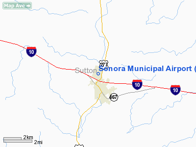
Location & QuickFacts
| FAA Information Effective: | 2008-09-25 |
| Airport Identifier: | SOA |
| Airport Status: | Operational |
| Longitude/Latitude: | 100-38-54.8000W/30-35-08.5000N
-100.648556/30.585694 (Estimated) |
| Elevation: | 2140 ft / 652.27 m (Surveyed) |
| Land: | 40 acres |
| From nearest city: | 1 nautical miles N of Sonora, TX |
| Location: | Sutton County, TX |
| Magnetic Variation: | 08E (1995) |
Owner & Manager
| Ownership: | Publicly owned |
| Owner: | City Of Sonora |
| Address: | 201 Ne Main St
Sonora, TX 76950 |
| Phone number: | 325-387-2558 |
| Manager: | Tony Lane |
| Address: | 1603 Airport Rd
Sonora, TX 76950 |
| Phone number: | 325-387-2447 |
Airport Operations and Facilities
| Airport Use: | Open to public |
| Wind indicator: | Yes |
| Segmented Circle: | No |
| Control Tower: | No |
| Lighting Schedule: | DUSK-DAWN
MIRL RY 18/36 PRESET MED INTST ONLY. ACTVT PVASI RYS 18 & 36 - CTAF. |
| Beacon Color: | Clear-Green (lighted land airport) |
| Landing fee charge: | No |
| Sectional chart: | San Antonio |
| Region: | ASW - Southwest |
| Boundary ARTCC: | ZHU - Houston |
| Tie-in FSS: | SJT - San Angelo |
| FSS on Airport: | No |
| FSS Toll Free: | 1-800-WX-BRIEF |
| NOTAMs Facility: | SOA (NOTAM-d service avaliable) |
Airport Communications
| CTAF: | 122.800 |
| Unicom: | 122.800 |
Airport Services
| Fuel available: | 100LLA |
| Airframe Repair: | NONE |
| Power Plant Repair: | NONE |
| Bottled Oxygen: | NONE |
| Bulk Oxygen: | NONE |
Runway Information
Runway 18/36
| Dimension: | 4037 x 60 ft / 1230.5 x 18.3 m |
| Surface: | ASPH, Good Condition |
| Weight Limit: | Single wheel: 12500 lbs. |
| Edge Lights: | Medium |
| |
Runway 18 |
Runway 36 |
| Longitude: | 100-38-50.8153W | 100-38-58.8669W |
| Latitude: | 30-35-28.1883N | 30-34-48.8455N |
| Elevation: | 2139.00 ft | 2135.00 ft |
| Alignment: | 127 | 10 |
| Traffic Pattern: | Left | Left |
| Markings: | Non-precision instrument, Good Condition | Basic, Good Condition |
| Crossing Height: | 29.00 ft | 56.00 ft |
| Displaced threshold: | 93.00 ft | 601.00 ft |
| VASI: | pulsating/steady burning on left side | pulsating/steady burning on left side |
| Visual Glide Angle: | 3.00° | 3.00° |
| Runway End Identifier: | Yes | Yes |
| Obstruction: | 6 ft gnd, 200.0 ft from runway, 200 ft right of centerline
APCH RATIO 0:1 FM DSPLCD THLD TO FENCE 18 FT ABOVE RY AT DSPLCD THLD, 195 FT RIGHT OF CENTERLINE.
6-15 FT FENCE 20 FT FROM RY END ACROSS THLD. | 40 ft pole, 200.0 ft from runway, 239 ft left of centerline
APCH SLOPE 12:1 AT DSPLCD THLD FM 50 FT POLE 32 FT FM THLD 233 FT L OF CENTERLINE.
+8 FT FENCE 90 FT FM THLD 0B; +25 FT RD 150 FT FM THLD 0B; +50 FT POLE 32 FT FM THLD 233 FT L. |
|
Radio Navigation Aids
| ID |
Type |
Name |
Ch |
Freq |
Var |
Dist |
| SOA | NDB | Sonora | | 371.00 | 08E | 0.2 nm |
| RSG | VORTAC | Rocksprings | 049X | 111.20 | 10E | 38.8 nm |
| JCT | VORTAC | Junction | 107X | 116.00 | 08E | 43.0 nm |
| SJT | VORTAC | San Angelo | 098X | 115.10 | 10E | 48.5 nm |
Remarks
- ARPT CLSD TO ACFT 12500 LBS AND OVER.
- 400 FT AGL TETHERED BALLOON 25 NM SE SR-SS.
Images and information placed above are from
http://www.airport-data.com/airport/SOA/
We thank them for the data!
| General Info
|
| Country |
United States
|
| State |
TEXAS
|
| FAA ID |
SOA
|
| Time |
UTC-6(-5DT)
|
| Latitude |
30.585700
30° 35' 08.52" N
|
| Longitude |
-100.648561
100° 38' 54.82" W
|
| Elevation |
2140 feet
652 meters
|
| Magnetic Variation |
006° E (01/06)
|
| Beacon |
Yes
|
| Operating Agency |
U.S.CIVIL AIRPORT WHEREIN PERMIT COVERS USE BY TRANSIT MILITARY AIRCRAFT
|
| Operating Hours |
24 HOUR OPERATIONS
|
| Daylight Saving Time |
Second Sunday in March at 0200 to first Sunday in November at 0200 local time (Exception Arizona and that portion of Indiana in the Eastern Time Zone)
|
We don't guarantee the information is fresh and accurate. The data may
be wrong or outdated.
For more up-to-date information please refer to other sources.
|
|


