 |
|
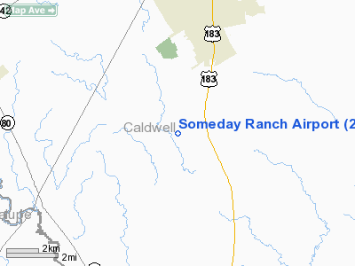
Location & QuickFacts
| FAA Information Effective: | 2008-09-25 |
| Airport Identifier: | 2XA5 |
| Airport Status: | Operational |
| Longitude/Latitude: | 097-41-28.3800W/29-48-13.2600N
-97.691217/29.803683 (Estimated) |
| Elevation: | 466 ft / 142.04 m (Estimated) |
| Land: | 0 acres |
| From nearest city: | 4 nautical miles S of Lockhart, TX |
| Location: | Caldwell County, TX |
| Magnetic Variation: | () |
Owner & Manager
| Ownership: | Privately owned |
| Owner: | John Cyrier |
| Address: | 1301 Westwood Rd
Lockhart, TX 78644 |
| Phone number: | 512-924-7892 |
| Manager: | John Cyrier |
| Address: | 1301 Westwood Rd
Lockhart, TX 78644 |
| Phone number: | 512-924-7892 |
Airport Operations and Facilities
| Airport Use: | Private |
| Control Tower: | No |
| Sectional chart: | San Antonio |
| Region: | ASW - Southwest |
| Boundary ARTCC: | ZHU - Houston |
| Tie-in FSS: | SJT - San Angelo |
| FSS Toll Free: | 1-800-WX-BRIEF |
Runway Information
Runway 13/31
| Dimension: | 1876 x 95 ft / 571.8 x 29.0 m |
| Surface: | TURF, |
| |
Runway 13 |
Runway 31 |
| Traffic Pattern: | Left | Left |
| Obstruction: | 45 ft trees | 45 ft trees, 600.0 ft from runway |
|
Radio Navigation Aids
| ID |
Type |
Name |
Ch |
Freq |
Var |
Dist |
| OKT | NDB | Yoakum | | 350.00 | 06E | 41.3 nm |
| GYB | NDB | Lee County | | 385.00 | 07E | 43.1 nm |
| DHK | TACAN | Randolph | 036X | | 09E | 34.1 nm |
| RND | VORTAC | Randolph | 70X | 112.30 | 09E | 35.4 nm |
| CWK | VORTAC | Centex | 075X | 112.80 | 06E | 35.6 nm |
| SAT | VORTAC | San Antonio | 115X | 116.80 | 08E | 41.3 nm |
| SAT | VOT | San Antonio Intl | | 110.40 | | 43.8 nm |
Remarks
- 268 FT TOWER 1.6 NM SE & 246 FT TOWER 3.3 NM SE.
Images and information placed above are from
http://www.airport-data.com/airport/2XA5/
We thank them for the data!
|
|


