 |
|
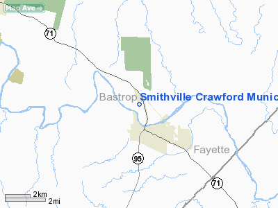
Smithville Crawford Muni Airport |
Location & QuickFacts
| FAA Information Effective: | 2008-09-25 |
| Airport Identifier: | 84R |
| Airport Status: | Operational |
| Longitude/Latitude: | 097-10-01.3000W/30-01-41.6000N
-97.167028/30.028222 (Estimated) |
| Elevation: | 323 ft / 98.45 m (Surveyed) |
| Land: | 63 acres |
| From nearest city: | 2 nautical miles N of Smithville, TX |
| Location: | Bastrop County, TX |
| Magnetic Variation: | 07E (1985) |
Owner & Manager
| Ownership: | Publicly owned |
| Owner: | City Of Smithville |
| Address: | Po Box 449
Smithville, TX 78957 |
| Phone number: | 512-237-3282 |
| Manager: | Tex Middlebrook |
| Address: | Box 449
Smithville, TX 78957 |
| Phone number: | 512-237-3282 |
Airport Operations and Facilities
| Airport Use: | Open to public |
| Wind indicator: | Yes |
| Segmented Circle: | Yes |
| Control Tower: | No |
| Lighting Schedule: | DUSK-DAWN
ACTVT MIRL RY 17/35 - 123.3 |
| Beacon Color: | Clear-Green (lighted land airport) |
| Landing fee charge: | No |
| Sectional chart: | San Antonio |
| Region: | ASW - Southwest |
| Boundary ARTCC: | ZHU - Houston |
| Tie-in FSS: | SJT - San Angelo |
| FSS on Airport: | No |
| FSS Toll Free: | 1-800-WX-BRIEF |
| NOTAMs Facility: | SJT (NOTAM-d service avaliable) |
| Federal Agreements: | N |
Airport Communications
Airport Services
| Fuel available: | 100LL |
| Airframe Repair: | MAJOR |
| Power Plant Repair: | MAJOR |
| Bottled Oxygen: | NONE |
| Bulk Oxygen: | NONE |
Runway Information
Runway 17/35
| Dimension: | 4000 x 75 ft / 1219.2 x 22.9 m |
| Surface: | ASPH, Good Condition |
| Weight Limit: | Single wheel: 12500 lbs. |
| Edge Lights: | Medium |
| |
Runway 17 |
Runway 35 |
| Longitude: | 097-10-04.5436W | 097-09-58.1313W |
| Latitude: | 30-02-01.1505N | 30-01-21.9525N |
| Elevation: | 323.00 ft | 322.00 ft |
| Alignment: | 127 | 127 |
| Traffic Pattern: | Left | Left |
| Markings: | Non-precision instrument, Fair Condition | Non-precision instrument, Fair Condition |
| Crossing Height: | 34.00 ft | 23.00 ft |
| VASI: | pulsating/steady burning on left side | pulsating/steady burning on left side |
| Visual Glide Angle: | 4.00° | 3.00° |
| Obstruction: | 34 ft tree, 915.0 ft from runway, 50 ft right of centerline, 21:1 slope to clear | 34 ft pline, 1326.0 ft from runway, 33:1 slope to clear |
|
Radio Navigation Aids
| ID |
Type |
Name |
Ch |
Freq |
Var |
Dist |
| GYB | NDB | Lee County | | 385.00 | 07E | 13.0 nm |
| BNH | NDB | Brenham | | 362.00 | 06E | 42.9 nm |
| OKT | NDB | Yoakum | | 350.00 | 06E | 43.1 nm |
| GUO | NDB | Georgetown | | 332.00 | 06E | 47.6 nm |
| ELA | VOR/DME | Eagle Lake | 111X | 116.40 | 08E | 49.5 nm |
| CWK | VORTAC | Centex | 075X | 112.80 | 06E | 28.3 nm |
| IDU | VORTAC | Industry | 039X | 110.20 | 08E | 31.8 nm |
Remarks
- AIRPORT PHONE: 512-237-3211.
Images and information placed above are from
http://www.airport-data.com/airport/84R/
We thank them for the data!
| General Info
|
| Country |
United States
|
| State |
TEXAS
|
| FAA ID |
84R
|
| Latitude |
30-01-49.729N
|
| Longitude |
097-10-00.739W
|
| Elevation |
323 feet
|
| Near City |
SMITHVILLE
|
We don't guarantee the information is fresh and accurate. The data may
be wrong or outdated.
For more up-to-date information please refer to other sources.
|
|


