 |
|
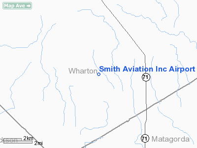
Smith Aviation Inc Airport |
Location & QuickFacts
| FAA Information Effective: | 2008-09-25 |
| Airport Identifier: | 78XS |
| Airport Status: | Operational |
| Longitude/Latitude: | 096-15-43.8740W/29-03-10.9220N
-96.262187/29.053034 (Estimated) |
| Elevation: | 75 ft / 22.86 m (Estimated) |
| Land: | 0 acres |
| From nearest city: | 3 nautical miles W of Danevang, TX |
| Location: | Wharton County, TX |
| Magnetic Variation: | 06E (1985) |
Owner & Manager
| Ownership: | Privately owned |
| Owner: | Norme Thompson |
| Address: | D.s.r. Box 89-a
El Campo, TX 77437 |
| Phone number: | 713-543-3692 |
| Manager: | Larry Smith |
| Address: | D.s.r. Box 89-a
El Campo, TX 77437 |
| Phone number: | 713-543-3692 |
Airport Operations and Facilities
| Airport Use: | Private |
| Wind indicator: | Yes |
| Segmented Circle: | No |
| Control Tower: | No |
| Landing fee charge: | No |
| Sectional chart: | Houston |
| Region: | ASW - Southwest |
| Boundary ARTCC: | ZHU - Houston |
| Tie-in FSS: | CXO - Montgomery County |
| FSS on Airport: | No |
| FSS Toll Free: | 1-800-WX-BRIEF
FOR FP FILING CALL CXO FSS 1-800-833-5602. |
Runway Information
Runway 09/27
| Dimension: | 2600 x 100 ft / 792.5 x 30.5 m |
| Surface: | TURF, |
| |
Runway 09 |
Runway 27 |
| Traffic Pattern: | Left | Left |
|
Radio Navigation Aids
| ID |
Type |
Name |
Ch |
Freq |
Var |
Dist |
| ARM | NDB | Wharton | | 245.00 | 06E | 13.4 nm |
| BYY | NDB | Bay City | | 344.00 | 06E | 21.7 nm |
| PKV | NDB | Port Lavaca | | 515.00 | 05E | 32.7 nm |
| SGR | NDB | Hull | | 388.00 | 05E | 47.1 nm |
| OKT | NDB | Yoakum | | 350.00 | 06E | 48.6 nm |
| SYG | NDB | Sandy Point | | 402.00 | 05E | 49.6 nm |
| ELA | VOR/DME | Eagle Lake | 111X | 116.40 | 08E | 36.7 nm |
| VCT | VOR/DME | Victoria | 027X | 109.00 | 06E | 38.8 nm |
| PSX | VORTAC | Palacios | 120X | 117.30 | 08E | 17.5 nm |
Remarks
- VFR OPNS ONLY PRVDD A CLEAR MNM 20:1 APCH SLOPE ESTABD & MAINTD OVER ANY OBSTNS AT RWY ENDS.
Images and information placed above are from
http://www.airport-data.com/airport/78XS/
We thank them for the data!
| General Info
|
| Country |
United States
|
| State |
TEXAS
|
| FAA ID |
78XS
|
| Latitude |
29-03-10.922N
|
| Longitude |
096-15-43.874W
|
| Elevation |
75 feet
|
| Near City |
DANEVANG
|
We don't guarantee the information is fresh and accurate. The data may
be wrong or outdated.
For more up-to-date information please refer to other sources.
|
|


