 |
|
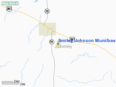
Smiley Johnson Muni/bass Field Airport |
Location & QuickFacts
| FAA Information Effective: | 2008-09-25 |
| Airport Identifier: | E34 |
| Airport Status: | Operational |
| Longitude/Latitude: | 100-52-09.7000W/34-54-41.4000N
-100.869361/34.911500 (Estimated) |
| Elevation: | 2833 ft / 863.50 m (Surveyed) |
| Land: | 74 acres |
| From nearest city: | 2 nautical miles SE of Clarendon, TX |
| Location: | Donley County, TX |
| Magnetic Variation: | 08E (1995) |
Owner & Manager
| Ownership: | Publicly owned |
| Owner: | City Of Clarendon |
| Address: | Po Box 1089
Clarendon, TX 79226 |
| Phone number: | 806-874-3438 |
| Manager: | Jim Roberts
CITY SUPERINTENDENT. |
| Address: | Po Box 1089
Clarendon, TX 79226 |
| Phone number: | 806-874-3438 |
Airport Operations and Facilities
| Airport Use: | Open to public |
| Wind indicator: | Yes |
| Segmented Circle: | Yes |
| Control Tower: | No |
| Lighting Schedule: | RDO-CTL
ACTVT ROTG BCN - 122.8. |
| Beacon Color: | Clear-Green (lighted land airport) |
| Landing fee charge: | No |
| Sectional chart: | Dallas-ft Worth |
| Region: | ASW - Southwest |
| Boundary ARTCC: | ZAB - Albuquerque |
| Tie-in FSS: | FTW - Fort Worth |
| FSS on Airport: | No |
| FSS Phone: | 817-541-3474 |
| FSS Toll Free: | 1-800-WX-BRIEF |
| NOTAMs Facility: | FTW (NOTAM-d service avaliable) |
| Federal Agreements: | GY |
Airport Communications
Airport Services
Runway Information
Runway 01/19
| Dimension: | 4496 x 60 ft / 1370.4 x 18.3 m |
| Surface: | ASPH, |
| Weight Limit: | Single wheel: 17000 lbs. |
| Edge Lights: | Medium |
| |
Runway 01 |
Runway 19 |
| Longitude: | 100-52-18.5878W | 100-52-00.7064W |
| Latitude: | 34-54-20.4194N | 34-55-02.3711N |
| Elevation: | 2833.00 ft | 2820.00 ft |
| Alignment: | 19 | 127 |
| Traffic Pattern: | Left | Left |
| Markings: | Non-precision instrument, Good Condition | Non-precision instrument, Good Condition |
| Obstruction: | 10 ft brush, 462.0 ft from runway, 105 ft right of centerline, 26:1 slope to clear | 20 ft pline, 750.0 ft from runway, 291 ft left of centerline, 27:1 slope to clear
4 FT TREE 78 FT FM THLD 135 FT LEFT; 10 FT TREE 135 FT LEFT 199 FT FM THLD. |
|
Radio Navigation Aids
| ID |
Type |
Name |
Ch |
Freq |
Var |
Dist |
| PPA | NDB | Pampa | | 368.00 | 09E | 42.6 nm |
| AM | NDB | Pande | | 251.00 | 09E | 48.2 nm |
| CDS | VORTAC | Childress | 123X | 117.60 | 10E | 43.4 nm |
| PNH | VORTAC | Panhandle | 113X | 116.60 | 08E | 45.2 nm |
Remarks
- NO LINE OF SIGHT BTN RY ENDS.
Images and information placed above are from
http://www.airport-data.com/airport/E34/
We thank them for the data!
| General Info
|
| Country |
United States
|
| State |
TEXAS
|
| FAA ID |
E34
|
| Latitude |
34-54-37.685N
|
| Longitude |
100-52-11.213W
|
| Elevation |
2832 feet
|
| Near City |
CLARENDON
|
We don't guarantee the information is fresh and accurate. The data may
be wrong or outdated.
For more up-to-date information please refer to other sources.
|
|


