 |
|
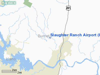
Location & QuickFacts
| FAA Information Effective: | 2008-09-25 |
| Airport Identifier: | 86TA |
| Airport Status: | Operational |
| Longitude/Latitude: | 098-17-51.0860W/30-36-45.6740N
-98.297524/30.612687 (Estimated) |
| Elevation: | 890 ft / 271.27 m (Estimated) |
| Land: | 0 acres |
| From nearest city: | 3 nautical miles NW of Marble Falls, TX |
| Location: | Burnet County, TX |
| Magnetic Variation: | 07E (1985) |
Owner & Manager
| Ownership: | Privately owned |
| Owner: | Carl J. Slaughter, Jr. |
| Address: | P.o. Box 6
Marble Falls, TX 78654 |
| Phone number: | 512-693-7042 |
| Manager: | Carl J. Slaughter, Jr. |
| Address: | P O Box 771
Marble Falls, TX 78654 |
| Phone number: | 512-693-3768 |
Airport Operations and Facilities
| Airport Use: | Private |
| Wind indicator: | Yes |
| Segmented Circle: | No |
| Control Tower: | No |
| Landing fee charge: | No |
| Sectional chart: | San Antonio |
| Region: | ASW - Southwest |
| Boundary ARTCC: | ZHU - Houston |
| Tie-in FSS: | SJT - San Angelo |
| FSS Toll Free: | 1-800-WX-BRIEF |
Runway Information
Runway 02/20
| Dimension: | 3376 x 60 ft / 1029.0 x 18.3 m |
| Surface: | TURF, |
| |
Runway 02 |
Runway 20 |
| Traffic Pattern: | Left | Left |
| Obstruction: | 50 ft trees, 1010.0 ft from runway | 30 ft tree, 640.0 ft from runway |
|
Radio Navigation Aids
| ID |
Type |
Name |
Ch |
Freq |
Var |
Dist |
| MFS | NDB | Horseshoe Bay Resort | | 403.00 | 07E | 6.2 nm |
| BMQ | NDB | Burnet | | 341.00 | 07E | 8.3 nm |
| GUO | NDB | Georgetown | | 332.00 | 06E | 32.2 nm |
| IL | NDB | Iresh | | 278.00 | 07E | 39.2 nm |
| GR | NDB | Starn | | 323.00 | 07E | 39.8 nm |
| HLR | NDB | Hood | | 347.00 | 07E | 43.3 nm |
| GRK | VOR/DME | Gray | 055X | 111.80 | 07E | 35.5 nm |
| LLO | VORTAC | Llano | 019X | 108.20 | 08E | 27.6 nm |
| STV | VORTAC | Stonewall | 085X | 113.80 | 08E | 32.3 nm |
| LZZ | VORTAC | Lampasas | 072X | 112.50 | 08E | 35.4 nm |
| CWK | VORTAC | Centex | 075X | 112.80 | 06E | 42.2 nm |
Remarks
- CONDITIONAL - PROVIDED LANDING THRESHOLDS ARE LOCATED TO PROVIDE A CLEAR 20:1 APPROACH SURFACE OVER ANY OBSTRUCTIONS IN THE APPROACH AREAS.
Images and information placed above are from
http://www.airport-data.com/airport/86TA/
We thank them for the data!
| General Info
|
| Country |
United States
|
| State |
TEXAS
|
| FAA ID |
86TA
|
| Latitude |
30-36-45.674N
|
| Longitude |
098-17-51.086W
|
| Elevation |
890 feet
|
| Near City |
MARBLE FALLS
|
We don't guarantee the information is fresh and accurate. The data may
be wrong or outdated.
For more up-to-date information please refer to other sources.
|
|


