 |
|
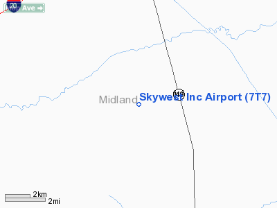
Location & QuickFacts
| FAA Information Effective: | 2008-09-25 |
| Airport Identifier: | 7T7 |
| Airport Status: | Operational |
| Longitude/Latitude: | 102-04-26.4890W/31-51-30.4590N
-102.074025/31.858461 (Estimated) |
| Elevation: | 2800 ft / 853.44 m (Estimated) |
| Land: | 56 acres |
| From nearest city: | 9 nautical miles S of Midland, TX |
| Location: | Midland County, TX |
| Magnetic Variation: | 09E (1985) |
Owner & Manager
| Ownership: | Privately owned |
| Owner: | Skywest Airport Inc |
| Address: | 10000 S Cr 1210
Midland, TX 79706 |
| Phone number: | 432-570-5983 |
| Manager: | Paige Fulton |
| Address: | 10000 S Cr 1210
Midland, TX 79706 |
| Phone number: | 432-570-5983 |
Airport Operations and Facilities
| Airport Use: | Open to public |
| Wind indicator: | Yes |
| Segmented Circle: | Yes |
| Control Tower: | No |
| Lighting Schedule: | DUSK-0000 |
| Landing fee charge: | No |
| Sectional chart: | San Antonio |
| Region: | ASW - Southwest |
| Boundary ARTCC: | ZFW - Fort Worth |
| Tie-in FSS: | SJT - San Angelo |
| FSS on Airport: | No |
| FSS Toll Free: | 1-800-WX-BRIEF |
| NOTAMs Facility: | SJT (NOTAM-d service avaliable) |
Airport Communications
Airport Services
| Fuel available: | 100LLMOGAS
FOR FUEL AFT HRS CALL 432-682-5705. |
| Airframe Repair: | MAJOR |
| Power Plant Repair: | MAJOR |
Runway Information
Runway 06/24
| Dimension: | 2800 x 45 ft / 853.4 x 13.7 m |
| Surface: | DIRT, Fair Condition |
| |
Runway 06 |
Runway 24 |
| Traffic Pattern: | Left | Left |
| Obstruction: | 5 ft fence, 80 ft right of centerline | 5 ft fence, 0.0 ft from runway, 80 ft left of centerline |
|
Runway 16/34
| Dimension: | 5000 x 42 ft / 1524.0 x 12.8 m |
| Surface: | ASPH, Good Condition |
| Weight Limit: | Single wheel: 12500 lbs. |
| |
Runway 16 |
Runway 34 |
| Traffic Pattern: | Left | Left |
| Markings: | Nonstandard,
MARKINGS NSTD DUE TO INCORRECT SIZE AND PLACEMENT. | Nonstandard,
MARKINGS NSTD DUE TO INCORRECT SIZE AND PLACEMENT. |
| Obstruction: | 4 ft fence, 200.0 ft from runway
+4 FT FENCE AT THLD 85 FT' RIGHT; +4 FT FENCE 145 FT & ROAD 160 FT FM THLD. | 6 ft brush, 200.0 ft from runway
+5 FT FENCE 17 FT FM THLD ACROSS APCH; 7 FT BRUSH 20-200 FT FM THLD ACROSS APCH. |
|
Radio Navigation Aids
| ID |
Type |
Name |
Ch |
Freq |
Var |
Dist |
| MA | NDB | Farly | | 326.00 | 09E | 15.0 nm |
| ANR | NDB | Andrews | | 245.00 | 09E | 37.7 nm |
| OHE | NDB | Monahans | | 214.00 | 09E | 45.7 nm |
| MAF | VORTAC | Midland | 095X | 114.80 | 11E | 10.8 nm |
| BGS | VORTAC | Big Spring | 090X | 114.30 | 11E | 43.7 nm |
| MAF | VOT | Midland International | | 108.20 | | 8.3 nm |
Remarks
- +3 FT POLES 105 FT WEST OF CNTRLN ON SOUTH 1200 FT OF RY.
- DEER ON & INVOF ARPT.
Images and information placed above are from
http://www.airport-data.com/airport/7T7/
We thank them for the data!
| General Info
|
| Country |
United States
|
| State |
TEXAS
|
| FAA ID |
7T7
|
| Latitude |
31-51-30.459N
|
| Longitude |
102-04-26.489W
|
| Elevation |
2800 feet
|
| Near City |
MIDLAND
|
We don't guarantee the information is fresh and accurate. The data may
be wrong or outdated.
For more up-to-date information please refer to other sources.
|
|


