 |
|
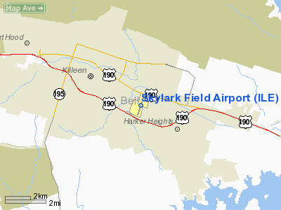
| Skylark Field |
| IATA: ILE – ICAO: KILE |
| Summary |
| Airport type |
Public |
| Operator |
City of Killeen |
| Location |
Killeen, Texas |
| Elevation AMSL |
848 ft / 258.5 m |
| Coordinates |
31°05′09″N 97°41′11″W / 31.08583°N 97.68639°W / 31.08583; -97.68639Coordinates: 31°05′09″N 97°41′11″W / 31.08583°N 97.68639°W / 31.08583; -97.68639 |
| Runways |
| Direction |
Length |
Surface |
| ft |
m |
| 1/19 |
5,495 |
1,675 |
Asphalt |
Skylark Field (IATA: ILE, ICAO: KILE), formerly known as Killeen Municipal Airport, is a public airport located in the City of Killeen, in Bell County, Texas, USA. The airport covers 180 acres (73 ha) and has one runway. It is currently a general aviation facility with no scheduled passenger service on commercial airlines.
Atlantic Southeast Airlines, operating as Delta Connection, served this airport until August 2003, when it replaced its turboprop airplanes with regional jets which required a longer runway. In August 2004, the City of Killeen relocated the remaining airlines from Killeen Municipal Airport to new facilities at the Killeen-Fort Hood Regional Airport, which has a longer runway to accommodate larger jets and an expanded terminal to handle more passengers.
The above content comes from Wikipedia and is published under free licenses – click here to read more.
Location & QuickFacts
| FAA Information Effective: | 2008-09-25 |
| Airport Identifier: | ILE |
| Airport Status: | Operational |
| Longitude/Latitude: | 097-41-11.4000W/31-05-09.0000N
-97.686500/31.085833 (Estimated) |
| Elevation: | 848 ft / 258.47 m (Surveyed) |
| Land: | 180 acres |
| From nearest city: | 3 nautical miles E of Killeen, TX |
| Location: | Bell County, TX |
| Magnetic Variation: | 07E (1980) |
Owner & Manager
| Ownership: | Publicly owned |
| Owner: | City Of Killeen |
| Address: | Box 1329
Killeen, TX 76541 |
| Phone number: | 254-501-7600 |
| Manager: | John Sutton |
| Address: | 8101 Clear Creek Rd.
Killeen, TX 76549 |
| Phone number: | 254-501-8700 |
Airport Operations and Facilities
| Airport Use: | Open to public |
| Wind indicator: | Yes |
| Segmented Circle: | Yes |
| Control Tower: | No |
| Lighting Schedule: | DUSK-DAWN
MIRL RY 01/19 PRESET LOW INTST; TO INCR INTST & ACTVT TWY LIGHTS & MALSR RY 01 - CTAF. |
| Beacon Color: | Clear-Green (lighted land airport) |
| Landing fee charge: | No |
| Sectional chart: | San Antonio |
| Region: | ASW - Southwest |
| Traffic Pattern Alt: | 800 ft |
| Boundary ARTCC: | ZHU - Houston |
| Responsible ARTCC: | ZFW - Fort Worth |
| Tie-in FSS: | SJT - San Angelo |
| FSS on Airport: | No |
| FSS Toll Free: | 1-800-WX-BRIEF |
| NOTAMs Facility: | ILE (NOTAM-d service avaliable) |
| Federal Agreements: | NGY |
Airport Communications
| CTAF: | 122.700 |
| Unicom: | 122.700 |
Airport Services
| Fuel available: | 100LLA |
| Airframe Repair: | MINOR |
| Power Plant Repair: | MINOR |
| Bottled Oxygen: | NONE |
| Bulk Oxygen: | NONE |
Runway Information
Runway 01/19
| Dimension: | 5495 x 100 ft / 1674.9 x 30.5 m |
| Surface: | ASPH, Good Condition |
| Surface Treatment: | Aggregate Friction Seal Coat |
| Weight Limit: | Single wheel: 17000 lbs.
Dual wheel: 50000 lbs. |
| Edge Lights: | Medium |
| |
Runway 01 |
Runway 19 |
| Longitude: | 097-41-20.5540W | 097-41-02.2900W |
| Latitude: | 31-04-42.9320N | 31-05-34.9890N |
| Elevation: | 848.00 ft | 841.00 ft |
| Alignment: | 17 | 127 |
| ILS Type: | ILS
| |
| Traffic Pattern: | Right | Left |
| Markings: | Precision instrument, Fair Condition | Basic, Fair Condition |
| Displaced threshold: | 844.00 ft | 0.00 ft |
| VASI: | 4-light PAPI on left side | 4-light PAPI on left side |
| Visual Glide Angle: | 3.00° | 3.00° |
| Approach lights: | MALSR | |
| Obstruction: | 20 ft road, 200.0 ft from runway, 120 ft right of centerline
APCH RATIO 0:1 FM DSPLCD THLD TO BASED ON +14 FT GROUND AT DSPLCD THLD 500 FT L.
+9 FT BLDG 100 FT FM RY END 407 FT LEFT. | 24 ft pline, 200.0 ft from runway, 495 ft right of centerline
+4 FT GROUND 183 FT LEFT AT THLD. |
| Decleard distances: | Take off run available 5495.00 ft
Take off distance available 5495.00 ft
Actual stop distance available 5495.00 ft
Landing distance available 4641.00 ft
| Take off run available 5495.00 ft
Take off distance available 5495.00 ft
Actual stop distance available 5495.00 ft
Landing distance available 5495.00 ft
|
|
Radio Navigation Aids
| ID |
Type |
Name |
Ch |
Freq |
Var |
Dist |
| HLR | NDB | Hood | | 347.00 | 07E | 2.9 nm |
| IL | NDB | Iresh | | 278.00 | 07E | 3.9 nm |
| GR | NDB | Starn | | 323.00 | 07E | 11.0 nm |
| GUO | NDB | Georgetown | | 332.00 | 06E | 24.1 nm |
| BMQ | NDB | Burnet | | 341.00 | 07E | 35.1 nm |
| MNZ | NDB | Hamilton | | 251.00 | 07E | 39.9 nm |
| ROB | NDB | Robinson | | 400.00 | 07E | 40.4 nm |
| MFS | NDB | Horseshoe Bay Resort | | 403.00 | 07E | 48.4 nm |
| GRK | VOR/DME | Gray | 055X | 111.80 | 07E | 7.3 nm |
| TPL | VOR/DME | Temple | 041X | 110.40 | 09E | 15.4 nm |
| LZZ | VORTAC | Lampasas | 072X | 112.50 | 08E | 24.2 nm |
| ACT | VORTAC | Waco | 100X | 115.30 | 09E | 40.7 nm |
| CWK | VORTAC | Centex | 075X | 112.80 | 06E | 43.3 nm |
Remarks
- RY 01 DESIGNATED AS CALM WIND RY.
- HELICOPTER TFC WEST SIDE OF ARPT.
Images and information placed above are from
http://www.airport-data.com/airport/ILE/
We thank them for the data!
| General Info
|
| Country |
United States
|
| State |
TEXAS
|
| FAA ID |
ILE
|
| Latitude |
31-05-09.000N
|
| Longitude |
097-41-11.400W
|
| Elevation |
848 feet
|
| Near City |
KILLEEN
|
We don't guarantee the information is fresh and accurate. The data may
be wrong or outdated.
For more up-to-date information please refer to other sources.
|
|


