 |
|
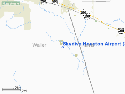
| Skydive Houston Airport |
| IATA: none – ICAO: none – FAA LID: 37X |
| Summary |
| Airport type |
Public |
| Owner |
Richard D. Davis, LLP |
| Serves |
Waller, Texas |
| Elevation AMSL |
235 ft / 72 m |
| Coordinates |
29°59′36″N 095°55′49″W / 29.99333°N 95.93028°W / 29.99333; -95.93028 |
| Website |
www.SkydiveHouston.com |
| Runways |
| Direction |
Length |
Surface |
| ft |
m |
| 17/35 |
4,190 |
1,277 |
Asphalt/Treated |
| N/S |
3,030 |
924 |
Turf |
| Statistics (1995) |
| Aircraft operations |
15,500 |
| Based aircraft |
50 |
| Source: Federal Aviation Administration |
Skydive Houston Airport (FAA LID: 37X, formerly 3XS7) is a privately-owned, public-use airport located in unincorporated Waller County, Texas, United States. It is four nautical miles (7 km) south of the central business district of Waller and is northwest of Houston. It was formerly known as Skylake Airport.
Facilities and aircraft
Skydive Houston Airport covers an area of 55 acres (22 ha) at an elevation of 235 feet (72 m) above mean sea level and has two runways. Runway 17/35 has a 4,190 x 50 ft (1,277 x 15 m) treated asphalt pavement. Runway N/S has a 3,030 x 53 ft (924 x 16 m) turf surface.
For the 12-month period ending February 24, 1995, the airport had 15,500 general aviation aircraft operations, an average of 42 per day. At that time there were 50 aircraft based at this airport: 88% single-engine, 8% multi-engine, 2% helicopter and 2% glider.
Information as of July 7, 2008: Runway 17/35 is closed, with "X's" marked on the asphalt. Turf runway is used by all aircraft at this time. There is a high concentration of skydiving activity with a 3-mile (4.8 km) radius of the airport for 7 days a week, morning to sundown. The airport is the location of a skydiving school that has a unique Accelerated Free Fall Academy for those wanting to become skydivers. Skydive Houston is home to one Cessna 182, a Super Twin Otter, and a helicopter on standby. Unicom is 122.9. There is no fuel or any other aviation businesses at the airport. It is an aviation community, but there are no known EAA, USUA, ASC or other clubs in operation at Skydive Houston.
The above content comes from Wikipedia and is published under free licenses – click here to read more.
Location & QuickFacts
| FAA Information Effective: | 2008-09-25 |
| Airport Identifier: | 37X |
| Airport Status: | Operational |
| Longitude/Latitude: | 095-55-49.2350W/29-59-36.2000N
-95.930343/29.993389 (Estimated) |
| Elevation: | 235 ft / 71.63 m (Surveyed) |
| Land: | 55 acres |
| From nearest city: | 4 nautical miles S of Waller, TX |
| Location: | Waller County, TX |
| Magnetic Variation: | 06E (1985) |
Owner & Manager
| Ownership: | Privately owned |
| Owner: | Richard D. Davis
LIMITED LIABILITY PARTNERSHIP; LEASEE. |
| Address: | 15355 Penick Road
Waller, TX 77484 |
| Phone number: | 281-320-5995 |
| Manager: | Richard D. Davis |
| Address: | 15355 Penick Road
Waller, TX 77484 |
| Phone number: | 936-931-1600 |
Airport Operations and Facilities
| Airport Use: | Open to public |
| Wind indicator: | Yes |
| Segmented Circle: | No |
| Control Tower: | No |
| Lighting Schedule: | DUSK-DAWN
ACTVT LIRL RY N/S - CTAF. CALL FOR AVAILABILITY 281-320-5995. |
| Beacon Color: | Clear-Green (lighted land airport) |
| Landing fee charge: | No |
| Sectional chart: | Houston |
| Region: | ASW - Southwest |
| Boundary ARTCC: | ZHU - Houston |
| Tie-in FSS: | CXO - Montgomery County |
| FSS on Airport: | No |
| FSS Toll Free: | 1-800-WX-BRIEF
FOR FP FILING CALL CXO FSS 1-800-833-5602 |
| NOTAMs Facility: | CXO (NOTAM-d service avaliable) |
Airport Communications
Airport Services
| Airframe Repair: | MINOR
FOR REPAIRS CALL 936-931-1600. |
| Power Plant Repair: | MINOR |
Runway Information
Runway 17/35
| Dimension: | 4190 x 50 ft / 1277.1 x 15.2 m |
| Surface: | ASPH-TRTD, Poor Condition
SEVERELY GRASS ENCROACHED. |
| |
Runway 17 |
Runway 35 |
| Traffic Pattern: | Left | Left |
| Obstruction: | 50 ft trees, 280.0 ft from runway, 1:1 slope to clear
45 FT TREE 50 FT FM THLD 55 FT R. | 30 ft trees, 675.0 ft from runway, 50 ft right of centerline, 15:1 slope to clear
+32 FT PLINE 107 FT FM THLD ACRS APCH. |
|
Runway N/S
| Dimension: | 3030 x 53 ft / 923.5 x 16.2 m |
| Surface: | TURF, Good Condition
SEVERELY GRASS ENCROACHED. |
| Edge Lights: | Low
2590 FT OF RY AVBL FOR NIGHT OPNS; RY N THLD RELOCATED 440 FT AT NIGHT. |
| |
Runway N |
Runway S |
| Longitude: | 095-55-50.1000W | 095-55-50.4900W |
| Latitude: | 29-59-16.3400N | 29-59-46.3400N |
| Elevation: | 224.00 ft | 228.00 ft |
| Traffic Pattern: | Left | Left |
| Obstruction: | 8 ft brush, 30 ft right of centerline | 50 ft trees, 1100.0 ft from runway, 22:1 slope to clear |
|
Radio Navigation Aids
| ID |
Type |
Name |
Ch |
Freq |
Var |
Dist |
| EYQ | NDB | Weiser | | 286.00 | 06E | 15.5 nm |
| LYD | NDB | Lakeside | | 249.00 | 05E | 16.9 nm |
| DWH | NDB | David Hooks | | 521.00 | 05E | 20.6 nm |
| SGR | NDB | Hull | | 388.00 | 05E | 26.0 nm |
| BNH | NDB | Brenham | | 362.00 | 06E | 26.8 nm |
| BVP | NDB | Nixin | | 326.00 | 05E | 37.2 nm |
| SYG | NDB | Sandy Point | | 402.00 | 05E | 38.1 nm |
| ARM | NDB | Wharton | | 245.00 | 06E | 45.9 nm |
| UTS | NDB | Huntsville | | 308.00 | 06E | 48.2 nm |
| JPA | NDB | Sanjac | | 347.00 | 05E | 48.9 nm |
| EFD | TACAN | Ellington | 031X | | 05E | 46.5 nm |
| ELA | VOR/DME | Eagle Lake | 111X | 116.40 | 08E | 28.3 nm |
| HUB | VOR/DME | Hobby | 118X | 117.10 | 05E | 39.7 nm |
| TNV | VORTAC | Navasota | 106X | 115.90 | 08E | 18.9 nm |
| IAH | VORTAC | Humble | 113X | 116.60 | 05E | 30.5 nm |
| IDU | VORTAC | Industry | 039X | 110.20 | 08E | 33.0 nm |
| CLL | VORTAC | College Station | 080X | 113.30 | 08E | 44.7 nm |
| HOU | VOT | Houston Wm P Hobby | | 108.40 | | 39.9 nm |
Remarks
- HIGH CONCENTRATION OF SKYDIVING ACTIVITY WITHIN A 3 MILES RADIUS OF ARPT.
Images and information placed above are from
http://www.airport-data.com/airport/37X/
We thank them for the data!
|
|


