 |
|
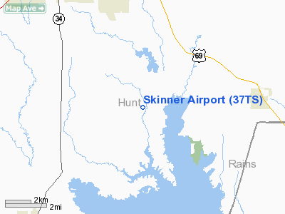
Location & QuickFacts
| FAA Information Effective: | 2008-09-25 |
| Airport Identifier: | 37TS |
| Airport Status: | Operational |
| Longitude/Latitude: | 096-02-23.8940W/32-59-26.4270N
-96.039971/32.990674 (Estimated) |
| Elevation: | 460 ft / 140.21 m (Estimated) |
| Land: | 0 acres |
| From nearest city: | 10 nautical miles SE of Greenville, TX |
| Location: | Hunt County, TX |
| Magnetic Variation: | 07E (1980) |
Owner & Manager
| Ownership: | Privately owned |
| Owner: | Jim Skinner |
| Address: | Rr 3, Box 299 A5
Quinlan, TX 75474 |
| Phone number: | 903-883-4555 |
| Manager: | Jim Skinner |
| Address: | Rr 3, Box 299 A5
Quinlan, TX 75474 |
| Phone number: | 903-883-4555 |
Airport Operations and Facilities
| Airport Use: | Private
PERSONAL USE. |
| Segmented Circle: | No |
| Control Tower: | No |
| Sectional chart: | Dallas-ft Worth |
| Region: | ASW - Southwest |
| Boundary ARTCC: | ZFW - Fort Worth |
| Tie-in FSS: | FTW - Fort Worth |
| FSS Phone: | 817-541-3474 |
| FSS Toll Free: | 1-800-WX-BRIEF |
Runway Information
Runway 18/36
| Dimension: | 1600 x 100 ft / 487.7 x 30.5 m |
| Surface: | TURF, |
| |
Runway 18 |
Runway 36 |
| Traffic Pattern: | Left | Left |
| Obstruction: | | 30 ft pline |
|
Radio Navigation Aids
| ID |
Type |
Name |
Ch |
Freq |
Var |
Dist |
| SYW | NDB | Cash | | 428.00 | 05E | 1.5 nm |
| MII | NDB | Caddo Mills | | 316.00 | 06E | 10.9 nm |
| AVZ | NDB | Travis | | 260.00 | 06E | 17.4 nm |
| PQF | NDB | Mesquite | | 248.00 | 06E | 27.0 nm |
| JUG | NDB | Jecca | | 388.00 | 06E | 31.5 nm |
| HJM | NDB | Rayburn | | 415.00 | 06E | 38.1 nm |
| LNC | NDB | Lancaster | | 239.00 | 06E | 42.5 nm |
| TY | NDB | Tyler | | 320.00 | 06E | 45.0 nm |
| RBD | NDB | Redbird | | 287.00 | 06E | 46.0 nm |
| MJF | TACAN | Arvilla | 033X | | 05E | 4.7 nm |
| SLR | VOR/DME | Sulphur Springs | 027X | 109.00 | 08E | 28.0 nm |
| UIM | VOR/DME | Quitman | 087X | 114.00 | 08E | 34.6 nm |
| CVE | VOR/DME | Cowboy | 109X | 116.20 | 06E | 44.0 nm |
| PRX | VOR/DME | Paris | 083X | 113.60 | 07E | 44.5 nm |
| TYR | VOR/DME | Tyler | 089X | 114.20 | 06E | 49.9 nm |
| BYP | VORTAC | Bonham | 093X | 114.60 | 06E | 34.3 nm |
| CQY | VORTAC | Cedar Creek | 095X | 114.80 | 06E | 49.2 nm |
| DAL | VOT | Dallas Love Field | | 113.30 | | 41.9 nm |
Images and information placed above are from
http://www.airport-data.com/airport/37TS/
We thank them for the data!
| General Info
|
| Country |
United States
|
| State |
TEXAS
|
| FAA ID |
37TS
|
| Latitude |
32-59-26.427N
|
| Longitude |
096-02-23.894W
|
| Elevation |
460 feet
|
| Near City |
GREENVILLE
|
We don't guarantee the information is fresh and accurate. The data may
be wrong or outdated.
For more up-to-date information please refer to other sources.
|
|


