 |
|
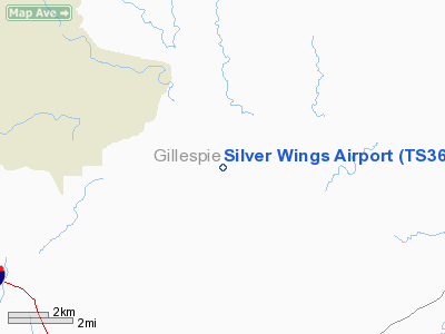
Location & QuickFacts
| FAA Information Effective: | 2008-09-25 |
| Airport Identifier: | TS36 |
| Airport Status: | Operational |
| Longitude/Latitude: | 099-08-27.0000W/30-13-10.4000N
-99.140833/30.219556 (Estimated) |
| Elevation: | 2110 ft / 643.13 m (Estimated) |
| Land: | 11 acres |
| From nearest city: | 15 nautical miles W of Fredricksburg, TX |
| Location: | Gillespie County, TX |
| Magnetic Variation: | 07E (2000) |
Owner & Manager
| Ownership: | Privately owned |
| Owner: | Ricky Friedrich |
| Address: | 740 Sally Lake Road
Angleton, TX 77515 |
| Phone number: | 713-947-9756 |
| Manager: | Ricky Friedrich |
| Address: | 740 Sally Lake Road
Angleton, TX 77515 |
| Phone number: | 713-947-9756 |
Airport Operations and Facilities
| Airport Use: | Private |
| Segmented Circle: | No |
| Control Tower: | No |
| Sectional chart: | San Antonio |
| Region: | ASW - Southwest |
| Boundary ARTCC: | ZHU - Houston |
| Tie-in FSS: | SJT - San Angelo |
| FSS on Airport: | No |
| FSS Toll Free: | 1-800-WX-BRIEF |
Runway Information
Runway 17/35
| Dimension: | 3800 x 80 ft / 1158.2 x 24.4 m |
| Surface: | ASPH, |
| |
Runway 17 |
Runway 35 |
| Traffic Pattern: | Right | Left |
| Obstruction: | 13 ft fence, 10.0 ft from runway | |
|
Radio Navigation Aids
| ID |
Type |
Name |
Ch |
Freq |
Var |
Dist |
| ER | NDB | Shein | | 263.00 | 08E | 19.5 nm |
| MFS | NDB | Horseshoe Bay Resort | | 403.00 | 07E | 44.5 nm |
| CSI | VORTAC | Center Point | 122X | 117.50 | 08E | 18.3 nm |
| STV | VORTAC | Stonewall | 085X | 113.80 | 08E | 22.6 nm |
| LLO | VORTAC | Llano | 019X | 108.20 | 08E | 39.2 nm |
| JCT | VORTAC | Junction | 107X | 116.00 | 08E | 41.8 nm |
| SAT | VORTAC | San Antonio | 115X | 116.80 | 08E | 49.5 nm |
Images and information placed above are from
http://www.airport-data.com/airport/TS36/
We thank them for the data!
|
|


