 |
|
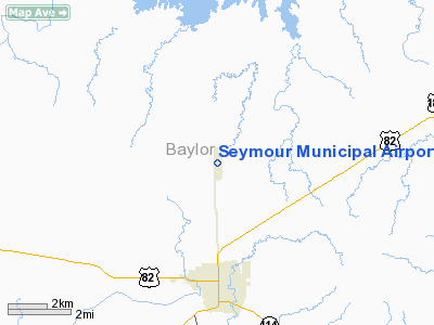
Location & QuickFacts
| FAA Information Effective: | 2008-09-25 |
| Airport Identifier: | 60F |
| Airport Status: | Operational |
| Longitude/Latitude: | 099-15-38.2700W/33-38-55.3350N
-99.260631/33.648704 (Estimated) |
| Elevation: | 1344 ft / 409.65 m (Surveyed) |
| Land: | 58 acres |
| From nearest city: | 3 nautical miles N of Seymour, TX |
| Location: | Baylor County, TX |
| Magnetic Variation: | 07E (1995) |
Owner & Manager
| Ownership: | Publicly owned |
| Owner: | City Of Seymour |
| Address: | Po Box 31
Seymour, TX 76380 |
| Phone number: | 940-889-3148 |
| Manager: | Joe Shephard
CITY ADMINISTRATOR |
| Address: | Box 31
Seymour, TX 76380 |
| Phone number: | 940-889-3148 |
Airport Operations and Facilities
| Airport Use: | Open to public |
| Wind indicator: | Yes |
| Segmented Circle: | Yes |
| Control Tower: | No |
| Lighting Schedule: | DUSK-DAWN |
| Beacon Color: | Clear-Green (lighted land airport) |
| Landing fee charge: | No |
| Sectional chart: | Dallas-ft Worth |
| Region: | ASW - Southwest |
| Boundary ARTCC: | ZFW - Fort Worth |
| Tie-in FSS: | FTW - Fort Worth |
| FSS on Airport: | No |
| FSS Phone: | 817-541-3474 |
| FSS Toll Free: | 1-800-WX-BRIEF |
| NOTAMs Facility: | FTW (NOTAM-d service avaliable) |
| Federal Agreements: | NGY |
Airport Communications
Airport Services
| Airframe Repair: | NONE |
| Power Plant Repair: | NONE |
| Bottled Oxygen: | NONE |
| Bulk Oxygen: | NONE |
Runway Information
Runway 17/35
| Dimension: | 4300 x 50 ft / 1310.6 x 15.2 m |
| Surface: | ASPH, Fair Condition |
| Weight Limit: | Single wheel: 4000 lbs. |
| Edge Lights: | Medium |
| |
Runway 17 |
Runway 35 |
| Longitude: | 099-15-40.7000W | 099-15-40.7000W |
| Latitude: | 33-39-15.9200N | 33-38-33.4000N |
| Elevation: | 1344.00 ft | 1338.00 ft |
| Alignment: | 127 | 0 |
| Traffic Pattern: | Left | Left |
| Markings: | Nonstandard, Poor Condition
17/35 NSTD NPI MARKINGS. NRS 50 FT TALL; MARKINGS FADED. | Nonstandard, Poor Condition |
| Obstruction: | 4 ft fence, 200.0 ft from runway, 20 ft right of centerline
+4 FT FENCE 199 FT L & 203 FT R AT RY THLD. | 15 ft road, 550.0 ft from runway, 23:1 slope to clear
+4 FT FENCE 203 FT L AT RY THLD. |
|
Radio Navigation Aids
| ID |
Type |
Name |
Ch |
Freq |
Var |
Dist |
| ONY | NDB | Olney | | 272.00 | 07E | 28.6 nm |
| VRT | NDB | Wilbarger | | 230.00 | 08E | 34.7 nm |
| AKL | NDB | Haskell | | 407.00 | 08E | 35.9 nm |
| SKB | NDB | Scotland | | 344.00 | 08E | 39.6 nm |
| GHX | NDB | Graham | | 371.00 | 07E | 48.1 nm |
| SHP | TACAN | Sheppard | 045X | | 10E | 43.5 nm |
| SPS | VORTAC | Wichita Falls | 074X | 112.70 | 10E | 39.0 nm |
Images and information placed above are from
http://www.airport-data.com/airport/60F/
We thank them for the data!
| General Info
|
| Country |
United States
|
| State |
TEXAS
|
| FAA ID |
60F
|
| Latitude |
33-38-55.335N
|
| Longitude |
099-15-38.270W
|
| Elevation |
1344 feet
|
| Near City |
SEYMOUR
|
We don't guarantee the information is fresh and accurate. The data may
be wrong or outdated.
For more up-to-date information please refer to other sources.
|
|


