 |
|
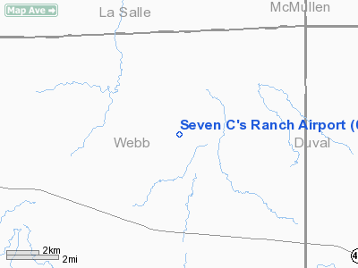
Location & QuickFacts
| FAA Information Effective: | 2008-09-25 |
| Airport Identifier: | 0XA4 |
| Airport Status: | Operational |
| Longitude/Latitude: | 098-52-56.0000W/27-59-49.0000N
-98.882222/27.996944 (Estimated) |
| Elevation: | 331 ft / 100.89 m (Estimated) |
| Land: | 49 acres |
| From nearest city: | 20 nautical miles W of Freer, TX |
| Location: | Webb County, TX |
| Magnetic Variation: | () |
Owner & Manager
| Ownership: | Privately owned |
| Owner: | Laredo Marine Llc |
| Address: | Po Box 477
Freer, TX 78357 |
| Phone number: | 956-763-8466 |
| Manager: | Laredo Marine Llc |
| Address: | Po Box 477
Freer, TX 78357 |
| Phone number: | 956-763-8466 |
Airport Operations and Facilities
| Airport Use: | Private |
| Wind indicator: | Yes |
| Control Tower: | No |
| Sectional chart: | Brownsville |
| Region: | ASW - Southwest |
| Boundary ARTCC: | ZHU - Houston |
| Tie-in FSS: | SJT - San Angelo |
| FSS Toll Free: | 1-800-WX-BRIEF |
Airport Communications
Runway Information
Runway 15/33
| Dimension: | 5000 x 75 ft / 1524.0 x 22.9 m |
| Surface: | ASPH, Good Condition |
| |
Runway 15 |
Runway 33 |
| Traffic Pattern: | Left | Left |
| Markings: | Basic, Good Condition | Basic, Good Condition |
|
Radio Navigation Aids
| ID |
Type |
Name |
Ch |
Freq |
Var |
Dist |
| HBV | NDB | Hebbronville | | 266.00 | 06E | 39.3 nm |
| TKB | NDB | Kleberg County | | 347.00 | 06E | 48.4 nm |
| NOG | TACAN | Orange Grove | 063X | | 09E | 45.0 nm |
| ALI | VOR | Alice | | 114.50 | 06E | 48.3 nm |
| NLD | VOR/DME | Nuevo Laredo | 073X | 112.60 | 09E | 49.7 nm |
| COT | VORTAC | Cotulla | 105X | 115.80 | 09E | 30.6 nm |
| LRD | VORTAC | Laredo | 121X | 117.40 | 09E | 42.2 nm |
| THX | VORTAC | Three Rivers | 051X | 111.40 | 08E | 49.3 nm |
Remarks
- PRVDD A CLEAR 20:1 APCH SFC EACH RY; AND PLINE AT NORTH END EITHER BURIED OR MKD.
Images and information placed above are from
http://www.airport-data.com/airport/0XA4/
We thank them for the data!
| General Info
|
| Country |
United States
|
| State |
TEXAS
|
| FAA ID |
0XA4
|
| Latitude |
27.996944
27° 59' 49.00" N
|
| Longitude |
-98.882222
098° 52' 56.00" W
|
| Elevation |
331 feet
101 meters
|
| Magnetic Variation |
005° E (08/06)
|
| Operating Agency |
PRIVATE
|
We don't guarantee the information is fresh and accurate. The data may
be wrong or outdated.
For more up-to-date information please refer to other sources.
|
|


