 |
|
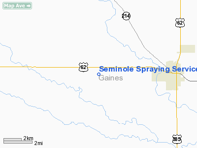
Seminole Spraying Service Airport |
Location & QuickFacts
| FAA Information Effective: | 2008-09-25 |
| Airport Identifier: | 39TE |
| Airport Status: | Operational |
| Longitude/Latitude: | 102-44-17.6940W/32-43-05.3790N
-102.738248/32.718161 (Estimated) |
| Elevation: | 3372 ft / 1027.79 m (Surveyed) |
| Land: | 0 acres |
| From nearest city: | 4 nautical miles W of Seminole, TX |
| Location: | Gaines County, TX |
| Magnetic Variation: | 09E (1985) |
Owner & Manager
| Ownership: | Privately owned |
| Owner: | Seminole Spraying Service |
| Address: | Rt 4 Box 141
Seminole, TX 79360 |
| Manager: | James Davis |
| Address: | Rt 4
Seminole, TX 79360 |
| Phone number: | 915-758-5651 |
Airport Operations and Facilities
| Airport Use: | Private |
| Wind indicator: | Yes |
| Segmented Circle: | No |
| Control Tower: | No |
| Landing fee charge: | No |
| Sectional chart: | Albuquerque |
| Region: | ASW - Southwest |
| Boundary ARTCC: | ZFW - Fort Worth |
| Tie-in FSS: | FTW - Fort Worth |
| FSS on Airport: | No |
| FSS Phone: | 817-541-3474 |
| FSS Toll Free: | 1-800-WX-BRIEF |
Airport Services
| Fuel available: | 100 |
| Airframe Repair: | NONE |
| Power Plant Repair: | NONE |
| Bottled Oxygen: | NONE |
| Bulk Oxygen: | NONE |
Runway Information
Runway 08/26
| Dimension: | 2700 x 75 ft / 823.0 x 22.9 m |
| Surface: | GRAVEL, Fair Condition |
| |
Runway 08 |
Runway 26 |
| Traffic Pattern: | Left | Left |
| Runway End Identifier: | No | No |
| Centerline Lights: | No | No |
| Touchdown Lights: | No | No |
|
Runway 17/35
| Dimension: | 4000 x 50 ft / 1219.2 x 15.2 m |
| Surface: | ASPH, Poor Condition |
| Weight Limit: | Single wheel: 12000 lbs. |
| |
Runway 17 |
Runway 35 |
| Traffic Pattern: | Left | Left |
| Runway End Identifier: | No | No |
| Centerline Lights: | No | No |
| Touchdown Lights: | No | No |
|
Radio Navigation Aids
| ID |
Type |
Name |
Ch |
Freq |
Var |
Dist |
| GNC | NDB | Gaines County | | 344.00 | 09E | 5.5 nm |
| ANR | NDB | Andrews | | 245.00 | 09E | 24.5 nm |
| BFE | NDB | Brownfield | | 311.00 | 09E | 39.1 nm |
| LSA | NDB | Lamesa | | 338.00 | 09E | 41.6 nm |
| MA | NDB | Farly | | 326.00 | 09E | 48.6 nm |
| HOB | VORTAC | Hobbs | 047X | 111.00 | 11E | 27.3 nm |
Remarks
- ASPH RWY, TWY AND APRON COND: POOR.
- GRAVEL RWY, TWY COND: FAIR
Images and information placed above are from
http://www.airport-data.com/airport/39TE/
We thank them for the data!
| General Info
|
| Country |
United States
|
| State |
TEXAS
|
| FAA ID |
39TE
|
| Latitude |
32-43-05.379N
|
| Longitude |
102-44-17.694W
|
| Elevation |
3372 feet
|
| Near City |
SEMINOLE
|
We don't guarantee the information is fresh and accurate. The data may
be wrong or outdated.
For more up-to-date information please refer to other sources.
|
|


