 |
|
Location & QuickFacts
| FAA Information Effective: | 2008-09-25 |
| Airport Identifier: | F97 |
| Airport Status: | Operational |
| Longitude/Latitude: | 102-32-27.2350W/32-57-16.3920N
-102.540899/32.954553 (Estimated) |
| Elevation: | 3366 ft / 1025.96 m (Estimated) |
| Land: | 104 acres |
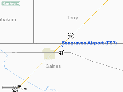
| From nearest city: | 1 nautical miles NE of Seagraves, TX |
| Location: | Gaines County, TX |
| Magnetic Variation: | 09E (1985) |
Owner & Manager
| Ownership: | Privately owned |
| Owner: | Seagraves Spraying Service
RWYS OWNED AND MAINTAINED BY GAINES COUNTY. |
| Address: | P.o. Box 1221
Seagraves, TX 79359 |
| Phone number: | 806-546-2513 |
| Manager: | Mike Williams |
| Address: | P.o. Box 1221
Seagraves, TX 79359 |
| Phone number: | 806-546-2513 |
Airport Operations and Facilities
| Airport Use: | Open to public |
| Wind indicator: | Yes |
| Segmented Circle: | No |
| Control Tower: | No |
| Lighting Schedule: | DUSK-DAWN |
| Landing fee charge: | No |
| Sectional chart: | Albuquerque |
| Region: | ASW - Southwest |
| Boundary ARTCC: | ZFW - Fort Worth |
| Tie-in FSS: | FTW - Fort Worth |
| FSS on Airport: | No |
| FSS Phone: | 817-541-3474 |
| FSS Toll Free: | 1-800-WX-BRIEF |
| NOTAMs Facility: | FTW (NOTAM-d service avaliable) |
Airport Communications
Airport Services
| Airframe Repair: | NONE |
| Power Plant Repair: | NONE |
| Bottled Oxygen: | NONE |
| Bulk Oxygen: | NONE |
Runway Information
Runway 04/22
| Dimension: | 4010 x 70 ft / 1222.2 x 21.3 m |
| Surface: | ASPH, Fair Condition
LOOSE ROCKS AND VEGETATION IN RY. |
| Edge Lights: | Non-standard lighting system
NSTD LIRL DUE TO INCORRECT SPACING. |
| |
Runway 04 |
Runway 22 |
| Traffic Pattern: | Left | Left |
| Obstruction: | 23 ft rr, 200.0 ft from runway, 120 ft left of centerline
RAILROAD 120L AT THR. | 23 ft rr, 200.0 ft from runway, 120 ft right of centerline
RR 120' RIGHT AT THR; 17' ROAD 40' FM THR ON CNTRLN. |
|
Runway 17/35
| Dimension: | 2445 x 37 ft / 745.2 x 11.3 m |
| Surface: | ASPH, Poor Condition
LOOSE ROCKS AND VEGETATION IN RY. |
| |
Runway 17 |
Runway 35 |
| Traffic Pattern: | Left | Left |
| Obstruction: | 15 ft road, 201.0 ft from runway
+4 FT BERM 160 FT FM THLD 0B; +25 FT POLES 110 FT LEFT; ROAD 60 FT LEFT AT THLD. | 15 ft road, 200.0 ft from runway, 60 ft right of centerline
ROAD 55 FT RIGHT AT THLD; +1 FT LEVEE 20 FT FM THLD 0B. |
|
Radio Navigation Aids
| ID |
Type |
Name |
Ch |
Freq |
Var |
Dist |
| GNC | NDB | Gaines County | | 344.00 | 09E | 17.8 nm |
| BFE | NDB | Brownfield | | 311.00 | 09E | 22.2 nm |
| LSA | NDB | Lamesa | | 338.00 | 09E | 33.7 nm |
| ANR | NDB | Andrews | | 245.00 | 09E | 36.4 nm |
| LLN | NDB | Levelland | | 266.00 | 09E | 37.1 nm |
| HOB | VORTAC | Hobbs | 047X | 111.00 | 11E | 41.4 nm |
Remarks
- RYS 04/22 & 17/35 UNMARKED.
Images and information placed above are from
http://www.airport-data.com/airport/F97/
We thank them for the data!
| General Info
|
| Country |
United States
|
| State |
TEXAS
|
| FAA ID |
F97
|
| Latitude |
32-57-00.350N
|
| Longitude |
102-32-01.688W
|
| Elevation |
3366 feet
|
| Near City |
SEAGRAVES
|
We don't guarantee the information is fresh and accurate. The data may
be wrong or outdated.
For more up-to-date information please refer to other sources.
|
|


