|
|
Scholes Intl At Galveston Airport |
| Scholes International Airport at Galveston |
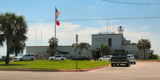 |
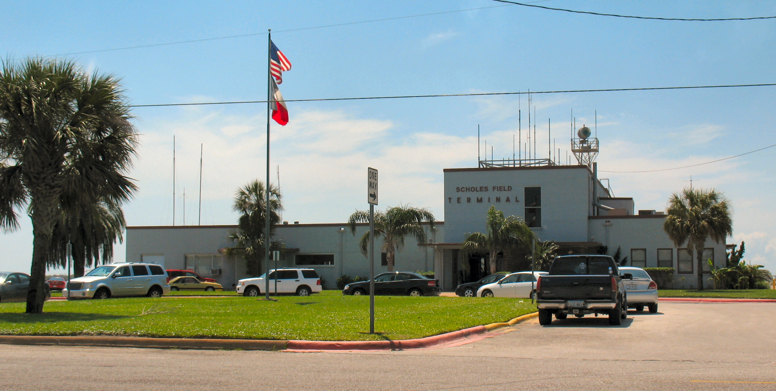
| Main Terminal of Scholes International Airport |
| IATA: GLS – ICAO: KGLS – FAA LID: GLS |
| Summary |
| Airport type |
Public |
| Owner |
City of Galveston |
| Operator |
City of Galveston |
| Serves |
Galveston, Texas. Scholes is the only public airport in Galveston County. |
| Location |
Galveston, Texas |
| Elevation AMSL |
6 ft / 2 m |
| Coordinates |
29°15′55.1640″N 94°51′37.4640″W / 29.26532333°N 94.86040667°W / 29.26532333; -94.86040667Coordinates: 29°15′55.1640″N 94°51′37.4640″W / 29.26532333°N 94.86040667°W / 29.26532333; -94.86040667 |
| Website |
www.galvestonairport.com |
| Runways |
| Direction |
Length |
Surface |
| ft |
m |
| 17/35 |
6,001 |
1,829 |
Concrete |
| 13/31 |
6,001 |
1,829 |
Asphalt |
| Statistics (2008) |
| Aircraft operations |
61,087 |
| Based aircraft |
141 |
| Source: Federal Aviation Administration |
Scholes International Airport at Galveston (IATA: GLS, ICAO: KGLS) is an airport located in Galveston, Texas, United States. The airport, three miles (5 km) southwest of downtown Galveston, has two runways. Overview
Operated and maintained by the City of Galveston, GLS is now a general aviation airport serving diverse aviation segments. It has enjoyed the service of many airlines in its history, including Trans-Texas Airways (forerunner to Texas International Airlines), Braniff Airways, and Houston Metro Airlines. GLS's Master Plan has considered the potential return of commercial airline service as well as the increasing trend of corporate aircraft and oil industry helicopter activity. In preparation for increased corporate activity, the ultimate plan considers the extension of the primary runway (17/35) from 6001 x 150 ft (46 m). to 7,100 feet (2,200 m). Currently, it can accommodate aircraft as large as a Boeing 767.
GLS is an airport with air traffic control 12 hours a day (0600-1800), with direct clearance delivery service to Houston TRACON after the tower is closed. The Class D surface area changes to Class E and airport is uncontrolled. Airport lighting includes HIRL, MIRL, MALSR, REIL’s and PAPI’s as well as lighted taxiway and runway signage. It has an "A" ARFF Index. The 1,200-acre (4.9 km) airport offers a terminal, a 24 hour fixed base operator, 24 hour weather services, a U.S. Customs agent on call, and state-of-the-art navigational aids with precision approaches providing all-weather capabilities. It is a fairly popular fueling stop for transient military aircraft due to a Military Operations Area in the Gulf of Mexico. It is also the destination airport for air ambulances transferring patients to the Shriner's Burn Center.
Of the 220+ aircraft based at GLS, 50+ are helicopters belonging to Air Logistics, Era, Evergreen, PHI, Tex-Air, and other oil industry vendors.
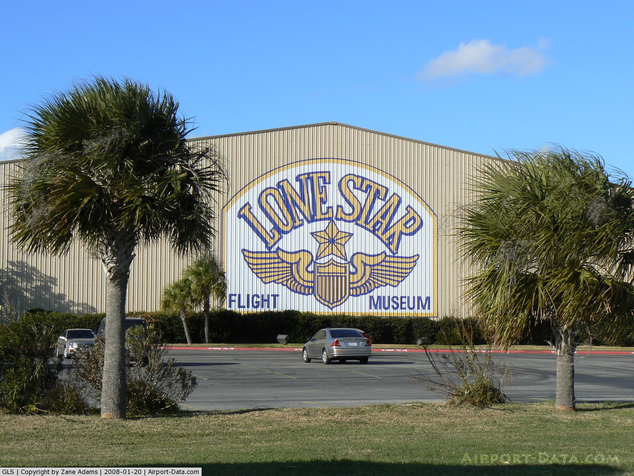
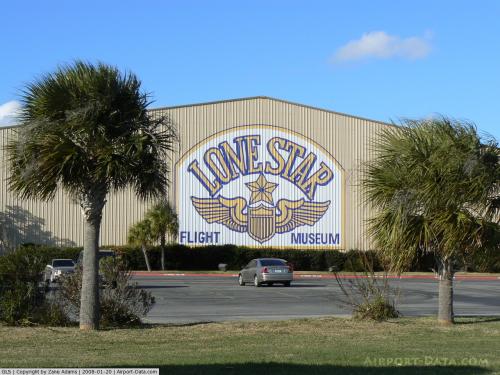
The Lone Star Flight Museum is located at the airport and boasts a large collection of flying antique military aircraft as well as the Texas Aviation Hall of Fame.
GLS ATIS Freq: 119.275, Phone Number: (409) 740-9248 ASOS
Regular Traffic
Light general aviation aircraft, and the occasional transient bizjets can be seen at GLS.
The most frequent traffic is that of the helicopters that support the off shore petrochemical industry. Of the larger vendors:
AIR LOGISTICS flies Sikorsky S-76s, Hueys;
ERA flies Augusta A-119s, Eurocopter EC-135s, Sikorsky S-61s;
EVERGREEN flies Eurocopter AS-350s, Hueys, Sikorsky S-61s;
PHI (Petrolium Helicopters Inc.) flies Bell JetRangers, Messerschmidt BO-105s, Eurocopter EC-135s, Sikorsky S-76s.
History
Scholes International Airport is the former Galveston Municipal Airport that dates back to 1931. It was renamed Corrigan Airport in 1938 for Douglas "Wrong Way" Corrigan, a Galveston native, who worked at Ryan Aeronautical Company and helped to build Charles Lindbergh's "Spirit of St. Louis". Later he piloted his own 1929 Curtiss Robin OX-5 monoplane named "Sunshine" from Floyd Bennett Field in Brooklyn, New York, to Ireland allegedly due to a "compass error" after being denied permission to fly that same trans-Atlantic route by the U.S. Bureau of Air Commerce many times before. This incident earned him his nickname.
During World War II, it was redesignated a U.S. Army Air Corps base and named "Galveston Army Air Field", United States Army Corps of Engineers, using funds made available by Congress through the Civil Aeronautics Authority, constructed three 6,000-foot (1,800 m)-long, hard-surface runways at the airport to accommodate army aircraft.
In January 1943, Galveston AAFld. was officially activated had the 46th Bombardment Group flying the Douglas A-20 Havoc in the anti-submarine role in the Gulf of Mexico until replaced by the 10th Antisubmarine Squadron, flying RM-37 Lockheed Venturas.
The Field was primarily used for replacement crew gunnery training by the 407th Fighter-Bomber Group, with targets being towed to the gunnery range at nearby Oyster Bay. The installation cost $7 million and at its peak had some 2,500 personnel assigned.
It was officially deactivated on November 15, 1945, with ownership reverting back to the City of Galveston. As late as 1948, it was an active seaplane base per Sectional Aeronautical chart SA SAC O-5.
Lone Star Flight Museum
The Lone Star Flight Museum has a large number of static warbirds, and also maintains a fleet of air worthy warbirds including: Vega B-17 Flying Fortress, North American B-25 Mitchell Bomber, Douglas SBD Dauntless, Republic P-47 Thunderbolt, Vought F4U Corsair, General Motors (Eastern Aircraft) TBM Avenger, Grumman F6F Hellcat, Grumman F8F Bearcat, General Motors FM-2 Wildcat, Supermarine Spitfire, Hawker Hurricane, North American AT-6 Texan, Beech AT-11 Kansan, Cessna AT-17 Bobcat, Stinson L-5, Douglas DC-3 Sky Train, Stearman PT-17.
The above content comes from Wikipedia and is published under free licenses – click here to read more.
 |
(Click on the photo to enlarge) |
Location & QuickFacts
| FAA Information Effective: | 2008-09-25 |
| Airport Identifier: | GLS |
| Airport Status: | Operational |
| Longitude/Latitude: | 094-51-37.5000W/29-15-55.2000N
-94.860417/29.265333 (Estimated) |
| Elevation: | 6 ft / 1.83 m (Surveyed) |
| Land: | 966 acres |
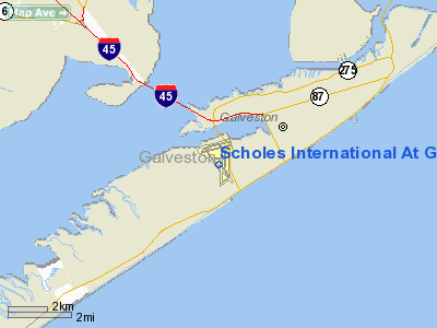
| From nearest city: | 3 nautical miles SW of Galveston, TX |
| Location: | Galveston County, TX |
| Magnetic Variation: | 06E (1985) |
Owner & Manager
| Ownership: | Publicly owned |
| Owner: | City Of Galveston |
| Address: | Po Box 3266
Galveston, TX 77552 |
| Phone number: | 409-741-4609 |
| Manager: | Hud Hopkins |
| Address: | P O Box 3266
Galveston, TX 77552 |
| Phone number: | 409-741-4609 |
Airport Operations and Facilities
| Airport Use: | Open to public |
| Wind indicator: | Yes |
| Segmented Circle: | Yes |
| Control Tower: | Yes |
| Lighting Schedule: | DUSK-DAWN
HIRL RY 13/31 AND MIRL RY 17/35 PRESET ON MED INTST. WHEN ATCT CLSD ACTVT MALSR RY 13 - CTAF. |
| Beacon Color: | Clear-Green (lighted land airport) |
| Landing fee charge: | No |
| Sectional chart: | Houston |
| Region: | ASW - Southwest |
| Boundary ARTCC: | ZHU - Houston |
| Tie-in FSS: | CXO - Montgomery County |
| FSS on Airport: | No |
| FSS Toll Free: | 1-800-WX-BRIEF
FOR FP FILING CALL CXO FSS 1-800-833-5602 |
| NOTAMs Facility: | GLS (NOTAM-d service avaliable) |
| Federal Agreements: | NGPY3 |
Airport Communications
| CTAF: | 120.575 |
| Unicom: | 123.050 |
Airport Services
| Fuel available: | 100LLA
FOR FUEL SVC AFT HRS CALL 409-939-7121. SELF SERVE 100 OCTANE AVBL 24 HRS WITH CREDIT CARD. |
| Airframe Repair: | MAJOR |
| Power Plant Repair: | MAJOR |
| Bottled Oxygen: | NONE |
Runway Information
Runway 13/31
| Dimension: | 6000 x 150 ft / 1828.8 x 45.7 m |
| Surface: | ASPH-CONC, Good Condition
FIRST 1300 FT NW END IS CONC. |
| Weight Limit: | Single wheel: 30000 lbs.
Dual wheel: 45000 lbs.
Dual tandem wheel: 90000 lbs. |
| Edge Lights: | High |
| |
Runway 13 |
Runway 31 |
| Longitude: | 094-52-03.5316W | 094-51-20.0934W |
| Latitude: | 29-16-18.1801N | 29-15-32.6039N |
| Elevation: | 5.00 ft | 5.00 ft |
| Alignment: | 127 | 127 |
| ILS Type: | ILS
| |
| Traffic Pattern: | Left | Left |
| Markings: | Precision instrument, Good Condition | Precision instrument, Good Condition |
| Crossing Height: | 45.00 ft | 49.00 ft |
| VASI: | 4-light PAPI on left side | 4-light PAPI on left side |
| Visual Glide Angle: | 3.00° | 3.00° |
| Approach lights: | MALSR | |
| Runway End Identifier: | | Yes |
| Obstruction: | 124 ft crane, 4386.0 ft from runway, 1114 ft right of centerline, 33:1 slope to clear | 40 ft pole, 1990.0 ft from runway, 440 ft right of centerline, 44:1 slope to clear |
| Decleard distances: | Take off run available 6001.00 ft
Take off distance available 6001.00 ft
Actual stop distance available 6001.00 ft
Landing distance available 6001.00 ft
| Take off run available 6001.00 ft
Take off distance available 6001.00 ft
Actual stop distance available 6001.00 ft
Landing distance available 6001.00 ft
|
|
Runway 17/35
| Dimension: | 6001 x 150 ft / 1829.1 x 45.7 m |
| Surface: | CONC, Good Condition
FIRST 1300 FT NW END IS CONC. |
| Weight Limit: | Single wheel: 30000 lbs.
Dual wheel: 45000 lbs.
Dual tandem wheel: 90000 lbs. |
| Edge Lights: | Medium |
| |
Runway 17 |
Runway 35 |
| Longitude: | 094-51-32.6512W | 094-51-33.6651W |
| Latitude: | 29-16-24.6140N | 29-15-25.2108N |
| Elevation: | 6.00 ft | 5.00 ft |
| Alignment: | 127 | 1 |
| Traffic Pattern: | Left | Left |
| Markings: | Basic, Good Condition | Basic, Good Condition |
| Crossing Height: | 49.00 ft | 49.00 ft |
| VASI: | 4-light PAPI on left side | 4-light PAPI on left side |
| Visual Glide Angle: | 3.00° | 3.00° |
| Runway End Identifier: | Yes | Yes |
| Obstruction: | , 50:1 slope to clear | 120 ft bldg, 2970.0 ft from runway, 240 ft right of centerline, 23:1 slope to clear |
| Decleard distances: | Take off run available 6001.00 ft
Take off distance available 6001.00 ft
Actual stop distance available 6001.00 ft
Landing distance available 6001.00 ft
| Take off run available 6001.00 ft
Take off distance available 6001.00 ft
Actual stop distance available 6001.00 ft
Landing distance available 6001.00 ft
|
|
Radio Navigation Aids
| ID |
Type |
Name |
Ch |
Freq |
Var |
Dist |
| GLS | NDB | Galveston | | 206.00 | 08E | 6.8 nm |
| JPA | NDB | Sanjac | | 347.00 | 05E | 26.6 nm |
| CBC | NDB | Anahuac | | 413.00 | 05E | 32.2 nm |
| SYG | NDB | Sandy Point | | 402.00 | 05E | 34.9 nm |
| SGR | NDB | Hull | | 388.00 | 05E | 47.1 nm |
| BVP | NDB | Nixin | | 326.00 | 05E | 47.5 nm |
| EFD | TACAN | Ellington | 031X | | 05E | 25.8 nm |
| MHF | VOR/DME | Trinity | 083X | 113.60 | 07E | 17.9 nm |
| HUB | VOR/DME | Hobby | 118X | 117.10 | 05E | 32.0 nm |
| SBI | VOR/DME | Sabine Pass | 101X | 115.40 | 07E | 49.9 nm |
| VUH | VORTAC | Scholes | 077X | 113.00 | 06E | 0.5 nm |
| IAH | VORTAC | Humble | 113X | 116.60 | 05E | 48.7 nm |
| HOU | VOT | Houston Wm P Hobby | | 108.40 | | 31.6 nm |
Remarks
- FLOCKS OF BIRDS INVOF ARPT BLO 200' AGL.
- 124 FT LGTD CRANE NW SIDE OF ARPT.
- NO SKID MOUNTED HELICOPTER PARKING ON MAIN APRON.
- HELICOPTERS OPERATING ON & INVOF ARPT.
- 178 FT LGTD BLDG 2000 FT NE OF RY 17 THR.
- HELICOPTER PARKING IN DESIGNATED AREA ONLY. NO HELICOPTER PARKING ON TRML RAMP.
- PAEW ADJ RYS & TWYS.
- TWO 157 FT MSL LGTD TOWERS BTN RYS 31 & 35.
Images and information placed above are from
http://www.airport-data.com/airport/GLS/
We thank them for the data!
| General Info
|
| Country |
United States
|
| State |
TEXAS
|
| FAA ID |
GLS
|
| Latitude |
29-15-55.164N
|
| Longitude |
094-51-37.464W
|
| Elevation |
6 feet
|
| Near City |
GALVESTON
|
We don't guarantee the information is fresh and accurate. The data may
be wrong or outdated.
For more up-to-date information please refer to other sources.
|
|