 |
|
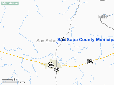
San Saba County Muni Airport |
Location & QuickFacts
| FAA Information Effective: | 2008-09-25 |
| Airport Identifier: | 81R |
| Airport Status: | Operational |
| Longitude/Latitude: | 098-43-01.1540W/31-14-06.6020N
-98.716987/31.235167 (Estimated) |
| Elevation: | 1249 ft / 380.70 m (Estimated) |
| Land: | 79 acres |
| From nearest city: | 3 nautical miles N of San Saba, TX |
| Location: | San Saba County, TX |
| Magnetic Variation: | 07E (1985) |
Owner & Manager
| Ownership: | Publicly owned |
| Owner: | San Saba City County |
| Address: | Po Box 788
San Saba, TX 76877 |
| Phone number: | 325-372-5144 |
| Manager: | Bill Dyer |
| Address: | Po Box 383
San Saba, TX 76877 |
| Phone number: | 325-372-6034 |
Airport Operations and Facilities
| Airport Use: | Open to public |
| Wind indicator: | Yes |
| Segmented Circle: | Yes |
| Control Tower: | No |
| Lighting Schedule: | DUSK-DAWN
ACTVT LIRL RY 13/31 - CTAF. |
| Beacon Color: | Clear-Green (lighted land airport)
GREEN LENS OTS INDEFLY. |
| Landing fee charge: | No |
| Sectional chart: | San Antonio |
| Region: | ASW - Southwest |
| Boundary ARTCC: | ZHU - Houston |
| Tie-in FSS: | SJT - San Angelo |
| FSS on Airport: | No |
| FSS Toll Free: | 1-800-WX-BRIEF |
| NOTAMs Facility: | SJT (NOTAM-d service avaliable) |
Airport Communications
| CTAF: | 122.800 |
| Unicom: | 122.800 |
Airport Services
| Fuel available: | 100LL
FOR FUEL CALL 915-372-3380/6034. |
| Airframe Repair: | NONE |
| Power Plant Repair: | NONE |
| Bottled Oxygen: | NONE |
| Bulk Oxygen: | NONE |
Runway Information
Runway 13/31
| Dimension: | 3800 x 60 ft / 1158.2 x 18.3 m |
| Surface: | ASPH, Fair Condition |
| Weight Limit: | Single wheel: 12500 lbs. |
| Edge Lights: | Low |
| |
Runway 13 |
Runway 31 |
| Traffic Pattern: | Left | Left |
| Markings: | Basic, Fair Condition | Basic, Fair Condition |
| Crossing Height: | 74.00 ft | 31.00 ft |
| VASI: | tri-color on left side
TRCV OTS INDEFLY. | tri-color on left side
TRCV OTS INDEFLY. |
| Visual Glide Angle: | 4.75° | 6.00° |
| Obstruction: | 5 ft berm, 201.0 ft from runway
RWY 13 8 FT BRUSH 195 FT FM THLD 20 FT R & L; 5 FT BERM 200 FT FM THLD 100 FT R & L. | , 50:1 slope to clear |
|
Radio Navigation Aids
| ID |
Type |
Name |
Ch |
Freq |
Var |
Dist |
| BBD | NDB | Brady | | 380.00 | 07E | 31.3 nm |
| MNZ | NDB | Hamilton | | 251.00 | 07E | 37.3 nm |
| BMQ | NDB | Burnet | | 341.00 | 07E | 38.7 nm |
| GR | NDB | Starn | | 323.00 | 07E | 43.3 nm |
| MFS | NDB | Horseshoe Bay Resort | | 403.00 | 07E | 46.6 nm |
| BWD | VOR/DME | Brownwood | 023X | 108.60 | 08E | 41.4 nm |
| GRK | VOR/DME | Gray | 055X | 111.80 | 07E | 48.0 nm |
| LLO | VORTAC | Llano | 019X | 108.20 | 08E | 26.6 nm |
| LZZ | VORTAC | Lampasas | 072X | 112.50 | 08E | 29.7 nm |
Remarks
- JET A FUEL AVBL FOR HELICOPTERS ONLY.
Images and information placed above are from
http://www.airport-data.com/airport/81R/
We thank them for the data!
| General Info
|
| Country |
United States
|
| State |
TEXAS
|
| FAA ID |
81R
|
| Latitude |
31-14-06.602N
|
| Longitude |
098-43-01.154W
|
| Elevation |
1249 feet
|
| Near City |
SAN SABA
|
We don't guarantee the information is fresh and accurate. The data may
be wrong or outdated.
For more up-to-date information please refer to other sources.
|
|


