 |
|
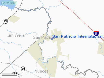
San Patricio Intl Airport |
Location & QuickFacts
| FAA Information Effective: | 2008-09-25 |
| Airport Identifier: | 68TX |
| Airport Status: | Operational |
| Longitude/Latitude: | 097-47-12.9920W/27-58-51.0580N
-97.786942/27.980849 (Estimated) |
| Elevation: | 50 ft / 15.24 m (Estimated) |
| Land: | 30 acres |
| From nearest city: | 2 nautical miles NW of San Patricio, TX |
| Location: | San Patricio County, TX |
| Magnetic Variation: | 07E (1985) |
Owner & Manager
| Ownership: | Privately owned |
| Owner: | Lonnie Glasscock Iii |
| Address: | Rt 2/box 45
San Patricio, TX 78368 |
| Phone number: | 512-547-2256 |
| Manager: | Lonnie Glasscock Iii |
| Address: | Rt 2/box 45
San Patricio, TX 78368 |
| Phone number: | 512-547-2256 |
Airport Operations and Facilities
| Airport Use: | Private |
| Wind indicator: | No |
| Segmented Circle: | No |
| Control Tower: | No |
| Sectional chart: | Brownsville |
| Region: | ASW - Southwest |
| Boundary ARTCC: | ZHU - Houston |
| Tie-in FSS: | SJT - San Angelo |
| FSS Toll Free: | 1-800-WX-BRIEF |
Runway Information
Runway 06/24
| Dimension: | 3000 x 110 ft / 914.4 x 33.5 m |
| Surface: | TURF, Poor Condition
RWY BUMPY.
RWY BUMPY. |
| |
Runway 06 |
Runway 24 |
| Traffic Pattern: | Left | Left |
| Displaced threshold: | 300.00 ft | 400.00 ft |
| Obstruction: | 18 ft plines, 600.0 ft from runway | 8 ft crops, 20.0 ft from runway |
|
Runway 12/30
| Dimension: | 5000 x 120 ft / 1524.0 x 36.6 m |
| Surface: | TURF, Poor Condition
RWY BUMPY.
RWY BUMPY. |
| |
Runway 12 |
Runway 30 |
| Traffic Pattern: | Left | Left |
| Displaced threshold: | 400.00 ft | 100.00 ft |
| Obstruction: | 18 ft plines, 600.0 ft from runway | 16 ft trees, 200.0 ft from runway |
|
Radio Navigation Aids
| ID |
Type |
Name |
Ch |
Freq |
Var |
Dist |
| BEA | NDB | Beeville | | 284.00 | 07E | 23.3 nm |
| TKB | NDB | Kleberg County | | 347.00 | 06E | 27.6 nm |
| MNO | NDB | Mellon Ranch | | 375.00 | 06E | 35.7 nm |
| RKP | NDB | Rockport | | 391.00 | 06E | 39.8 nm |
| BKS | NDB | Brooks County | | 353.00 | 06E | 49.8 nm |
| NOG | TACAN | Orange Grove | 063X | | 09E | 14.5 nm |
| NQI | TACAN | Kingsville | 125X | | 09E | 29.0 nm |
| ALI | VOR | Alice | | 114.50 | 06E | 19.1 nm |
| CRP | VORTAC | Corpus Christi | 102X | 115.50 | 09E | 18.7 nm |
| NGP | VORTAC | Truax | 087X | 114.00 | 06E | 31.6 nm |
| THX | VORTAC | Three Rivers | 051X | 111.40 | 08E | 36.9 nm |
Remarks
- RATTLESNAKES MAY BE ON RWYS--ESPECIALLY ON SUNNY DAYS DURING COOL WEATHER. DISTURBED SNAKES MAY PUNCTURE ACFT TIRES.
- PRVDD TFC PATS AT SAN PATRICIO INT'L ARE COORDINATED WITH TFC PAT AT KNOLLE ARPT.
Images and information placed above are from
http://www.airport-data.com/airport/68TX/
We thank them for the data!
| General Info
|
| Country |
United States
|
| State |
TEXAS
|
| FAA ID |
68TX
|
| Latitude |
27-58-51.058N
|
| Longitude |
097-47-12.992W
|
| Elevation |
50 feet
|
| Near City |
SAN PATRICIO
|
We don't guarantee the information is fresh and accurate. The data may
be wrong or outdated.
For more up-to-date information please refer to other sources.
|
|


