 |
|
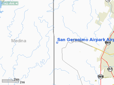
San Geronimo Airpark Airport |
Location & QuickFacts
| FAA Information Effective: | 2008-09-25 |
| Airport Identifier: | 8T8 |
| Airport Status: | Operational |
| Longitude/Latitude: | 098-47-54.0910W/29-30-37.8290N
-98.798359/29.510508 (Estimated) |
| Elevation: | 1040 ft / 316.99 m (Estimated) |
| Land: | 86 acres |
| From nearest city: | 10 nautical miles W of San Antonio, TX |
| Location: | Bexar County, TX |
| Magnetic Variation: | 07E (1985) |
Owner & Manager
| Ownership: | Privately owned |
| Owner: | San Geronimo Airpark Inc. |
| Address: | 15464 F.m. 471 West Box 30
San Antonio, TX 78253 |
| Phone number: | 210-688-9072 |
| Manager: | Lewis Mason |
| Address: | 15464 F.m. 471w No.27
San Antonio, TX 78253 |
| Phone number: | 210-688-9072 |
Airport Operations and Facilities
| Airport Use: | Open to public |
| Wind indicator: | Yes |
| Segmented Circle: | No |
| Control Tower: | No |
| Landing fee charge: | No |
| Sectional chart: | San Antonio |
| Region: | ASW - Southwest |
| Boundary ARTCC: | ZHU - Houston |
| Tie-in FSS: | SJT - San Angelo |
| FSS on Airport: | No |
| FSS Toll Free: | 1-800-WX-BRIEF |
| NOTAMs Facility: | SJT (NOTAM-d service avaliable) |
Airport Communications
| CTAF: | 122.950 |
| Unicom: | 122.950 |
Runway Information
Runway 17/35
| Dimension: | 3000 x 40 ft / 914.4 x 12.2 m
SHOULDERS SOFT & MUDDY WHEN WET. |
| Surface: | ASPH, Good Condition |
| |
Runway 17 |
Runway 35 |
| Traffic Pattern: | Left | Left |
| Markings: | Nonstandard, Fair Condition
RY NUMERALS 35 FT HIGH. CNTRLN 4 INCH WIDE BY 10 FT LONG WITH 30 FT SPACES. | Nonstandard, Fair Condition
RY NUMERALS 35 FT HIGH. CNTRLN 4 INCH WIDE BY 10 FT LONG WITH 30 FT SPACES. |
| Obstruction: | 10 ft tree, 200.0 ft from runway, 100 ft left of centerline
+5 FT FENCE 100 FT EAST OF RY CNTRLN FM THLD TO 200 FT. 6-20 FT TREES 100 FT EAST OF CNTRLN FM THLD TO 200 FT. | 25 ft tree, 200.0 ft from runway, 100 ft right of centerline
+5 FT FENCE 100 FT EAST OF RY CNTRLN FM THLD TO 200 FT. 15-30+ FT TREES 100 FT EAST OF CNTRLN FM THLD TO 200 FT. |
|
Radio Navigation Aids
| ID |
Type |
Name |
Ch |
Freq |
Var |
Dist |
| CVB | NDB | Castroville | | 338.00 | 08E | 10.2 nm |
| HMA | NDB | Hondo | | 329.00 | 08E | 21.2 nm |
| HHH | NDB | Devine | | 359.00 | 07E | 23.6 nm |
| ER | NDB | Shein | | 263.00 | 08E | 26.7 nm |
| PEZ | NDB | Pleasanton | | 275.00 | 07E | 36.5 nm |
| KSY | TACAN | Kelly | 057X | | 07E | 13.4 nm |
| DHK | TACAN | Randolph | 036X | | 09E | 27.8 nm |
| SSF | VOR | Stinson | | 108.40 | 09E | 24.0 nm |
| HDO | VOR/DME | Hondo | 31X | 109.40 | 08E | 22.1 nm |
| SAT | VORTAC | San Antonio | 115X | 116.80 | 08E | 19.4 nm |
| RND | VORTAC | Randolph | 70X | 112.30 | 09E | 26.8 nm |
| CSI | VORTAC | Center Point | 122X | 117.50 | 08E | 32.9 nm |
| STV | VORTAC | Stonewall | 085X | 113.80 | 08E | 42.1 nm |
| SAT | VOT | San Antonio Intl | | 110.40 | | 17.2 nm |
Remarks
- +15 FT HANGARS LOCATED 112 FT WEST ALONG RY 17/35.
Images and information placed above are from
http://www.airport-data.com/airport/8T8/
We thank them for the data!
| General Info
|
| Country |
United States
|
| State |
TEXAS
|
| FAA ID |
8T8
|
| Latitude |
29-30-37.829N
|
| Longitude |
098-47-54.091W
|
| Elevation |
1040 feet
|
| Near City |
SAN ANTONIO
|
We don't guarantee the information is fresh and accurate. The data may
be wrong or outdated.
For more up-to-date information please refer to other sources.
|
|


