 |
|
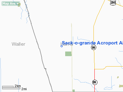
Sack-o-grande Acroport Airport |
Sack-O-Grande Acroport
Harbican Airport |
| IATA: none – ICAO: none – FAA LID: 9X9 |
| Summary |
| Airport type |
Public |
| Owner |
Sack-O-Grande Inc. |
| Serves |
Katy, Texas |
| Elevation AMSL |
165 ft / 50 m |
| Coordinates |
29°54′46″N 095°49′36″W / 29.91278°N 95.82667°W / 29.91278; -95.82667 |
| Runways |
| Direction |
Length |
Surface |
| ft |
m |
| 9/27 |
3,950 |
1,204 |
Turf |
| Source: Federal Aviation Administration |
Sack-O-Grande Acroport (FAA LID: 9X9), also known as the Harbican Airport (formerly 9XS9) is an airport in unincorporated Harris County, Texas, United States. It is located seven nautical miles (13 km) north of the central business district of the city of Katy.
The owner is Sack-O-Grande Incorporated, which is based in Hedwig Village, Texas. As of 2008 the manager is David Z. Mafrige.
Facilities
Sack-O-Grande Acroport covers an area of 20 acres (8 ha) at an elevation of 165 feet (50 m) above mean sea level. It has one runway designated 9/27 with a 3,950 by 100 ft (1,204 x 30 m) turf surface.
The above content comes from Wikipedia and is published under free licenses – click here to read more.
Location & QuickFacts
| FAA Information Effective: | 2008-09-25 |
| Airport Identifier: | 9X9 |
| Airport Status: | Operational |
| Longitude/Latitude: | 095-49-35.8230W/29-54-45.8100N
-95.826617/29.912725 (Estimated) |
| Elevation: | 165 ft / 50.29 m (Surveyed) |
| Land: | 20 acres |
| From nearest city: | 7 nautical miles N of Katy, TX |
| Location: | Harris County, TX |
| Magnetic Variation: | 06E (1985) |
Owner & Manager
| Ownership: | Privately owned |
| Owner: | Sack-o-grande Inc |
| Address: | 9219 Katy Freeway, Ste 291
Houston, TX 77024-1514 |
| Phone number: | 713-371-2276 |
| Manager: | Troy Maxwell |
| Address: | 9219 Katy Freeway, Ste 291
Houston, TX 77024-1514 |
| Phone number: | 281-398-8118 |
Airport Operations and Facilities
| Airport Use: | Open to public |
| Wind indicator: | Yes |
| Segmented Circle: | No |
| Control Tower: | No |
| Landing fee charge: | Yes |
| Sectional chart: | Houston |
| Region: | ASW - Southwest |
| Boundary ARTCC: | ZHU - Houston |
| Tie-in FSS: | CXO - Montgomery County |
| FSS on Airport: | No |
| FSS Toll Free: | 1-800-WX-BRIEF |
| NOTAMs Facility: | CXO (NOTAM-d service avaliable) |
Airport Communications
Airport Services
Runway Information
Runway 09/27
| Dimension: | 3950 x 100 ft / 1204.0 x 30.5 m |
| Surface: | TURF, Fair Condition |
| |
Runway 09 |
Runway 27 |
| Traffic Pattern: | Left | Left |
| Obstruction: | 15 ft road, 320.0 ft from runway, 21:1 slope to clear | 35 ft pline, 0.0 ft from runway |
|
Radio Navigation Aids
| ID |
Type |
Name |
Ch |
Freq |
Var |
Dist |
| LYD | NDB | Lakeside | | 249.00 | 05E | 9.7 nm |
| EYQ | NDB | Weiser | | 286.00 | 06E | 9.8 nm |
| DWH | NDB | David Hooks | | 521.00 | 05E | 18.6 nm |
| SGR | NDB | Hull | | 388.00 | 05E | 19.1 nm |
| SYG | NDB | Sandy Point | | 402.00 | 05E | 31.0 nm |
| BVP | NDB | Nixin | | 326.00 | 05E | 32.2 nm |
| BNH | NDB | Brenham | | 362.00 | 06E | 34.0 nm |
| JPA | NDB | Sanjac | | 347.00 | 05E | 42.1 nm |
| ARM | NDB | Wharton | | 245.00 | 06E | 43.1 nm |
| EFD | TACAN | Ellington | 031X | | 05E | 39.4 nm |
| ELA | VOR/DME | Eagle Lake | 111X | 116.40 | 08E | 29.7 nm |
| HUB | VOR/DME | Hobby | 118X | 117.10 | 05E | 32.6 nm |
| IAH | VORTAC | Humble | 113X | 116.60 | 05E | 25.2 nm |
| TNV | VORTAC | Navasota | 106X | 115.90 | 08E | 25.6 nm |
| IDU | VORTAC | Industry | 039X | 110.20 | 08E | 38.4 nm |
| HOU | VOT | Houston Wm P Hobby | | 108.40 | | 32.8 nm |
Remarks
Images and information placed above are from
http://www.airport-data.com/airport/9X9/
We thank them for the data!
|
|


