 |
|
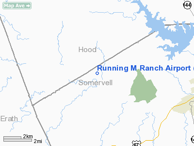
Location & QuickFacts
| FAA Information Effective: | 2008-09-25 |
| Airport Identifier: | 09TE |
| Airport Status: | Operational |
| Longitude/Latitude: | 097-52-01.1140W/32-16-00.5080N
-97.866976/32.266808 (Estimated) |
| Elevation: | 787 ft / 239.88 m (Estimated) |
| Land: | 6 acres |
| From nearest city: | 6 nautical miles NW of Glen Rose, TX |
| Location: | Somervell County, TX |
| Magnetic Variation: | 07E (1985) |
Owner & Manager
| Ownership: | Privately owned |
| Owner: | Ben Bishop |
| Address: | P.o. Box 731
Cleburne, TX 76033 |
| Phone number: | 817-641-6600 |
| Manager: | Ben Bishop |
| Address: | P.o. Box 731
Cleburne, TX 76033 |
| Phone number: | 817-641-6600 |
Airport Operations and Facilities
| Airport Use: | Private |
| Wind indicator: | Yes |
| Segmented Circle: | No |
| Control Tower: | No |
| Landing fee charge: | No |
| Sectional chart: | Dallas-ft Worth |
| Region: | ASW - Southwest |
| Boundary ARTCC: | ZFW - Fort Worth |
| Tie-in FSS: | FTW - Fort Worth |
| FSS on Airport: | No |
| FSS Phone: | 817-541-3474 |
| FSS Toll Free: | 1-800-WX-BRIEF |
Airport Services
| Airframe Repair: | NONE |
| Power Plant Repair: | NONE |
Runway Information
Runway 16/34
| Dimension: | 2815 x 45 ft / 858.0 x 13.7 m |
| Surface: | TURF, Fair Condition
TALL WEEDS ON RY. |
| |
Runway 16 |
Runway 34 |
| Traffic Pattern: | Left | Left |
| Obstruction: | 4 ft fence | 4 ft fence, 0.0 ft from runway |
|
Radio Navigation Aids
| ID |
Type |
Name |
Ch |
Freq |
Var |
Dist |
| MWL | NDB | Mineral Wells | | 266.00 | 06E | 32.6 nm |
| MNZ | NDB | Hamilton | | 251.00 | 07E | 41.4 nm |
| OIP | NDB | Old Rip | | 410.00 | 07E | 48.6 nm |
| XQH | NDB | Cedar Hill | | 353.00 | 08E | 49.2 nm |
| GZV | NDB | Brazos River | | 280.00 | 07E | 49.6 nm |
| NFW | TACAN | Nas Jrb Fort Worth | 024X | | 07E | 37.3 nm |
| JEN | VORTAC | Glen Rose | 097X | 115.00 | 06E | 6.5 nm |
| MQP | VORTAC | Millsap | 124X | 117.70 | 09E | 28.4 nm |
| ACT | VORTAC | Waco | 100X | 115.30 | 09E | 47.4 nm |
| FTW | VOT | Fort Worth Meacham | | 108.20 | | 42.0 nm |
Remarks
- RY 16 +30' TREES 75' L & R OF CNTRLN 100' FM THR.
- RY 34 +30' TREES 75' R & 60' L OF CNTRLN AT THR.
Images and information placed above are from
http://www.airport-data.com/airport/09TE/
We thank them for the data!
| General Info
|
| Country |
United States
|
| State |
TEXAS
|
| FAA ID |
09TE
|
| Latitude |
32-16-00.508N
|
| Longitude |
097-52-01.114W
|
| Elevation |
787 feet
|
| Near City |
GLEN ROSE
|
We don't guarantee the information is fresh and accurate. The data may
be wrong or outdated.
For more up-to-date information please refer to other sources.
|
|


