 |
|
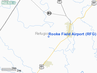
Location & QuickFacts
| FAA Information Effective: | 2008-09-25 |
| Airport Identifier: | RFG |
| Airport Status: | Operational |
| Longitude/Latitude: | 097-19-22.9740W/28-17-37.0210N
-97.323048/28.293617 (Estimated) |
| Elevation: | 56 ft / 17.07 m (Surveyed) |
| Land: | 107 acres |
| From nearest city: | 3 nautical miles W of Refugio, TX |
| Location: | Refugio County, TX |
| Magnetic Variation: | 07E (1985) |
Owner & Manager
| Ownership: | Privately owned |
| Owner: | Refugio County
COUNTY LEASES ARPT FM ROOKE FOUNDATION. |
| Address: | 808 Commerce Rm 104
Refugio, TX 78377 |
| Phone number: | 361-526-4434 |
| Manager: | James Henry |
| Address: | Po Box 581
Refugio, TX 78377 |
| Phone number: | 361-526-4141
OR 512-526-4141/2948. ARPT PHONE 361-526-4241. |
Airport Operations and Facilities
| Airport Use: | Open to public |
| Wind indicator: | Yes |
| Segmented Circle: | Yes |
| Control Tower: | No |
| Lighting Schedule: | DUSK-DAWN |
| Beacon Color: | Clear-Green (lighted land airport) |
| Landing fee charge: | No |
| Sectional chart: | San Antonio |
| Region: | ASW - Southwest |
| Boundary ARTCC: | ZHU - Houston |
| Tie-in FSS: | SJT - San Angelo |
| FSS on Airport: | No |
| FSS Toll Free: | 1-800-WX-BRIEF |
| NOTAMs Facility: | SJT (NOTAM-d service avaliable) |
| Federal Agreements: | N |
Airport Communications
| CTAF: | 122.800 |
| Unicom: | 122.800 |
Airport Services
| Fuel available: | 100LLMOGAS |
| Airframe Repair: | MINOR |
| Power Plant Repair: | MINOR |
| Bottled Oxygen: | NONE |
| Bulk Oxygen: | NONE |
Runway Information
Runway 14/32
| Dimension: | 4361 x 60 ft / 1329.2 x 18.3 m |
| Surface: | ASPH, Good Condition |
| Weight Limit: | Single wheel: 9000 lbs. |
| Edge Lights: | Medium |
| |
Runway 14 |
Runway 32 |
| Traffic Pattern: | Left | Left |
| Markings: | Non-precision instrument, Good Condition | Non-precision instrument, Good Condition |
| Crossing Height: | 35.00 ft | 0.00 ft |
| Displaced threshold: | 0.00 ft | 166.00 ft |
| VASI: | 2-light PAPI on left side | |
| Visual Glide Angle: | 3.00° | 0.00° |
| Obstruction: | 16 ft tree, 310.0 ft from runway, 115 ft left of centerline, 6:1 slope to clear | 15 ft road, 379.0 ft from runway, 142 ft left of centerline, 11:1 slope to clear
APCH SLOPE 34:1 FM DSPLCD THLD TO +15 FT ROAD 513 FT FM DSPLCD THLD 176 FT LEFT. |
|
Radio Navigation Aids
| ID |
Type |
Name |
Ch |
Freq |
Var |
Dist |
| MNO | NDB | Mellon Ranch | | 375.00 | 06E | 6.3 nm |
| RKP | NDB | Rockport | | 391.00 | 06E | 19.1 nm |
| BEA | NDB | Beeville | | 284.00 | 07E | 25.4 nm |
| PKV | NDB | Port Lavaca | | 515.00 | 05E | 40.1 nm |
| NOG | TACAN | Orange Grove | 063X | | 09E | 45.0 nm |
| ALI | VOR | Alice | | 114.50 | 06E | 49.8 nm |
| VCT | VOR/DME | Victoria | 027X | 109.00 | 06E | 40.7 nm |
| CRP | VORTAC | Corpus Christi | 102X | 115.50 | 09E | 24.3 nm |
| NGP | VORTAC | Truax | 087X | 114.00 | 06E | 36.5 nm |
| THX | VORTAC | Three Rivers | 051X | 111.40 | 08E | 45.6 nm |
Remarks
Images and information placed above are from
http://www.airport-data.com/airport/RFG/
We thank them for the data!
| General Info
|
| Country |
United States
|
| State |
TEXAS
|
| FAA ID |
RFG
|
| Latitude |
28-17-37.021N
|
| Longitude |
097-19-22.974W
|
| Elevation |
56 feet
|
| Near City |
REFUGIO
|
We don't guarantee the information is fresh and accurate. The data may
be wrong or outdated.
For more up-to-date information please refer to other sources.
|
|


