 |
|
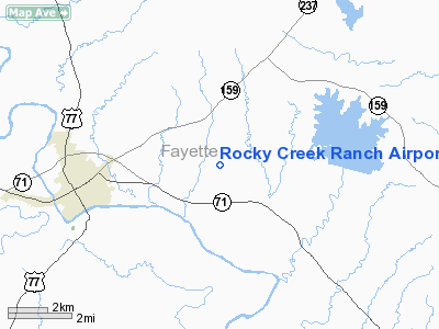
Rocky Creek Ranch Airport |
Location & QuickFacts
| FAA Information Effective: | 2008-09-25 |
| Airport Identifier: | 9TE6 |
| Airport Status: | Operational |
| Longitude/Latitude: | 096-48-00.9220W/29-55-00.8110N
-96.800256/29.916892 (Estimated) |
| Elevation: | 390 ft / 118.87 m (Estimated) |
| Land: | 35 acres |
| From nearest city: | 4 nautical miles NE of La Grange, TX |
| Location: | Fayette County, TX |
| Magnetic Variation: | 06E (1985) |
Owner & Manager
| Ownership: | Privately owned |
| Owner: | Mr Thomas J. Holmes |
| Address: | 3419 Mercer Drive
Houston, TX 77027 |
| Phone number: | 713-621-2773 |
| Manager: | Mr Thomas J. Holmes |
| Address: | 3419 Mercer Drive
Houston, TX 77027 |
| Phone number: | 713-621-2773 |
Airport Operations and Facilities
| Airport Use: | Private |
| Wind indicator: | Yes |
| Segmented Circle: | No |
| Control Tower: | No |
| Lighting Schedule: | PHONE REQ
FOR ROTG BCN CALL 512-249-5141. |
| Beacon Color: | Clear (unlighted land airport) |
| Landing fee charge: | No |
| Sectional chart: | Houston |
| Region: | ASW - Southwest |
| Boundary ARTCC: | ZHU - Houston |
| Tie-in FSS: | CXO - Montgomery County |
| FSS on Airport: | No |
| FSS Toll Free: | 1-800-WX-BRIEF |
Airport Services
| Airframe Repair: | NONE |
| Power Plant Repair: | NONE |
Runway Information
Runway 18/36
| Dimension: | 2984 x 50 ft / 909.5 x 15.2 m |
| Surface: | ASPH, Good Condition |
| |
Runway 18 |
Runway 36 |
| Traffic Pattern: | Left | Left |
|
Radio Navigation Aids
| ID |
Type |
Name |
Ch |
Freq |
Var |
Dist |
| GYB | NDB | Lee County | | 385.00 | 07E | 17.8 nm |
| BNH | NDB | Brenham | | 362.00 | 06E | 28.8 nm |
| OKT | NDB | Yoakum | | 350.00 | 06E | 40.4 nm |
| ELA | VOR/DME | Eagle Lake | 111X | 116.40 | 08E | 29.5 nm |
| IDU | VORTAC | Industry | 039X | 110.20 | 08E | 12.6 nm |
| TNV | VORTAC | Navasota | 106X | 115.90 | 08E | 44.6 nm |
| CLL | VORTAC | College Station | 080X | 113.30 | 08E | 45.8 nm |
| CWK | VORTAC | Centex | 075X | 112.80 | 06E | 47.0 nm |
Remarks
Images and information placed above are from
http://www.airport-data.com/airport/9TE6/
We thank them for the data!
| General Info
|
| Country |
United States
|
| State |
TEXAS
|
| FAA ID |
9TE6
|
| Latitude |
29-55-00.811N
|
| Longitude |
096-48-00.922W
|
| Elevation |
390 feet
|
| Near City |
LA GRANGE
|
We don't guarantee the information is fresh and accurate. The data may
be wrong or outdated.
For more up-to-date information please refer to other sources.
|
|


