 |
|
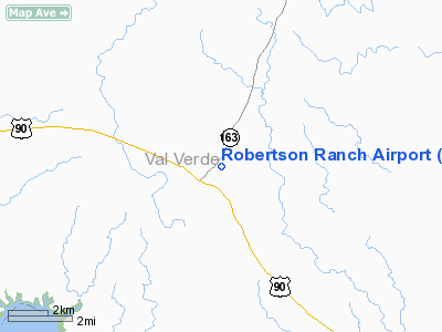
Location & QuickFacts
| FAA Information Effective: | 2008-09-25 |
| Airport Identifier: | 0TE0 |
| Airport Status: | Operational |
| Longitude/Latitude: | 101-09-42.3760W/29-41-34.7680N
-101.161771/29.692991 (Estimated) |
| Elevation: | 1663 ft / 506.88 m (Estimated) |
| Land: | 40 acres |
| From nearest city: | 1 nautical miles NE of Comstock, TX |
| Location: | Val Verde County, TX |
| Magnetic Variation: | 08E (1985) |
Owner & Manager
| Ownership: | Privately owned |
| Owner: | Robertson Ranch |
| Address: | 108 Ceniza Hills Circle
Del Rio, TX 78840 |
| Phone number: | 830-775-4675 |
| Manager: | Jonella R. Pride |
| Address: | 108 Ceniza Hills Circle
Del Rio, TX 78840 |
| Phone number: | 830-775-4675 |
Airport Operations and Facilities
| Airport Use: | Private |
| Wind indicator: | No |
| Segmented Circle: | No |
| Control Tower: | No |
| Landing fee charge: | No |
| Sectional chart: | San Antonio |
| Region: | ASW - Southwest |
| Boundary ARTCC: | ZHU - Houston |
| Tie-in FSS: | SJT - San Angelo |
| FSS on Airport: | No |
| FSS Toll Free: | 1-800-WX-BRIEF |
Airport Services
| Airframe Repair: | NONE |
| Power Plant Repair: | NONE |
| Bottled Oxygen: | NONE |
| Bulk Oxygen: | NONE |
Runway Information
Runway 03/21
| Dimension: | 2650 x 50 ft / 807.7 x 15.2 m |
| Surface: | GRAVEL, |
| |
Runway 03 |
Runway 21 |
| Traffic Pattern: | Left | Left |
| Obstruction: | 13 ft bldg, 100 ft right of centerline | 4 ft fence, 0.0 ft from runway, 60 ft right of centerline |
|
Runway 13/31
| Dimension: | 3250 x 50 ft / 990.6 x 15.2 m |
| Surface: | GRAVEL, |
| |
Runway 13 |
Runway 31 |
| Traffic Pattern: | Left | Left |
| Obstruction: | 4 ft fence, 60 ft left of centerline | 4 ft fence, 0.0 ft from runway, 60 ft right of centerline |
|
Radio Navigation Aids
| ID |
Type |
Name |
Ch |
Freq |
Var |
Dist |
| BRX | NDB | La Fonda Ranch | | 269.00 | 09E | 40.5 nm |
| DLF | VORTAC | Laughlin | 091X | 114.40 | 07E | 28.5 nm |
| RSG | VORTAC | Rocksprings | 049X | 111.20 | 10E | 48.9 nm |
Remarks
- RYS NOT MAINTAINED; ROUGH.
Images and information placed above are from
http://www.airport-data.com/airport/0TE0/
We thank them for the data!
| General Info
|
| Country |
United States
|
| State |
TEXAS
|
| FAA ID |
0TE0
|
| Latitude |
29-41-34.768N
|
| Longitude |
101-09-42.376W
|
| Elevation |
1663 feet
|
| Near City |
COMSTOCK
|
We don't guarantee the information is fresh and accurate. The data may
be wrong or outdated.
For more up-to-date information please refer to other sources.
|
|


