|
|
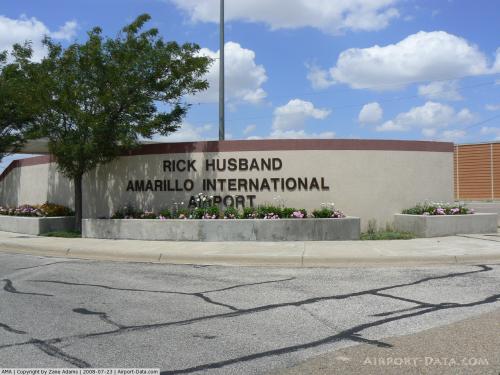
Rick Husband Amarillo Intl Airport |
Rick Husband
Amarillo International Airport |
 |
| IATA: AMA – ICAO: KAMA – FAA LID: AMA |
| Summary |
| Airport type |
Public |
| Owner |
City of Amarillo |
| Serves |
Amarillo, Texas |
| Elevation AMSL |
3,607 ft / 1,099 m |
| Coordinates |
35°13′10″N 101°42′21″W / 35.21944°N 101.70583°W / 35.21944; -101.70583 |
| Runways |
| Direction |
Length |
Surface |
| ft |
m |
| 4/22 |
13,502 |
4,115 |
Concrete |
| 13/31 |
7,901 |
2,408 |
Concrete |
| Statistics (2007) |
| Aircraft operations |
98,058 |
| Based aircraft |
40 |
| Source: Federal Aviation Administration |
Rick Husband Amarillo International Airport (IATA: AMA, ICAO: KAMA, FAA LID: AMA) is a public airport located six miles (10 km) east of the central business district of Amarillo, a city in Potter and Randall Counties, Texas, United States. The airport was renamed in 2003 after fallen NASA astronaut and Amarillo native Richard Douglas Husband, who died in the Space Shuttle Columbia disaster in February of that year. History
Harold English opened this airport as English Field in 1929. Also in 1929, Transcontinental & Western Air (the forerunner to TWA) inaugurated the first commercial airline service through Amarillo. Regularly scheduled services to Lubbock and Dallas were provided by Braniff International, Continental Airlines and Trans-Texas Airways (which was later rebranded as Texas International). Additionally, Trans World Airlines provided regularly scheduled service to such cities as Wichita, Kansas City, St. Louis, Chicago, Albuquerque, Las Vegas, and Los Angeles (nonstop) from this facility. Lockheed Jet-Prop Electra service was provided to Denver and Oklahoma City on Braniff International. Frontier Airlines provided regional service (Oklahoma/Kansas) utilizing Convair prop aircraft. Convenient connecting service at Dallas Love Field with American, Delta, Braniff International and Eastern Air Lines linked Amarillo with South, Southeast, Midwest, West Coast and East Coast destinations.
In 1952, the name changed to Amarillo Air Terminal. After the adjacent Amarillo Air Force Base was deactivated in 1968, a portion of it was converted to civilian use and became part of Amarillo Air Terminal. The primary instrument runway, while originally constructed as part of the former USAF Strategic Air Command base, at 13,502 feet (4,115 m) remains among the longest commercial runways in the United States, and it is still used by military pilots today. In 1976, the airport changed its name to Amarillo International Airport upon the opening of a U.S. Customs facility.
Southwest Airlines initiated service to Amarillo in 1978 with non-stop service to Dallas-Love Field. Southwest would eventually add non-stop service to Albuquerque, Las Vegas, and Denver.
The original English Field terminal building was converted in 1997 to a museum maintained by the Texas Aviation Historical Society. The name of the original airfield is memorialized in the English Fieldhouse, a local restaurant located adjacent to the general aviation terminal.
 | |
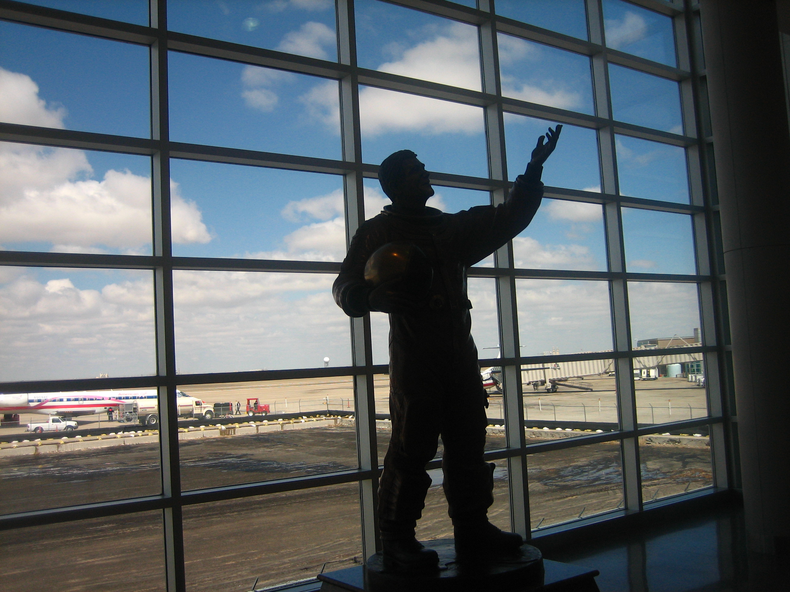
Statue of Rick Husband at Amarillo, Texas, airport |
In 2003, the airport terminal building was rededicated to NASA astronaut Rick Husband, the commander of mission STS-107 of the Space Shuttle Columbia and an Amarillo native. Husband and his crew were all killed when the Columbia disintegrated upon re-entry on February 1, 2003.
Visits by NASA Shuttle Carrier Aircraft (SCA)
On July 1, 2007, the Space Shuttle Atlantis made a stop at the airport while being piggybacked from Edwards Air Force Base to Florida -- one of the few visits by the shuttle to a commercial airport. After a brief stay it was flown on to Offutt Air Force Base.
In 2009, the airport was again used as a refuelling stop by the SCA. On September 20, the Space Shuttle Discovery was transported from Edwards Air Force Base to the Kennedy Space Center in Florida with intermediate stops in Amarillo, Carswell AFB in Ft.Worth, and Barksdale AFB in Louisiana.
Facilities and aircraft
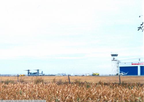
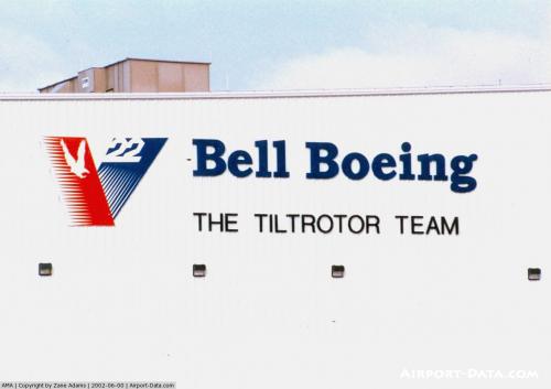
Rick Husband Amarillo International Airport covers an area of 3,547 acres (1,435 ha) which contains two concrete paved runways: 4/22 measuring 13,502 x 200 ft (4,115 x 61 m) and 13/31 measuring 7,901 x 150 ft (2,408 x 46 m). For the 12-month period ending December 31, 2007, the airport had 98,058 aircraft operations, an average of 268 per day: 48% military, 29% general aviation, 14% air taxi and 9% scheduled commercial. At that time there were 40 aircraft based at this airport: 52% single-engine, 18% multi-engine, 28% jet and 3% helicopter.
Airlines and destinations
| Airlines |
Destinations |
| American Eagle |
Dallas/Fort Worth |
| American Eagle operated by Executive Airlines |
Dallas/Fort Worth |
| Continental Express operated by Chautauqua Airlines |
Houston-Intercontinental |
| Continental Express operated by ExpressJet Airlines |
Houston-Intercontinental |
| Delta Connection operated by Pinnacle Airlines |
Memphis |
| Southwest Airlines |
Dallas/Love Field, Denver, Las Vegas |
The above content comes from Wikipedia and is published under free licenses – click here to read more.
 |
(Click on the photo to enlarge) |
 |
(Click on the photo to enlarge) |
 |
(Click on the photo to enlarge) |
 |
(Click on the photo to enlarge) |
 |
(Click on the photo to enlarge) |
Location & QuickFacts
| FAA Information Effective: | 2008-09-25 |
| Airport Identifier: | AMA |
| Airport Status: | Operational |
| Longitude/Latitude: | 101-42-21.3000W/35-13-09.7000N
-101.705917/35.219361 (Estimated) |
| Elevation: | 3607 ft / 1099.41 m (Surveyed) |
| Land: | 3547 acres |
| From nearest city: | 6 nautical miles E of Amarillo, TX |
| Location: | Potter County, TX |
| Magnetic Variation: | 08E (2000) |
Owner & Manager
| Ownership: | Publicly owned |
| Owner: | City Of Amarillo |
| Address: | Po Box 1971
Amarillo, TX 79106 |
| Phone number: | 806-378-3000 |
| Manager: | Scott Carr |
| Address: | 10801 Arpt Blvd
Amarillo, TX 79111 |
| Phone number: | 806-335-1671 |
Airport Operations and Facilities
| Airport Use: | Open to public |
| Wind indicator: | Yes |
| Segmented Circle: | Yes |
| Control Tower: | Yes |
| Lighting Schedule: | DUSK-DAWN
WHEN ATCT CLSD HIRL RYS 04/22 & 13/31 PRESET MED INTST ONLY; ACTVT REIL RY 13; MALSR RYS 04 & 22 - 118.3. |
| Beacon Color: | Clear-Green (lighted land airport) |
| Landing fee charge: | No |
| Sectional chart: | Dallas-ft Worth |
| Region: | ASW - Southwest |
| Traffic Pattern Alt: | 800 ft |
| Boundary ARTCC: | ZAB - Albuquerque |
| Tie-in FSS: | FTW - Fort Worth |
| FSS on Airport: | No |
| FSS Phone: | 817-541-3474 |
| FSS Toll Free: | 1-800-WX-BRIEF |
| NOTAMs Facility: | AMA (NOTAM-d service avaliable) |
| Certification type/date: | I B S 05/1973
INDEX C EQUIPMENT AVAILABLE. |
| Federal Agreements: | NGPY3 |
Airport Communications
| CTAF: | 118.300 |
| Unicom: | 122.950 |
Airport Services
| Fuel available: | 100LLA1+ B |
| Airframe Repair: | MAJOR |
| Power Plant Repair: | MAJOR |
| Bottled Oxygen: | LOW |
| Bulk Oxygen: | LOW |
Runway Information
Runway 04/22
| Dimension: | 13502 x 200 ft / 4115.4 x 61.0 m |
| Surface: | CONC, Good Condition |
| Surface Treatment: | Saw-cut or plastic Grooved
CENTER 130 FT GROOVED FULL LENGTH. |
| Weight Limit: | Single wheel: 100000 lbs.
Dual wheel: 200000 lbs.
Dual tandem wheel: 400000 lbs. |
| Edge Lights: | Non-standard lighting system
NSTD HIRL DUE TO SPACING. HIRL 60 FT FM RY EDGE, NSTD DSTC FM CNTRLN - PAVEMENT OUTSIDE RY EDGE STRIPES MAY NOT BE FULL STRENGTH AND DEPTH PERCEPTI0ON PROBLEMS MAY EXIST DURING PERIODS OF DARKNESS. |
| |
Runway 04 |
Runway 22 |
| Longitude: | 101-43-57.7198W | 101-42-00.7229W |
| Latitude: | 35-12-18.4250N | 35-13-51.1993N |
| Elevation: | 3607.00 ft | 3603.00 ft |
| Alignment: | 46 | 127 |
| ILS Type: | ILS
| LDA/DME
|
| Traffic Pattern: | Left | Left |
| Markings: | Precision instrument, Good Condition | Precision instrument, Good Condition |
| Crossing Height: | 44.00 ft | 62.00 ft |
| VASI: | 4-light PAPI on left side | 4-light PAPI on left side |
| Visual Glide Angle: | 3.00° | 3.00° |
| RVR Equipment: | touchdown
RVR AVBL 0600-0000 CTC ATCT. | rollout |
| Approach lights: | MALSR | MALSR |
| Runway End Identifier: | No | No |
| Centerline Lights: | No | No |
| Touchdown Lights: | No | No |
| Decleard distances: | Take off run available 13502.00 ft
Take off distance available 13502.00 ft
Actual stop distance available 13502.00 ft
Landing distance available 13502.00 ft
| Take off run available 13502.00 ft
Take off distance available 13502.00 ft
Actual stop distance available 13502.00 ft
Landing distance available 13502.00 ft
|
|
Runway 13/31
| Dimension: | 7901 x 150 ft / 2408.2 x 45.7 m |
| Surface: | CONC, Good Condition |
| Surface Treatment: | Saw-cut or plastic Grooved
CENTER 130 FT GROOVED FULL LENGTH. |
| Weight Limit: | Single wheel: 100000 lbs.
Dual wheel: 200000 lbs.
Dual tandem wheel: 400000 lbs. |
| Edge Lights: | High
NSTD HIRL DUE TO SPACING. HIRL 60 FT FM RY EDGE, NSTD DSTC FM CNTRLN - PAVEMENT OUTSIDE RY EDGE STRIPES MAY NOT BE FULL STRENGTH AND DEPTH PERCEPTI0ON PROBLEMS MAY EXIST DURING PERIODS OF DARKNESS. |
| |
Runway 13 |
Runway 31 |
| Longitude: | 101-41-48.8012W | 101-40-44.4325W |
| Latitude: | 35-13-46.9017N | 35-12-49.3277N |
| Elevation: | 3603.00 ft | 3594.00 ft |
| Alignment: | 127 | 127 |
| Traffic Pattern: | Left | Left |
| Markings: | Non-precision instrument, Fair Condition | Non-precision instrument, Fair Condition |
| VASI: | 4-light PAPI on left side | 4-light PAPI on left side |
| Runway End Identifier: | Yes | Yes |
| Decleard distances: | Take off run available 7901.00 ft
Take off distance available 7901.00 ft
Actual stop distance available 7901.00 ft
Landing distance available 7901.00 ft
| Take off run available 7901.00 ft
Take off distance available 7901.00 ft
Actual stop distance available 7901.00 ft
Landing distance available 7901.00 ft
|
|
Radio Navigation Aids
| ID |
Type |
Name |
Ch |
Freq |
Var |
Dist |
| AM | NDB | Pande | | 251.00 | 09E | 6.6 nm |
| HRX | NDB | Hereford | | 341.00 | 09E | 37.4 nm |
| DUX | NDB | Durrett | | 414.00 | 09E | 41.5 nm |
| PPA | NDB | Pampa | | 368.00 | 09E | 42.2 nm |
| PNH | VORTAC | Panhandle | 113X | 116.60 | 08E | 1.0 nm |
| BGD | VORTAC | Borger | 023X | 108.60 | 11E | 38.7 nm |
Images and information placed above are from
http://www.airport-data.com/airport/AMA/
We thank them for the data!
| General Info
|
| Country |
United States
|
| State |
TEXAS
|
| FAA ID |
AMA
|
| Latitude |
35-13-09.725N
|
| Longitude |
101-42-21.348W
|
| Elevation |
3607 feet
|
| Near City |
AMARILLO
|
We don't guarantee the information is fresh and accurate. The data may
be wrong or outdated.
For more up-to-date information please refer to other sources.
|
|