 |
|
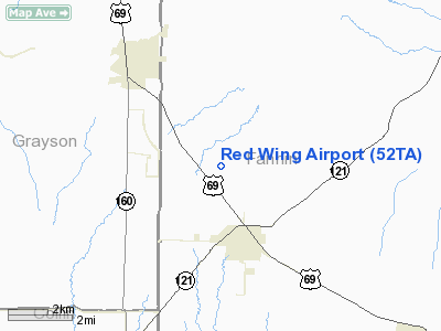
Location & QuickFacts
| FAA Information Effective: | 2008-09-25 |
| Airport Identifier: | 52TA |
| Airport Status: | Operational |
| Longitude/Latitude: | 096-21-00.9350W/33-27-50.3920N
-96.350260/33.463998 (Estimated) |
| Elevation: | 755 ft / 230.12 m (Estimated) |
| Land: | 11 acres |
| From nearest city: | 2 nautical miles NW of Trenton, TX |
| Location: | Fannin County, TX |
| Magnetic Variation: | 06E (1990) |
Owner & Manager
| Ownership: | Privately owned |
| Owner: | J. Kowalski |
| Address: | P.o. Box 421
Trenton, TX 75490 |
| Phone number: | 903-989-2365 |
| Manager: | J. Kowalski |
| Address: | P.o. Box 421
Trenton, TX 75490 |
| Phone number: | 903-989-2365 |
Airport Operations and Facilities
| Airport Use: | Private |
| Wind indicator: | Yes |
| Segmented Circle: | Yes |
| Control Tower: | No |
| Sectional chart: | Dallas-ft Worth |
| Region: | ASW - Southwest |
| Boundary ARTCC: | ZFW - Fort Worth |
| Tie-in FSS: | FTW - Fort Worth |
| FSS on Airport: | No |
| FSS Phone: | 817-541-3474 |
| FSS Toll Free: | 1-800-WX-BRIEF |
Runway Information
Runway 18/36
| Dimension: | 2175 x 100 ft / 662.9 x 30.5 m |
| Surface: | TURF, |
| |
Runway 18 |
Runway 36 |
| Traffic Pattern: | Left | Right |
| Displaced threshold: | 275.00 ft | 0.00 ft |
| Obstruction: | 25 ft pline, 350.0 ft from runway | |
|
Radio Navigation Aids
| ID |
Type |
Name |
Ch |
Freq |
Var |
Dist |
| HJM | NDB | Rayburn | | 415.00 | 06E | 12.5 nm |
| MII | NDB | Caddo Mills | | 316.00 | 06E | 26.0 nm |
| DNI | NDB | Denison | | 341.00 | 06E | 26.9 nm |
| DUA | NDB | Durant | | 359.00 | 05E | 28.9 nm |
| SYW | NDB | Cash | | 428.00 | 05E | 32.3 nm |
| PQF | NDB | Mesquite | | 248.00 | 06E | 40.4 nm |
| AVZ | NDB | Travis | | 260.00 | 06E | 42.6 nm |
| GLE | NDB | Gainesville | | 330.00 | 06E | 45.2 nm |
| JUG | NDB | Jecca | | 388.00 | 06E | 48.7 nm |
| MJF | TACAN | Arvilla | 033X | | 05E | 28.0 nm |
| URH | VOR/DME | Texoma | 090X | 114.30 | 05E | 28.9 nm |
| SLR | VOR/DME | Sulphur Springs | 027X | 109.00 | 08E | 43.6 nm |
| CVE | VOR/DME | Cowboy | 109X | 116.20 | 06E | 44.3 nm |
| PRX | VOR/DME | Paris | 083X | 113.60 | 07E | 45.5 nm |
| TTT | VOR/DME | Maverick | 078X | 113.10 | 06E | 49.8 nm |
| BYP | VORTAC | Bonham | 093X | 114.60 | 06E | 7.3 nm |
| DAL | VOT | Dallas Love Field | | 113.30 | | 44.9 nm |
Remarks
- PRVDD ALL RED WING ARPT TFC PATTERN OPS ARE FLOWN ON THE E SIDE OF THE PROPOSED ARPT.
Images and information placed above are from
http://www.airport-data.com/airport/52TA/
We thank them for the data!
| General Info
|
| Country |
United States
|
| State |
TEXAS
|
| FAA ID |
52TA
|
| Latitude |
33-27-50.392N
|
| Longitude |
096-21-00.935W
|
| Elevation |
755 feet
|
| Near City |
TRENTON
|
We don't guarantee the information is fresh and accurate. The data may
be wrong or outdated.
For more up-to-date information please refer to other sources.
|
|


