 |
|
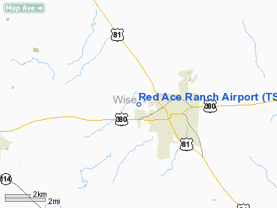
Location & QuickFacts
| FAA Information Effective: | 2008-09-25 |
| Airport Identifier: | TS57 |
| Airport Status: | Operational |
| Longitude/Latitude: | 097-37-16.1050W/33-14-30.4170N
-97.621140/33.241782 (Estimated) |
| Elevation: | 900 ft / 274.32 m (Estimated) |
| Land: | 0 acres |
| From nearest city: | 1 nautical miles W of Decatur, TX |
| Location: | Wise County, TX |
| Magnetic Variation: | 07E (1985) |
Owner & Manager
| Ownership: | Privately owned |
| Owner: | Wes Mowery |
| Address: | Box 11534
Fort Worth, TX 76110 |
| Phone number: | 817-627-2846 |
| Manager: | Wes Mowery |
| Address: | Box 11534
Fort Worth, TX 76110 |
| Phone number: | 817-627-2846 |
Airport Operations and Facilities
| Airport Use: | Private |
| Wind indicator: | Yes |
| Segmented Circle: | No |
| Control Tower: | No |
| Sectional chart: | Dallas-ft Worth |
| Region: | ASW - Southwest |
| Boundary ARTCC: | ZFW - Fort Worth |
| Tie-in FSS: | FTW - Fort Worth |
| FSS Phone: | 817-541-3474 |
| FSS Toll Free: | 1-800-WX-BRIEF |
Runway Information
Runway 01/19
| Dimension: | 2000 x 50 ft / 609.6 x 15.2 m |
| Surface: | TURF, |
| |
Runway 01 |
Runway 19 |
| Traffic Pattern: | Left | Left |
| Obstruction: | | 30 ft pline, 300.0 ft from runway |
|
Radio Navigation Aids
| ID |
Type |
Name |
Ch |
Freq |
Var |
Dist |
| GMZ | NDB | Grindstone Mountain | | 356.00 | 07E | 23.2 nm |
| MWL | NDB | Mineral Wells | | 266.00 | 06E | 35.2 nm |
| GLE | NDB | Gainesville | | 330.00 | 06E | 35.6 nm |
| GZV | NDB | Brazos River | | 280.00 | 07E | 43.5 nm |
| GHX | NDB | Graham | | 371.00 | 07E | 44.3 nm |
| NFW | TACAN | Nas Jrb Fort Worth | 024X | | 07E | 29.7 nm |
| TTT | VOR/DME | Maverick | 078X | 113.10 | 06E | 36.8 nm |
| CVE | VOR/DME | Cowboy | 109X | 116.20 | 06E | 41.8 nm |
| UKW | VORTAC | Bowie | 071X | 112.40 | 06E | 20.3 nm |
| FUZ | VORTAC | Ranger | 104X | 115.70 | 06E | 30.7 nm |
| MQP | VORTAC | Millsap | 124X | 117.70 | 09E | 36.3 nm |
| FTW | VOT | Fort Worth Meacham | | 108.20 | | 28.7 nm |
| DAL | VOT | Dallas Love Field | | 113.30 | | 45.4 nm |
Remarks
- PRVDD THR IS DSPLCD ON NORTH END TO PRVD 20:1 CLEARANCE OVER PLINE; COORDINATE TFC PTNS WITH DECATUR MUNI & FLY V ARPTS.
Images and information placed above are from
http://www.airport-data.com/airport/TS57/
We thank them for the data!
| General Info
|
| Country |
United States
|
| State |
TEXAS
|
| FAA ID |
TS57
|
| Latitude |
33-14-30.417N
|
| Longitude |
097-37-16.105W
|
| Elevation |
900 feet
|
| Near City |
DECATUR
|
We don't guarantee the information is fresh and accurate. The data may
be wrong or outdated.
For more up-to-date information please refer to other sources.
|
|


