 |
|
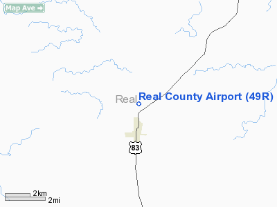
Location & QuickFacts
| FAA Information Effective: | 2008-09-25 |
| Airport Identifier: | 49R |
| Airport Status: | Operational |
| Longitude/Latitude: | 099-45-39.2130W/29-44-43.8040N
-99.760892/29.745501 (Estimated) |
| Elevation: | 1640 ft / 499.87 m (Estimated) |
| Land: | 35 acres |
| From nearest city: | 1 nautical miles N of Leakey, TX |
| Location: | Real County, TX |
| Magnetic Variation: | 08E (1985) |
Owner & Manager
| Ownership: | Privately owned
COUNTY LEASES RY, TWY, APRON & ENT RD. |
| Owner: | Buz Maxwell |
| Address: | 20 Campden
Corpus Christi, TX 78412 |
| Phone number: | 361-739-8279 |
| Manager: | W.b. Sansom
COUNTY JUDGE. |
| Address: | Po Box M
Leakey, TX 78873 |
| Phone number: | 830-232-5304 |
Airport Operations and Facilities
| Airport Use: | Open to public |
| Wind indicator: | Yes |
| Segmented Circle: | Yes |
| Control Tower: | No |
| Lighting Schedule: | DUSK-DAWN |
| Landing fee charge: | No |
| Sectional chart: | San Antonio |
| Region: | ASW - Southwest |
| Boundary ARTCC: | ZHU - Houston |
| Tie-in FSS: | SJT - San Angelo |
| FSS on Airport: | No |
| FSS Toll Free: | 1-800-WX-BRIEF |
| NOTAMs Facility: | SJT (NOTAM-d service avaliable) |
Airport Communications
Airport Services
Runway Information
Runway 15/33
| Dimension: | 3975 x 50 ft / 1211.6 x 15.2 m |
| Surface: | ASPH, Good Condition |
| Weight Limit: | Single wheel: 11000 lbs. |
| Edge Lights: | Non-standard lighting system
NSTD LIRL DUE TO COLOR. |
| |
Runway 15 |
Runway 33 |
| Traffic Pattern: | Left | Left |
| Markings: | Basic, Fair Condition | Basic, Fair Condition |
| Displaced threshold: | 240.00 ft
DSPLCD THLD UNLGTD. | 270.00 ft
DSPLCD THLD UNLGTD. |
| Obstruction: | 20 ft trees, 200.0 ft from runway, 60 ft right of centerline
APCH SLOPE 0:1 FM DSPLCD THLD TO +20 FT TREE 60 FT R OF CNTRLN 200 FT FROM THE DSPLCD THLD.
+30 FT TREE 80 FT R OF RY CNTRLN AT THLD. | 30 ft trees, 200.0 ft from runway
APCH SLOPE 0:1 FM DSPLCD THLD TO +4 FT FENCE 75 FT L OF CNTRLN AT DSPLCD THLD.
+3 FT GATE & HWY 60 FT FM THLD; +10 FT TREE 35 FT R OF RY CNTRLN AT THLD. |
|
Radio Navigation Aids
| ID |
Type |
Name |
Ch |
Freq |
Var |
Dist |
| UVA | NDB | Uvalde | | 281.00 | 07E | 34.2 nm |
| HMA | NDB | Hondo | | 329.00 | 08E | 38.1 nm |
| ER | NDB | Shein | | 263.00 | 08E | 40.5 nm |
| LKX | NDB | La Pryor | | 223.00 | 09E | 49.3 nm |
| HDO | VOR/DME | Hondo | 31X | 109.40 | 08E | 38.7 nm |
| CSI | VORTAC | Center Point | 122X | 117.50 | 08E | 30.4 nm |
| RSG | VORTAC | Rocksprings | 049X | 111.20 | 10E | 32.4 nm |
Remarks
- +4' FENCE 75' WEST RWY CNTRLN FULL LENGTH RWY.
- +4' FENCE 100' EAST RWY CNTRLN FROM RWY 15 THR SOUTH TO NORTH TWY.
- DO NOT USE TURF TWY FROM APRON TO END OF RWY 33.
- ULTRALIGHT ACTIVITY ADJ TO RY.
- VFR ONLY; PRVDD RWY 33 IS DSPLCD TO PRVD UNOBSTD 20:1 APCH SLOPE FOR RQRD 17' VERT CLNC NEEDED OVER US-83
Images and information placed above are from
http://www.airport-data.com/airport/49R/
We thank them for the data!
| General Info
|
| Country |
United States
|
| State |
TEXAS
|
| FAA ID |
49R
|
| Latitude |
29-44-43.804N
|
| Longitude |
099-45-39.213W
|
| Elevation |
1640 feet
|
| Near City |
LEAKEY
|
We don't guarantee the information is fresh and accurate. The data may
be wrong or outdated.
For more up-to-date information please refer to other sources.
|
|


