 |
|
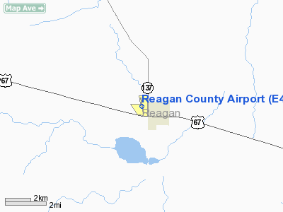
Location & QuickFacts
| FAA Information Effective: | 2008-09-25 |
| Airport Identifier: | E41 |
| Airport Status: | Operational |
| Longitude/Latitude: | 101-28-21.0845W/31-11-55.8560N
-101.472523/31.198849 (Estimated) |
| Elevation: | 2706 ft / 824.79 m (Surveyed) |
| Land: | 160 acres |
| From nearest city: | 1 nautical miles W of Big Lake, TX |
| Location: | Reagan County, TX |
| Magnetic Variation: | 08E (2000) |
Owner & Manager
| Ownership: | Publicly owned |
| Owner: | Reagan County |
| Address: | Courthouse
Big Lake, TX 76932 |
| Phone number: | 325-884-2665 |
| Manager: | Larry Isom
COUNTY JUDGE. |
| Address: | County Courthouse
Big Lake, TX 76932 |
| Phone number: | 325-884-2665 |
Airport Operations and Facilities
| Airport Use: | Open to public |
| Wind indicator: | Yes |
| Segmented Circle: | Yes |
| Control Tower: | No |
| Lighting Schedule: | DUSK-DAWN
ACTVT MIRL RY 16/34 & PAPI RYS 16 & 34 - CTAF. |
| Beacon Color: | Clear-Green (lighted land airport) |
| Landing fee charge: | No |
| Sectional chart: | San Antonio |
| Region: | ASW - Southwest |
| Boundary ARTCC: | ZFW - Fort Worth |
| Tie-in FSS: | SJT - San Angelo |
| FSS on Airport: | No |
| FSS Toll Free: | 1-800-WX-BRIEF |
| NOTAMs Facility: | SJT (NOTAM-d service avaliable) |
Airport Communications
Airport Services
| Fuel available: | 100LL
FOR FUEL CALL 325-884-2576 OR 325-650-3133. |
| Airframe Repair: | NONE |
| Power Plant Repair: | NONE |
| Bottled Oxygen: | NONE |
| Bulk Oxygen: | NONE |
Runway Information
Runway 09/27
| Dimension: | 3460 x 80 ft / 1054.6 x 24.4 m |
| Surface: | DIRT, Fair Condition |
| |
Runway 09 |
Runway 27 |
| Longitude: | 101-28-46.6600W | 101-28-07.1800W |
| Latitude: | 31-11-47.5900N | 31-11-43.0300N |
| Elevation: | 2690.00 ft | 2692.00 ft |
| Alignment: | 98 | 127 |
| Traffic Pattern: | Left | Right |
| Obstruction: | 10 ft brush | 4 ft fence, 0.0 ft from runway |
|
Runway 16/34
| Dimension: | 4032 x 50 ft / 1229.0 x 15.2 m |
| Surface: | ASPH, Good Condition |
| Weight Limit: | Single wheel: 14000 lbs. |
| Edge Lights: | Medium |
| |
Runway 16 |
Runway 34 |
| Longitude: | 101-28-25.3784W | 101-28-16.7910W |
| Latitude: | 31-12-15.4605N | 31-11-36.2515N |
| Elevation: | 2705.00 ft | 2700.00 ft |
| Alignment: | 127 | 127 |
| Traffic Pattern: | Right | Left |
| Markings: | Non-precision instrument, Good Condition | Non-precision instrument, Good Condition |
| Crossing Height: | 30.00 ft | 40.00 ft |
| VASI: | 2-light PAPI on left side | 2-light PAPI on left side |
| Visual Glide Angle: | 3.00° | 3.50° |
| Obstruction: | 8 ft brush, 293.0 ft from runway, 11:1 slope to clear | 38 ft pole, 660.0 ft from runway, 80 ft left of centerline, 12:1 slope to clear |
|
Radio Navigation Aids
| ID |
Type |
Name |
Ch |
Freq |
Var |
Dist |
Remarks
Images and information placed above are from
http://www.airport-data.com/airport/E41/
We thank them for the data!
| General Info
|
| Country |
United States
|
| State |
TEXAS
|
| FAA ID |
E41
|
| Latitude |
31-11-50.956N
|
| Longitude |
101-28-23.821W
|
| Elevation |
2704 feet
|
| Near City |
BIG LAKE
|
We don't guarantee the information is fresh and accurate. The data may
be wrong or outdated.
For more up-to-date information please refer to other sources.
|
|


